Topographic map of Pyrrhae Regio


Topographic map of Pyrrhae Regio
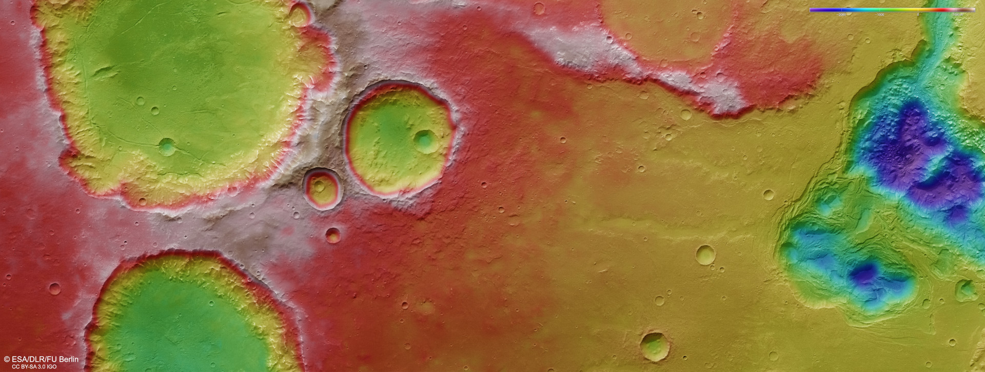
DLR’s High Resolution Stereo Camera (HRSC) on Mars Express, with its nine sensors arranged at right angles to the north-south flight direction, records the surface of Mars at different angles and in four colour channels. From the four inclined stereo channels and the nadir channel, which is directed perpendicular to the surface of Mars, scientists at the DLR Institute of Planetary Research and the Freie Universität Berlin compute digital terrain models, which assign elevation information to each pixel. The colour scale in the upper right corner shows that the Pyrrhae Regio highland plain is almost flat and rises only slowly over the ejecta blankets towards the three large craters in the south (on the left of the image). However, the craters themselves are 2000 metres deep from the rim to their sediment-filled basins. The view from the edges of the interconnected depressions in the north (right) would be even more extreme. The outflow of water ice stored in the subsurface has created chasms that are more than 4000 metres deep, where the erosive force of the water has carved out a ‘chaotic terrain’.