Satellite data showing the South Atlantic Anomaly

Satellite data showing the South Atlantic Anomaly
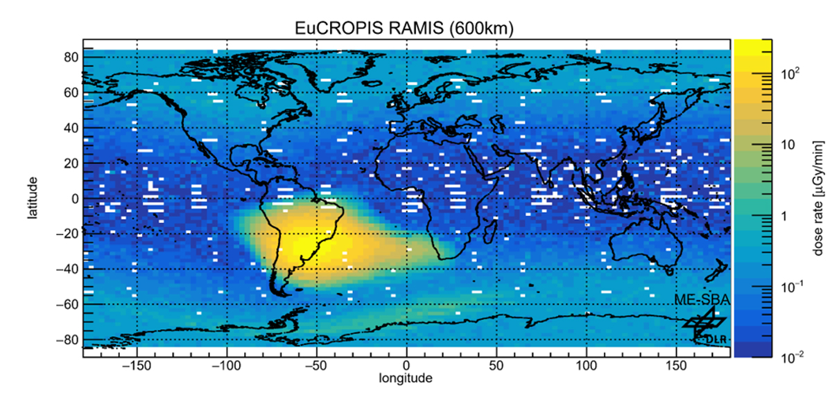
Data from DLR's Eu:CROPIS satellite shows the South Atlantic Anomaly at an altitude of 600 kilometres (yellow area). The data were obtained with the RAMIS detector of the Department of Radiation Biology of the DLR Institute of Aerospace Medicine. During the Eu:CROPIS mission, the RAMIS radiation detector was able to collect data almost around the entire globe.
Credit: © DLR. All rights reserved