EnMAP as an observer of agricultural land

EnMAP as an observer of agricultural land
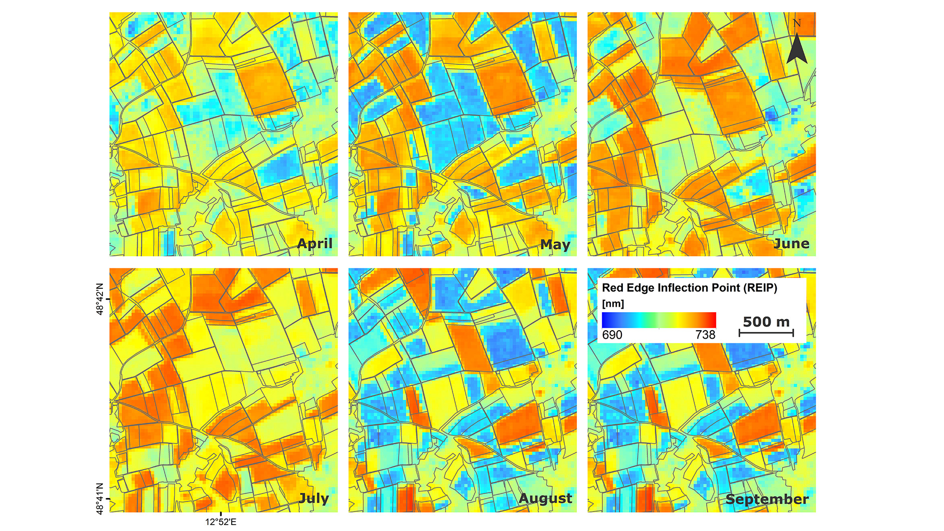
Special information products can be derived from EnMAP data, which can serve as a basis for decision-making in agriculture and thus lead to more sustainable land use. Compared to conventional multispectral Earth observation systems, hyperspectral imaging systems such as EnMAP guarantee a greater variety of observable variables, a higher accuracy of the information products by avoiding misinterpretations, and the comprehensive transfer of procedures for variable estimation that do not depend on calibration information from field measurements. The image shows simulated EnMAP time series of a growing season for an agricultural cropland near Neusling in southern Germany. The development of the 'Red Edge Inflection Point' (REIP) over time is illustrated, which can be an indicator of the current nutrient supply, among other things.