Drastic loss: forest inventory in Arnsberg 2017 and 2021

Drastic loss: forest inventory in Arnsberg 2017 and 2021
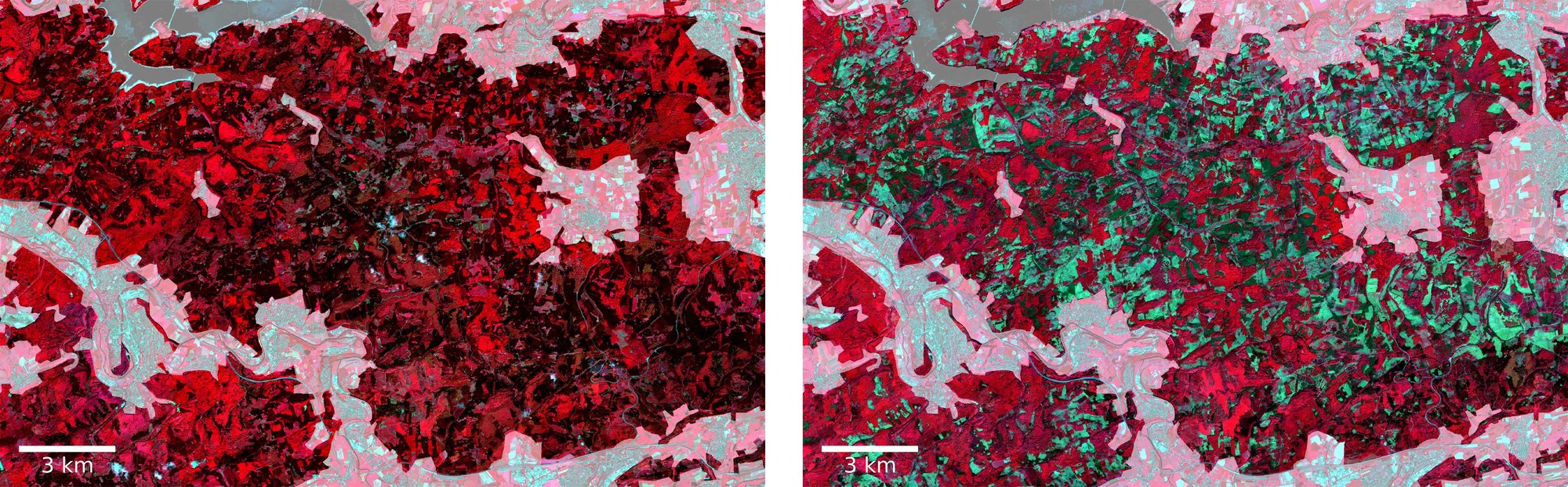
Satellite acquisitions from Arnsberg in the district Hochsauerlandkreis, Nordrhein-Westfalen: Red tones indicate vegetation, green tones indicate tree loss. Areas that do not represent forest are overlaid transparently. The satellite image to the left is from 2017 and shows a healthy, densely overgrown forest area. Dark red tones stand for vital coniferous forests while light red tones show healthy deciduous forests. This is in comparison to the image on the right, an acquisition from 2021, where the tree inventory is dramatically reduced. The light green areas reveal deforestation while the dark green areas show dead (spruce-) trees.