Forest loss in central Germany 2018-2020

Forest loss in central Germany 2018-2020
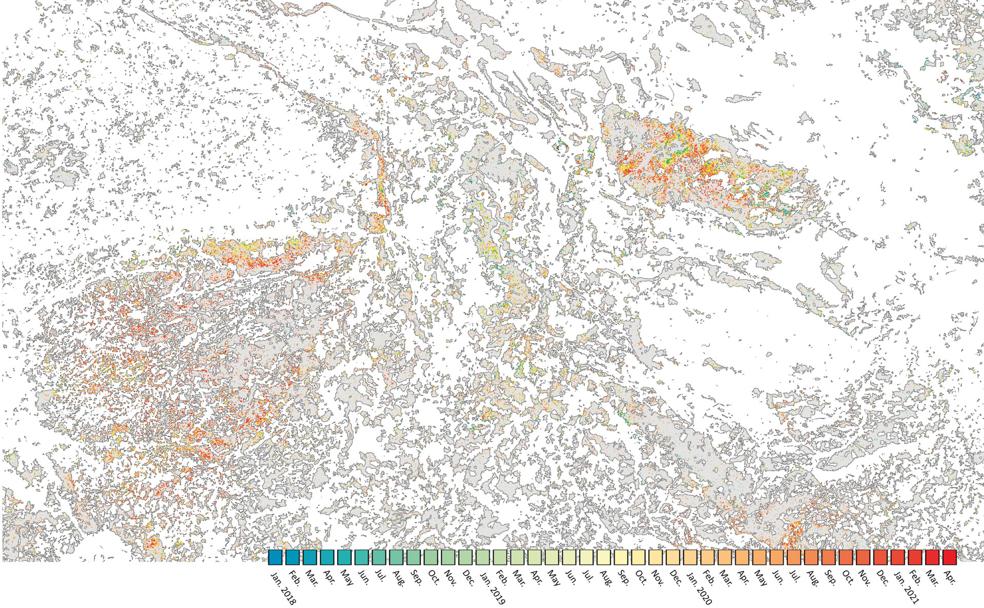
The map shows the forest loss in central Germany during the dry years from 2018 to 2020 at a spatial resolution of 10 metres. The colour scale marks the time period from January 2018 (in blue) to April 2021 (in red). Intact forest areas are represented in grey. Most notably is that the Harz Mountains (seen in the upper right area of the image) are especially affected by forest loss during the surveyed time period.