The topography of the Jovis Tholus volcano and its surroundings

The topography of the Jovis Tholus volcano and its surroundings
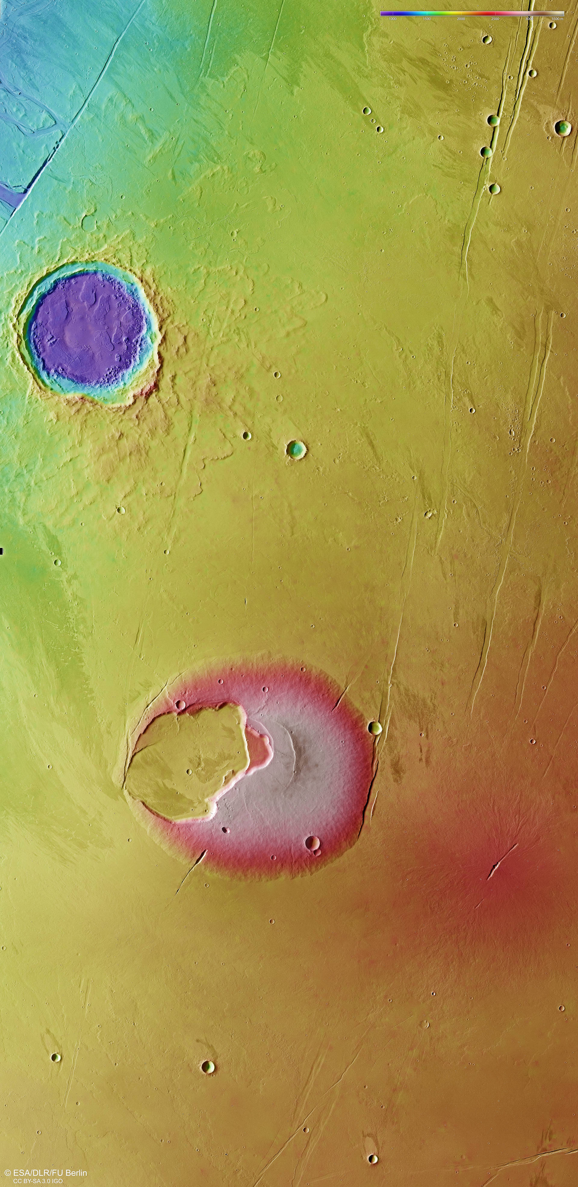
The DLR-operated High Resolution Stereo Camera (HRSC) on board ESA's Mars Express spacecraft, with its nine sensors arranged transversely to the north-south direction of flight, images the surface of Mars at different angles and with four colour channels. From the four oblique stereo channels and the nadir channel, which is oriented perpendicular to the planet's surface, teams of scientists at the DLR Institute of Planetary Research and the Freie Universität Berlin compute digital terrain models that assign elevation information to each pixel. The colour scale at the top right of the image shows the differences in altitude across the region. At 1500 metres, the Jovis Tholus shield volcano in the centre of the image has the highest elevation in this area. North is at the top of the image. Also striking is the topography of the impact crater to the north of Jovis Tholus. It is 30 kilometres across and almost two kilometres deep, with terraced terrain steps inside the crater rim. These were created by 'flooding' from the exterior of the crater by flows of low-viscosity lava.