Colour-coded topographic map of part of the Aonia Terra region

Colour-coded topographic map of part of the Aonia Terra region
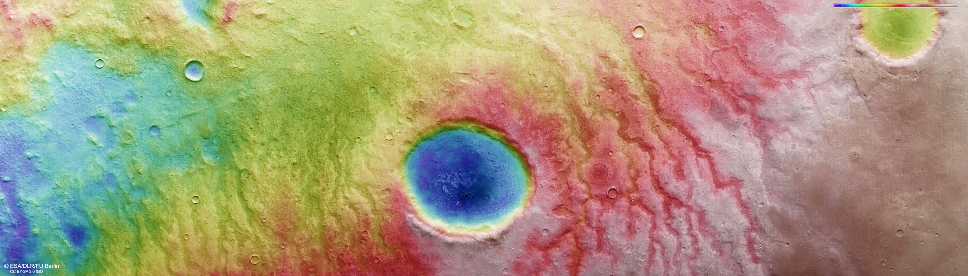
The DLR HRSC instrument on ESA’s Mars Express orbiter uses nine sensors arranged across the north-south flight direction to record the surface of Mars from different angles and with four colour channels. Teams of scientists from the DLR Institute of Planetary Research and the Freie Universität Berlin use the four angled stereo channels and the nadir channel, the field of view of which is directed perpendicular to the Martian surface, to compute digital terrain models that assign altitude information to each pixel. The colour scale at the top right of the image shows the differences in altitude in the region. The crater at the centre of the image is 30 kilometres in diameter and lies within a network of dry river valleys. It is approximately 2.5 kilometres deep.