Model of potential hazard zones

Model of potential hazard zones
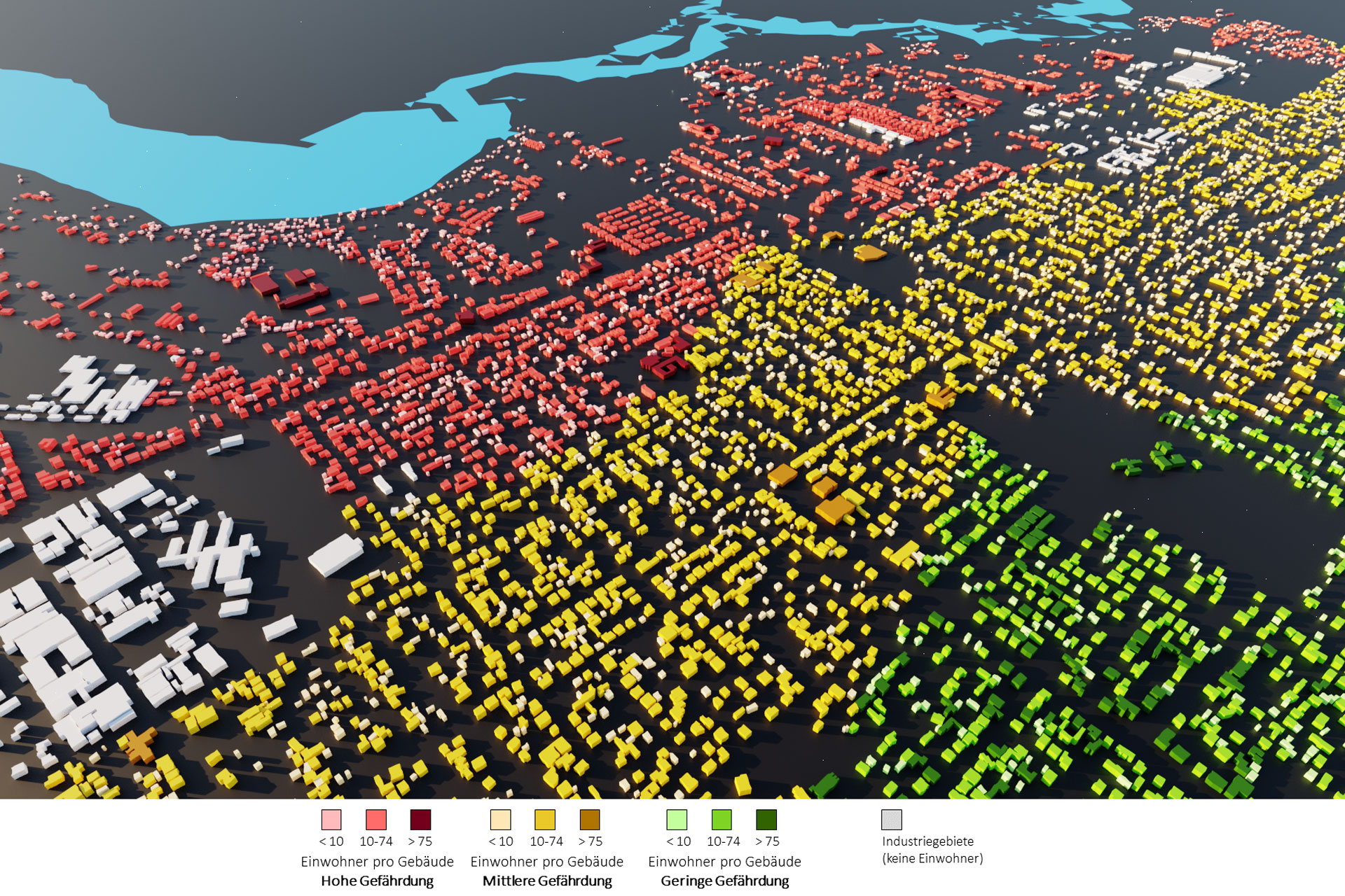
This model shows the number of inhabitants per individual building mapped, combined in this image with potential hazard zones. The red areas indicate a high risk to the building stock for a large city in south-east Africa.