Topographic image map of part of the Tantalus Fossae

Topographic image map of part of the Tantalus Fossae
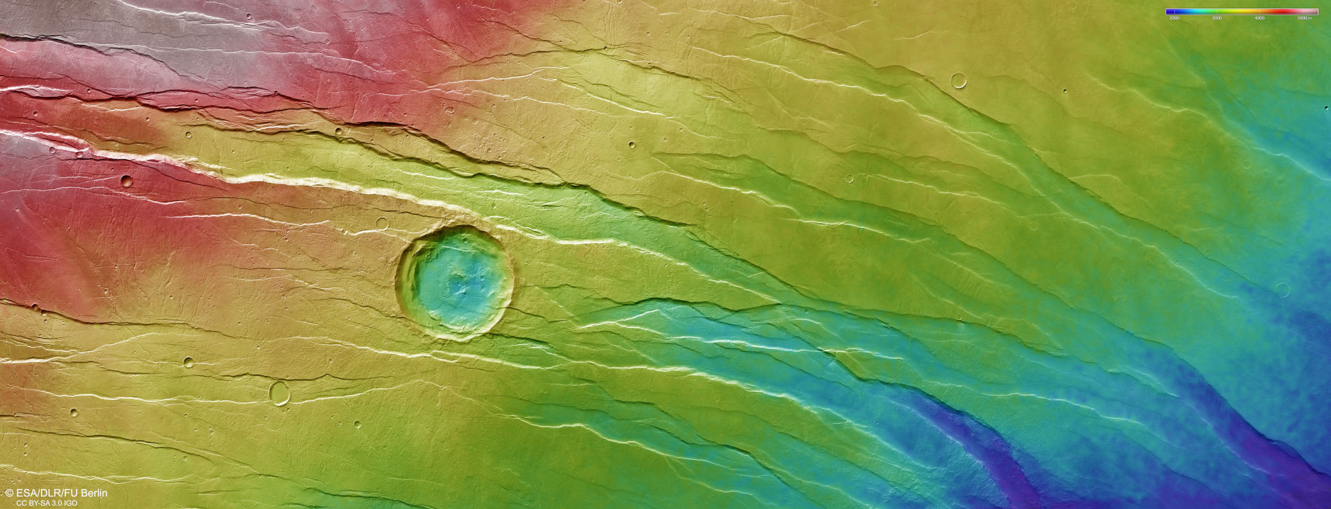
DLR’s High Resolution Stereo Camera (HRSC) on ESA’s Mars Express orbiter acquires images of the Martian surface from different angles and with four colour channels using its nine sensors, which are each oriented across the line of flight. From data acquired by the four stereo channels looking at an angle and the nadir channel pointing perpendicularly at Mars, teams of scientists at the DLR Institute of Planetary Research and Freie Universität Berlin compute digital terrain models that assign elevation information to each pixel. The colour scale at the top right of the image shows the differences in altitude in the region. The Tantalus Fossae are a gigantic network of grabens surrounding the Alba Patera volcano. The area in the northern (right) part of the image is much lower than the southern part. The impact crater in the middle is older than the grabens, as they intersect it.