Hemispheric overview map of the Uzboi-Ladon-Morava outflow system with possible former water level
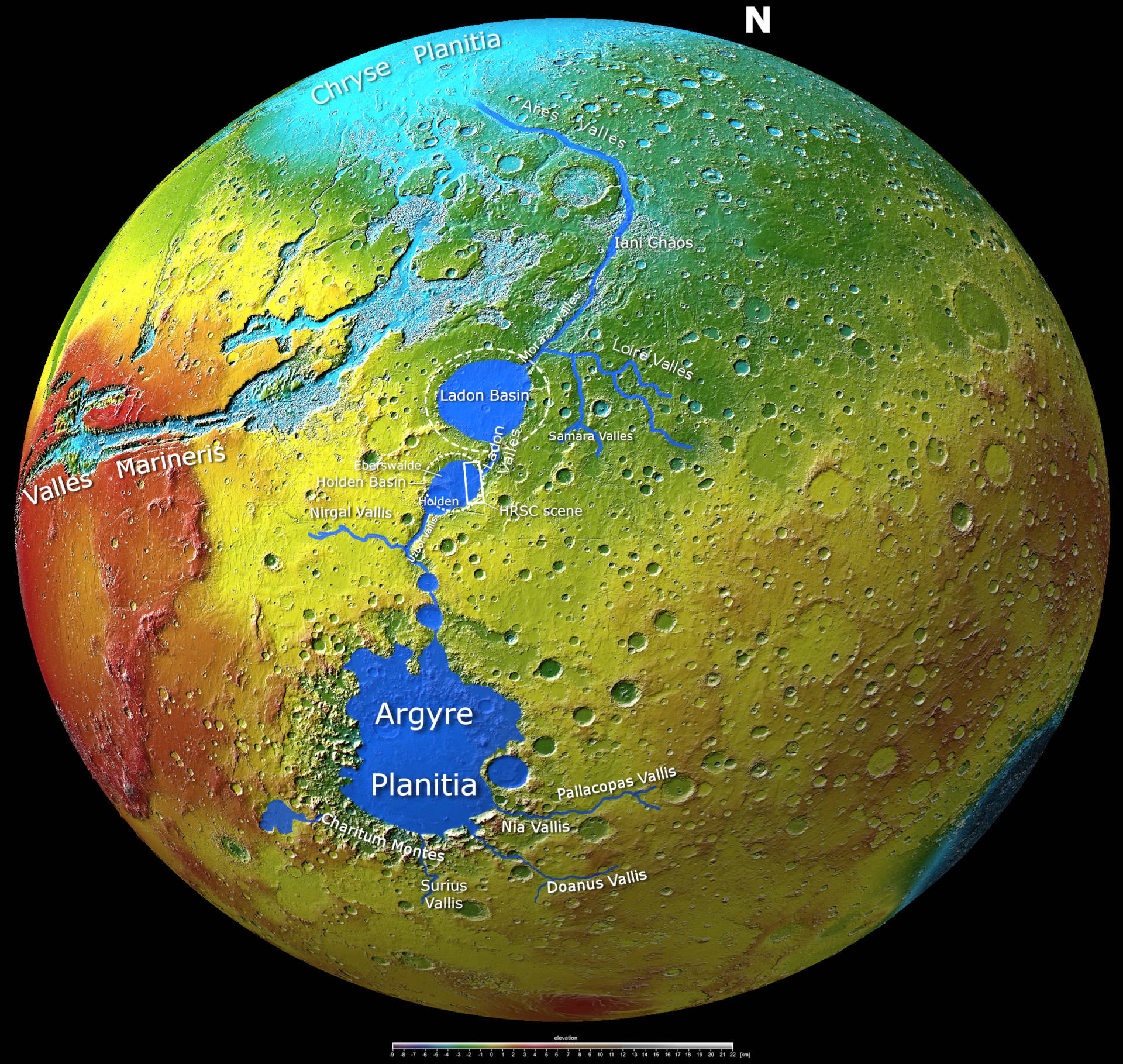

Hemispheric overview map of the Uzboi-Ladon-Morava outflow system with possible former water level
On this global topographic map of Mars, depth contours and depressions are easily recognised by their light blue colouring. In this artistic representation, a possible water level that might have prevailed in the ULM outflow system more than three billion years ago has been shaded in dark blue. This makes it easier to imagine what this interconnected outflow system of gigantic lakes and rivers might once have looked like. The names 'Holden Basin' and 'Landon Basin' (dashed circles) are not official names endorsed by the International Astronomical Union (IAU), but are used unofficially for these depressions.