Topographic image map of Ius and Tithonium Chasma


Topographic image map of Ius and Tithonium Chasma
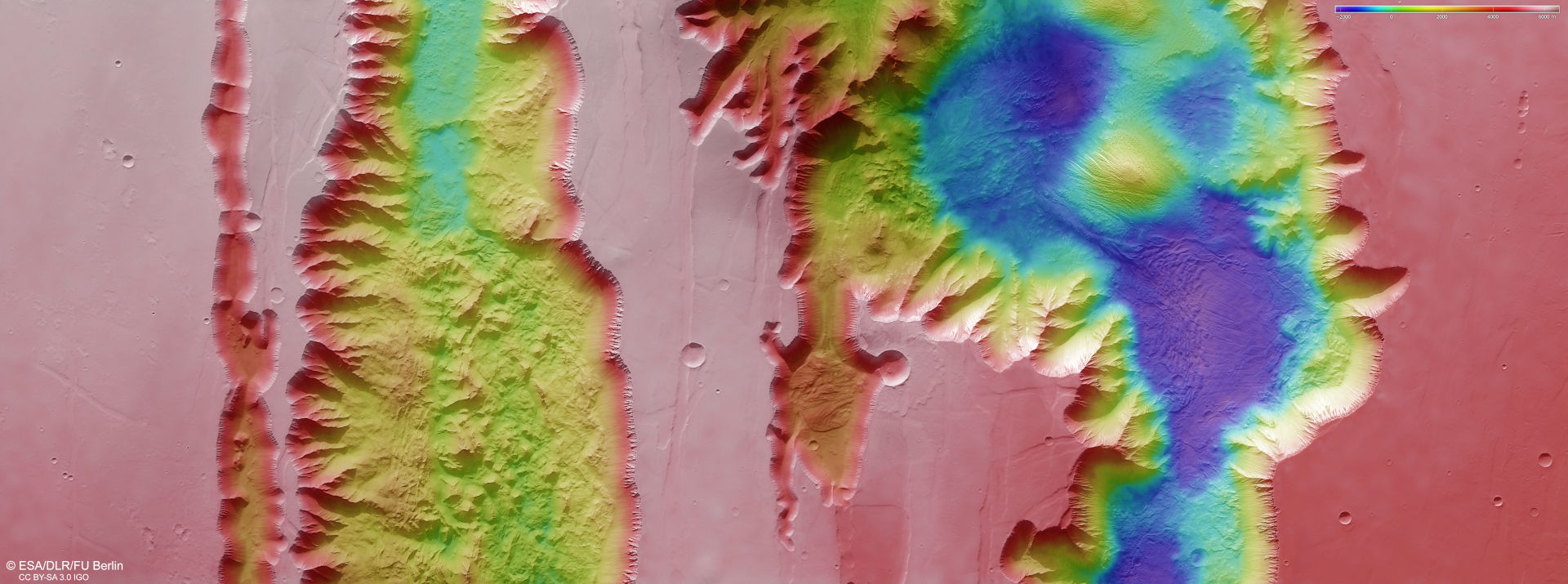
The DLR-developed HRSC stereo camera on ESA's Mars Express spacecraft uses its nine sensors arranged transversely to the direction of flight to take images of the planet from various angles and in colour. From the stereo channels that look obliquely at the surface and the nadir channel that points perpendicularly at Mars, teams of researchers at the DLR Institute of Planetary Research and the Freie Universität Berlin produce digital terrain models that assign elevation information to each pixel. The differences in altitude can be read from the colour scale at the top right of the image. There is an altitude difference of more than 7000 metres between the highest regions (light pink) and the lowest points in the two chasmata (deep blue) – all the mountains of the South American Andes, including Aconcagua, which is 6961 metres high, could be ‘hidden’ there below the top of the terrain.