Topographic map of 'Holden Basin' with chaotic terrain


Topographic map of 'Holden Basin' with chaotic terrain
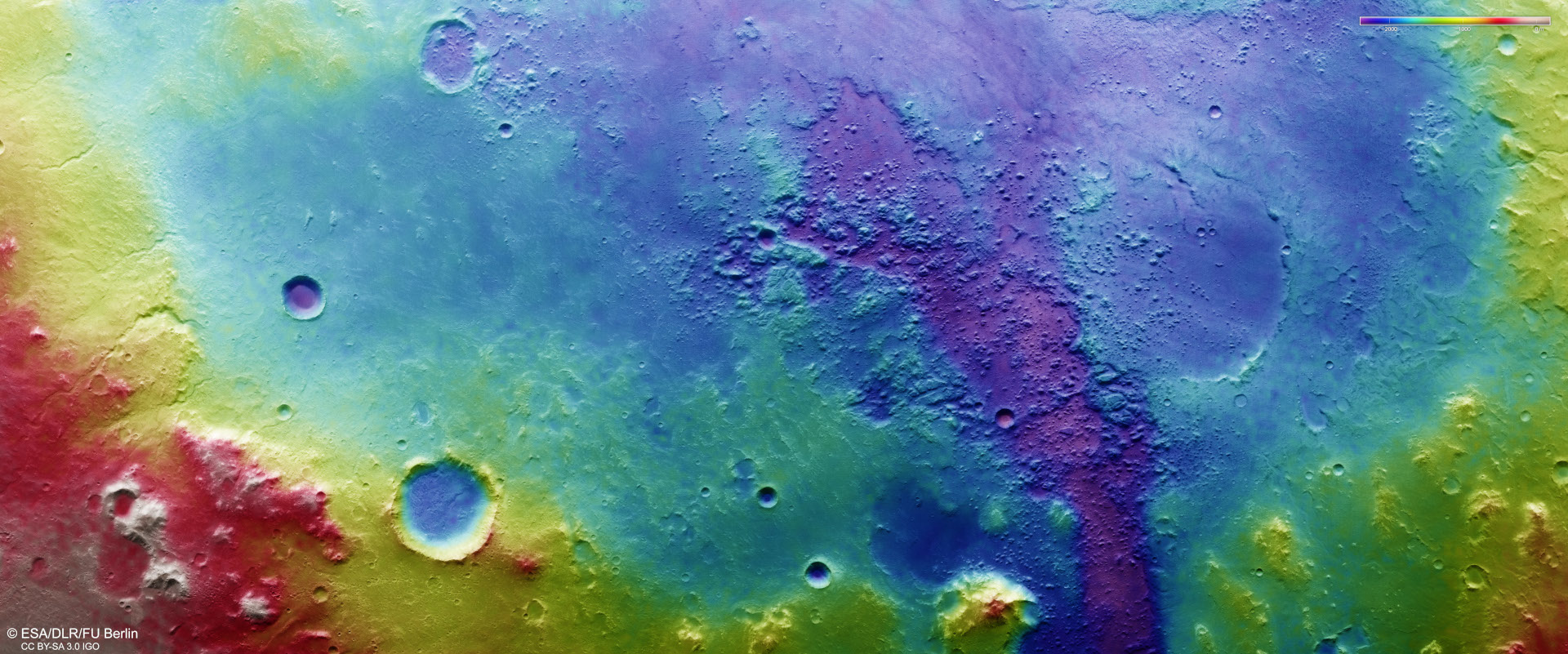
The DLR HRSC instrument on ESA's Mars Express orbiter uses nine sensors arranged across the north-south flight direction to record the surface of Mars from different angles and with four colour channels. Teams of scientists from the DLR Institute of Planetary Research and the Freie Universität Berlin use the four angled stereo channels and the nadir channel, the field of view of which is directed perpendicular to the Martian surface, to compute digital terrain models that assign altitude information to each pixel. The colour scale at the top right of the image shows the differences in altitude in the region. The depression is up to 2000 metres deep in some places, exactly where the regions of chaotic terrain are located. In this colour-coded image, the beginning of the Ladon Valles can be seen from the purple structures that cut through the northeastern rim of the basin. North is right in the image.