Close to Ma'adim Vallis

Close to Ma'adim Vallis
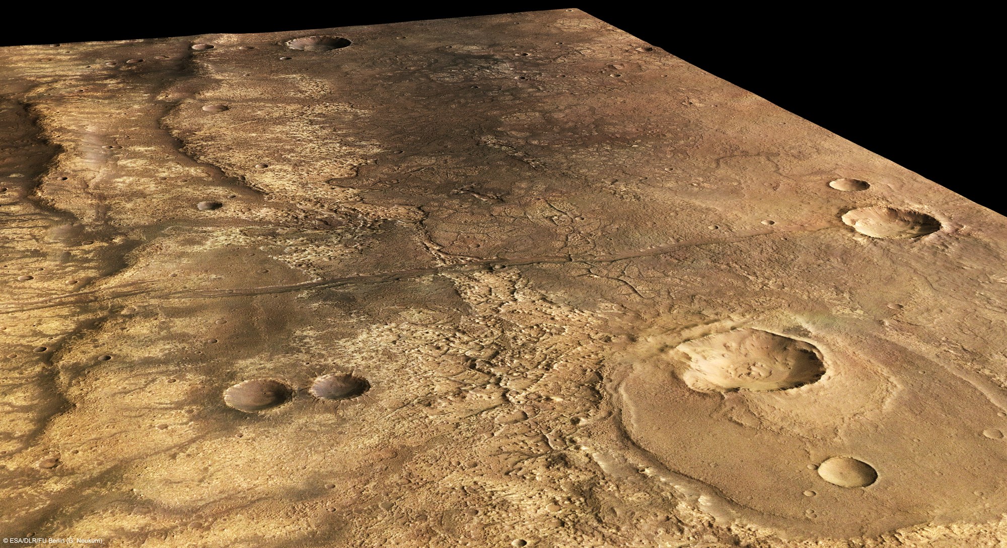
Mars Express image of a region close to Ma’adim Vallis, one of the largest canyons on Mars after Valles Marineris. The imaged region lies southeast of Ma’adim Vallis and is centred at about 29°S and 182°E with a ground resolution of 15 metres per pixel.
Ma’adim Vallis is located between the volcanic region of Tharsis, which harbours four volcanoes, including the largest volcano in the Solar System, and the Hellas Planitia impact basin, and originates in the southern highlands close to the dichotomy boundary and ends in Gusev crater. The canyon is 20 kilometres wide and 2 kilometres deep.
The image covers and area of 138 x 70 kilometres, roughly the size of Cyprus. A sharp boundary is visible in the centre, dividing dark material to the west and light material to the east. Scientists suspect that this feature is most likely the edge of a basaltic lava flow.
Wrinkle ridges are clearly visible on the surface of the lava flow. They were most likely formed by compressive forces.
On the northern side is a crater, almost 20 kilometres in size. It is partially filled with lava, which shows that it must have formed before the lava set in. The smaller, seven-kilometre crater at the southern edge of the larger crater must have formed later as it shows an ejecta blanket which possibly formed from water-ice-rich material ejected during impact.