Mars Express – Summer in the southern hemisphere of Mars
The primary task of the German Aerospace Center (Deutsches Zentrum für Luft- und Raumfahrt; DLR) High Resolution Stereo Camera (HRSC) on board ESA's Mars Express spacecraft is to acquire high-resolution image data for the mapping of Mars. For this purpose, the optical system is normally directed perpendicular to the surface of the planet. This produces image strips that are 200 to 500 kilometres wide and several hundred to over 1000 kilometres long. Occasionally, HRSC is pointed towards the horizon to perform calibration of its nine imaging channels; when this happens, a much larger portion of the planet comes into view. During such a calibration manoeuvre, this spectacular true-colour image of the south pole and the southern hemisphere was acquired as the spacecraft was orbiting near the Martian equator.
During the southern summer, a small, permanent ice cap composed of water ice remains – even while being illuminated by the high summer Sun. The ice cap has a diameter of about 400 kilometres and is believed to be at least three kilometres thick at its centre – dimensions that are comparable to ice sheets on Earth such as in Antarctica or the northern polar ice sheet in Greenland. During the six-month winter, however, sunlight over the south pole is greatly reduced and temperatures drop to minus 133 degrees Celsius. Then, carbon dioxide snow falls from the atmosphere, causing the ice cap to extend much further north – almost to the 60th line of southern latitude. This blanket of carbon dioxide ice is only about one metre thick, and disappears with the sunlight of the following spring. A thin layer of carbon dioxide ice remains in the central area of the south pole; this can be seen as the particularly bright areas of the main image.


A close-up view of the image from Mars Express orbit 14,150. The varying shades of white reveal the different composition of the polar ices; the brightest areas are carbon dioxide ice, while the darker whites are water ice. Credit: ESA/DLR/FU Berlin, CC BY-SA 3.0 IGO.
Below the surface, there are significant quantities of water ice that were discovered by the Mars Advanced Radar for Subsurface and Ionosphere Sounding (MARSIS) instrument on board Mars Express. These subterranean ice reservoirs were identified under the areas smoothed by the wintery carbon dioxide ice surface in the immediate vicinity of the ice cap. If the entire estimated amount of water ice at the Martian south pole were to melt and be distributed across the planet, it would create a global ocean with a depth of between 11 and 20 metres.
Calibration of the camera system optoelectronics
Calibration exposures of this kind are referred to as 'broom calibration' images. During this process, the sensor system, with its 5184 photosensitive pixels arranged transversely with respect to the direction of travel, is repointed. This is done by pivoting the spacecraft so that the imaging system changes from looking directly down (nadir viewing), to viewing along or behind the direction of travel (pushbroom viewing) from a high altitude – in this case 990 kilometres. Areas with identical lighting conditions are imaged along the direction of rotation. This is used to calibrate the sensors. The HRSC has four colour channels, four stereo channels and a nadir channel (which has the highest resolution), which are normally directed vertically down towards the surface of Mars. Calibration operations must be performed repeatedly during the mission to guarantee the quality of the image data during the life of the camera system, now 11.5 years.
Through this calibration process, the brightness values recorded during the first year of the mission in 2004 can be directly compared to the data being acquired now, which is important for scientific investigations. The sensitivity of optoelectronic components exposed to a space environment changes over time. Using the calibration images, the image data and exposure parameters from the start of the mission can be also compared with data acquired subsequently. This allows the researchers to correct the image processing algorithms.
At the top (north) edge of the main image, the view is somewhat dispersed, since clouds occasionally form. Due to the long, shallow viewing path through the Martian atmosphere, dust particles and aerosols obstruct the imaging. To the northwest (top left), the layers of the thin Martian atmosphere are clearly visible. The lower layers are more obvious, most likely because they contain a significant proportion of the dust.
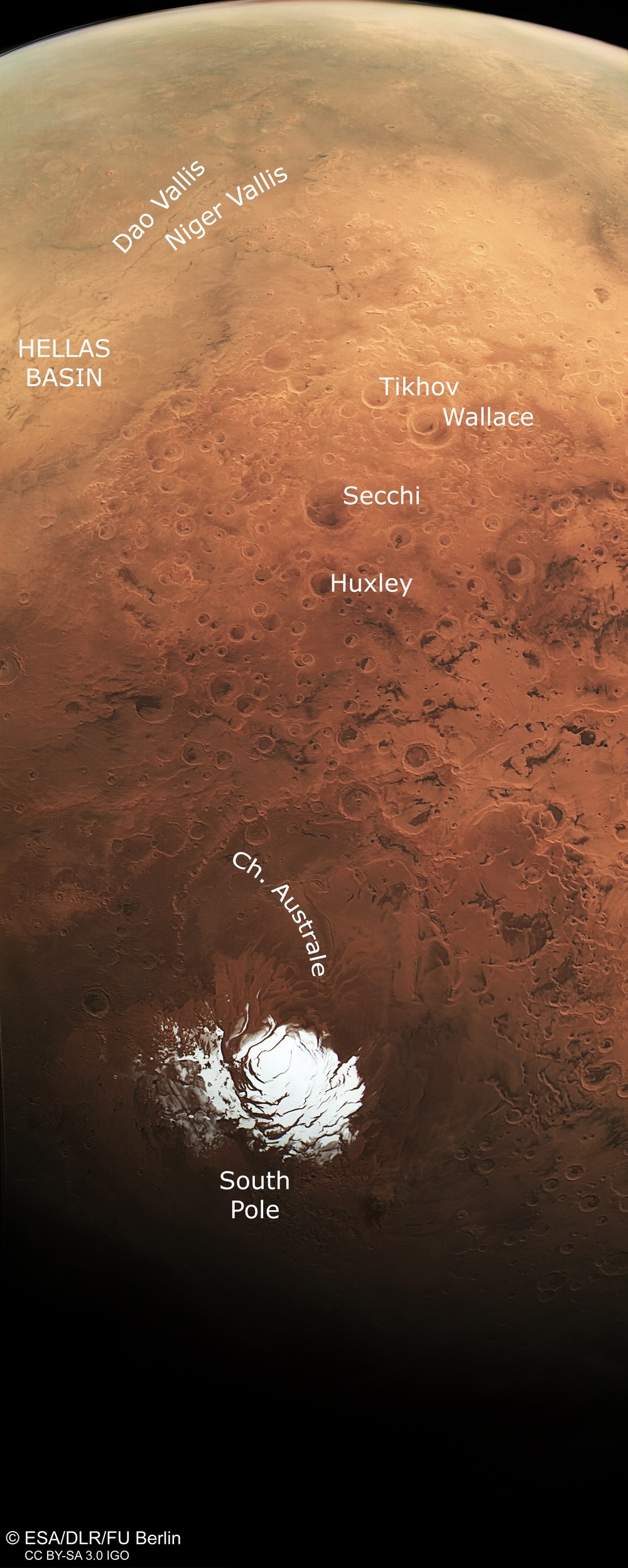
In the upper left of the image, part of Hellas Planitia is clearly visible; it is 2200 kilometres in diameter and eight kilometres deep. It is the largest impact basin on Mars and extends across more than 30 degrees in latitude. At its northeastern edge, the eroded ravines of Dao and Niger Valles, two very prominent outflow channels that extend into the Hellas Basin can be seen. Reull Vallis is also visible. Numerous dark dune fields, which were sculpted by the Martian winds are also observable in the recesses of the crater. For comparison, Huxley Crater in the centre of the image has a diameter of approximately 100 kilometres.
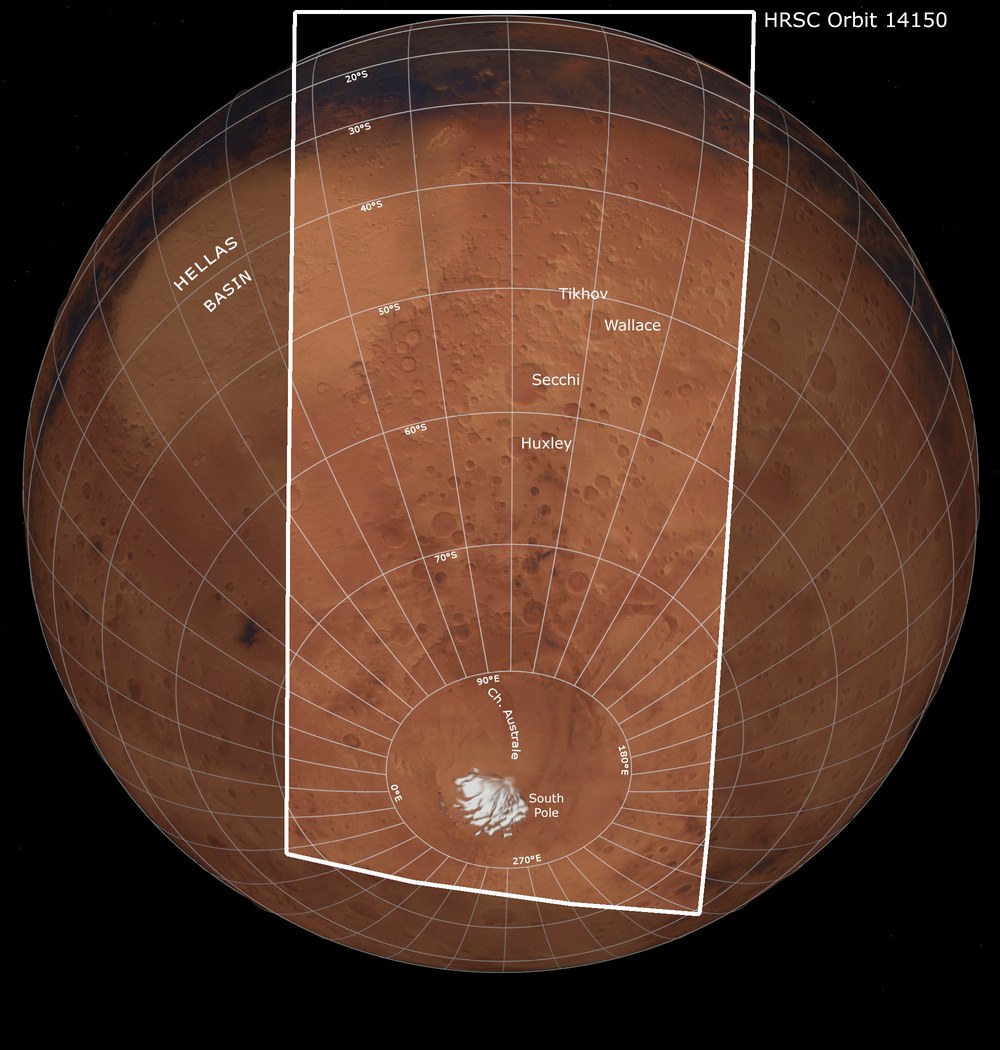
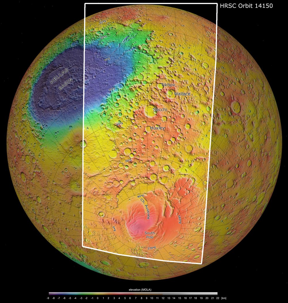
Image processing
The data used to generate this image was acquired by Mars Express during orbit 14,150. The image resolution is approximately one kilometre per pixel. The colour image was created from the data acquired by the nadir channel and the colour channels of the HRSC. The colour-coded view is based on a digital terrain model of the region, from which the topography of the landscape can be derived. The global view is based on data from the Viking spacecraft. The image data was processed at the DLR Institute of Planetary Research. The main image was created by the Mars Express team of the Department of Planetary Sciences at the Institute for Geosciences the Freie Universität Berlin.
The HRSC instrument
The High Resolution Stereo Camera (HRSC) was developed at DLR and built in collaboration with industrial partners (EADS Astrium, Lewicki Microelectronic GmbH and Jena-Optronik GmbH). The science team, which is headed by Principal Investigator (PI) Ralf Jaumann, consists of 52 co-investigators from 34 institutions in 11 countries. The camera is operated by the DLR Institute of Planetary Research in Berlin-Adlershof.