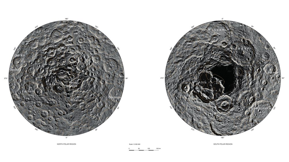
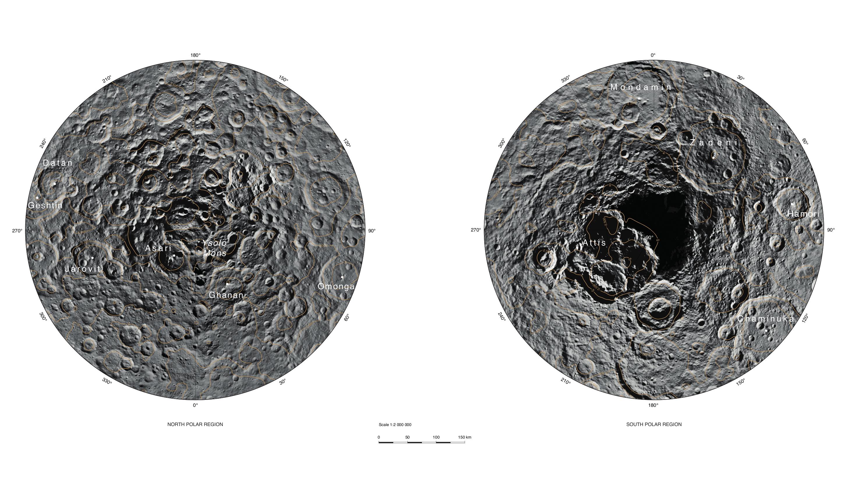
These two images show the North Pole (left) and the South Pole (right) of the dwarf planet Ceres in a scale of 1:2,000,000. Planetary researchers from the German Aerospace Center (Deutsches Zentrum für Luft- und Raumfahrt; DLR) used camera images acquired by the Dawn orbiter at a distance of 4400 kilometres from Ceres to produce these maps.
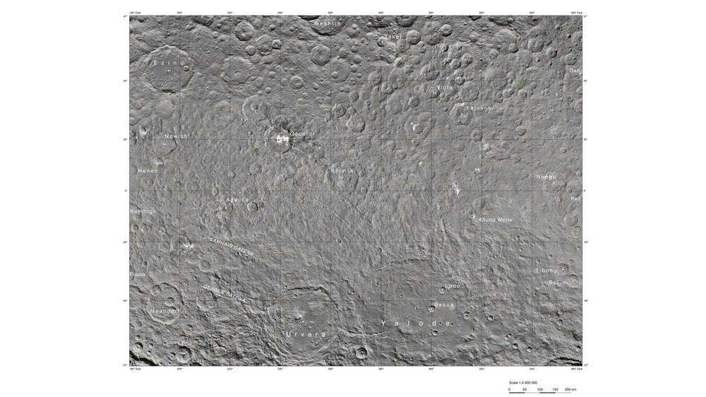
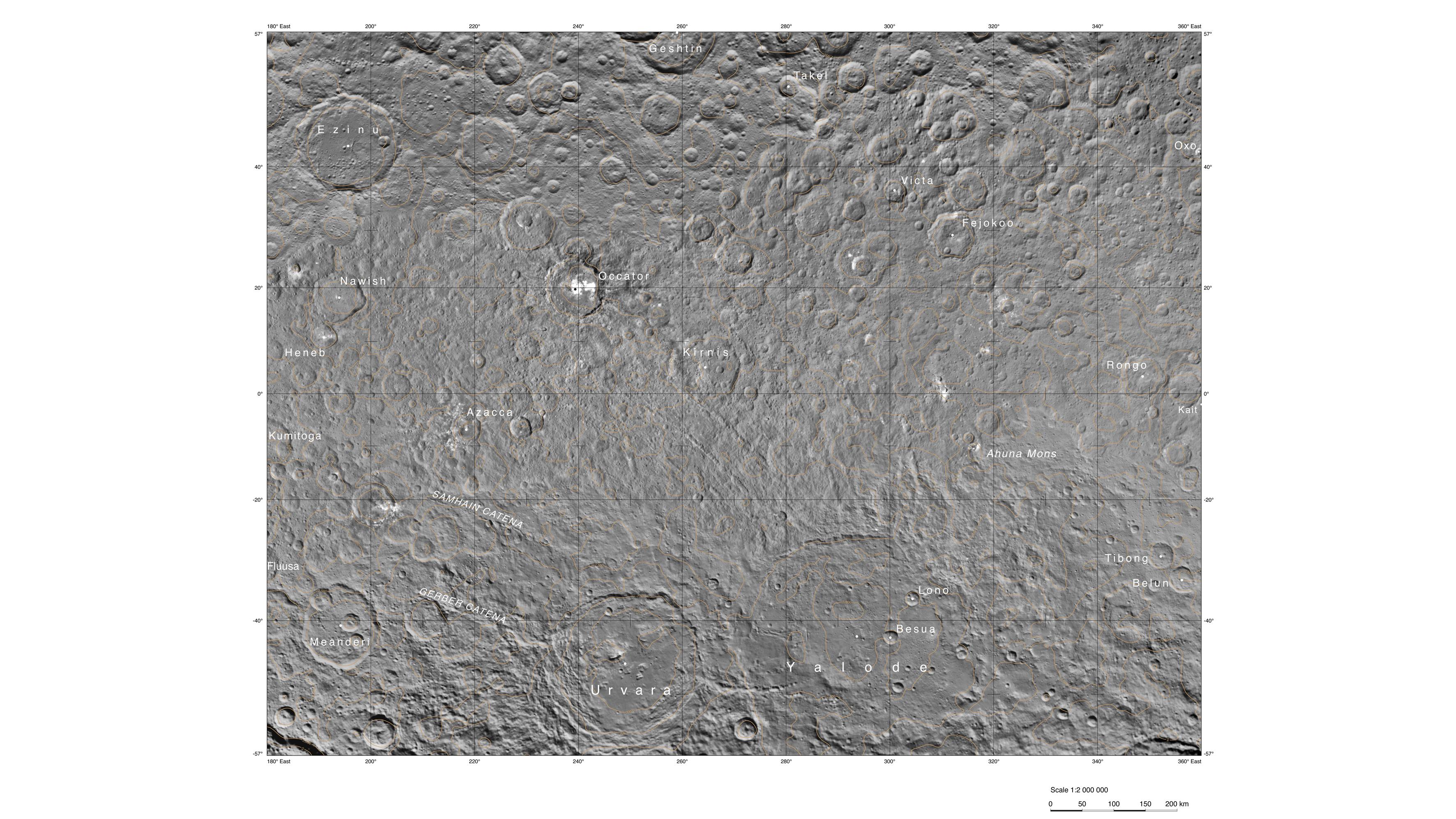
Planetary researchers from the German Aerospace Center (Deutsches Zentrum für Luft- und Raumfahrt; DLR) used camera images acquired by the Dawn orbiter at a distance of 4400 kilometres from Ceres to produce this map. It shows the striking Occator crater and the unusually bright spots on its interior.
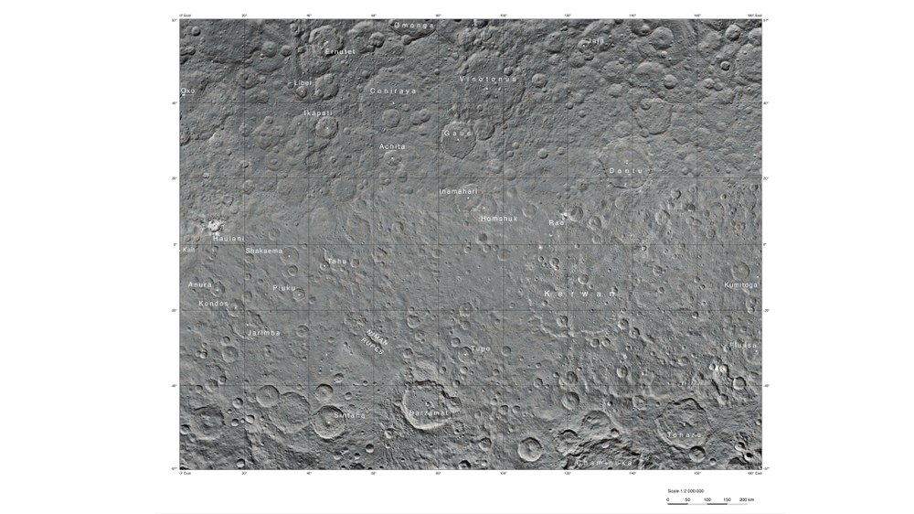
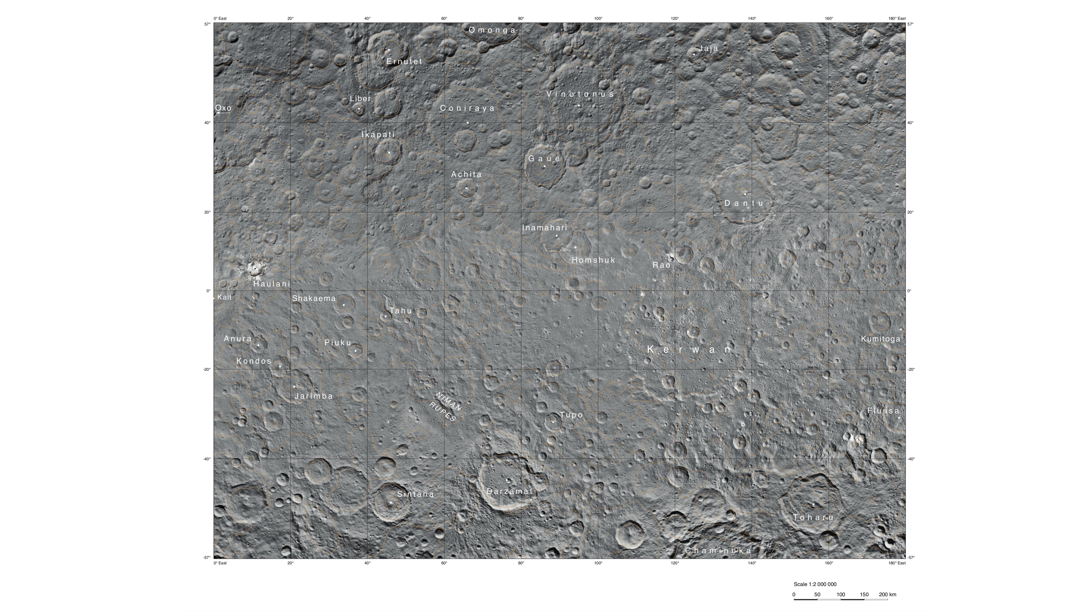
Planetary researchers from the German Aerospace Center (Deutsches Zentrum für Luft- und Raumfahrt; DLR) used camera images acquired by the Dawn orbiter at a distance of 4400 kilometres from Ceres to produce this map. It shows the region around Kerwan crater.
The dwarf planet Ceres measured a mere nine pixels across on an image acquired by NASA's Dawn orbiter on 1 December 2014. Since then, the planetary researchers at the German Aerospace Center (Deutsches Zentrum für Luft- und Raumfahrt; DLR) have received thousands of images showing the dwarf planet and its unusually varied surface. The scientists have now selected 42 images acquired during the 'Survey Orbit' in June 2015, during which Dawn observed Ceres from a distance of 4400 kilometres, to produce the Atlas of Ceres and Vesta. This is now available online. The most time-consuming task was to compute the three-dimensional elevation model, in which the DLR researchers determined the elevation of 12,000 points on Ceres.
"It was important to select images that covered the entire dwarf planet under the same illumination conditions," explains Thomas Roatsch from the DLR Institute of Planetary Research. "This allowed us to calculate a uniform, homogenous terrain model." In turn, the model was used as a basis for further processing, in which the individual images were put together to form a global mosaic of the dwarf planet. This was then used to produce the various maps contained in the atlas. Kait crater, named after an Asian crop goddess, was selected as the reference crater for the prime meridian.
The team at DLR is responsible for using the camera data to produce maps and elevation models throughout the entire mission. The images used for the first atlas have a resolution of 400 metres per pixel. The images acquired during lower orbits will serve as a basis to refine the terrain model and to create more detailed atlases. "We are already working with the data from the next orbit, which Dawn reached in August 2015." During this High Altitude Mapping Orbit (HAMO), the spacecraft and its camera system reached a position just 1470 kilometres above the dwarf planet. Dawn is not sending any images at the moment, as it is on its way to the mission's lowest orbit – the Low Altitude Mapping Orbit (LAMO). Once it arrives at its final destination, the camera will look down on the surface of Ceres from an altitude of just 375 kilometres.
Two very different celestial bodies
Dawn provides planetary researchers with the first opportunity to analyse two celestial bodies in the asteroid belt between Mars and Jupiter during just one mission, and so look back at the origin of the Solar System. The orbiter circled and analysed the asteroid Vesta from July 2011 to September 2012. Dawn has now orbited Ceres – in 2006 reclassified a dwarf planet and not an asteroid – since March 2015. "Dawn allows us to visit two entirely different celestial bodies for the first time on a single mission. Vesta is one of the dry asteroids, while Ceres is wet and may even have an ocean beneath its crust," says Ralf Jaumann, a DLR planetary researcher and member of the camera team on the NASA mission.
Vesta surprised the scientists with unusual impact craters, a mountain three times the height of Everest, valleys and canyons. But Ceres seems to be promising as well; among other things, the dwarf planet has crater walls steeper than the north face of the Eiger, which tower almost 2000 metres above their surroundings. The bright spots that had already been identified at a larger distance continue to provoke debate among the scientists. "Ceres gives us many fascinating puzzles, and exhibits phenomena that we have not seen anywhere else in our Solar System."
The mission
The Dawn mission to Vesta and Ceres is managed by NASA's Jet Propulsion Laboratory (JPL) in Pasadena, which is a division of the California Institute of Technology, for NASA's Science Mission Directorate in Washington DC. The University of California, Los Angeles, is responsible for overall Dawn mission science. The camera system on the spacecraft was developed and built under the leadership of the Max Planck Institute for Solar System Research in Göttingen, Germany, with significant contributions from the German Aerospace Center (DLR) To the Institute's website in Berlin and the Institute of Computer and Communication Network Engineering in Braunschweig. The Framing Camera project is funded by the Max Planck Society, DLR, and NASA/JPL.
