Signal measurements in wind and poor weather off Heligoland
February 15, 2016
Signal measurements in wind and poor weather off Heligoland
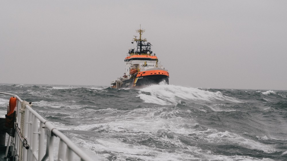
Ships sailing in formation
Two ships were deployed for a measurement campaign conducted by the DLR Institute of Communications and Navigation – the rescue vessel ‘Hermann Marwede’, operated by the German Maritime Search and Rescue Service (Deutsche Gesellschaft zur Rettung Schiffbrüchiger; DGzRS) and the multipurpose ship ‘Neuwerk’, operated by the Cuxhaven Waterways and Shipping Administration (Wasser- und Schifffahrtsamt Cuxhaven; WSV). The researchers sent signals between the ships at broadband frequencies to investigate how the waves, the vessels themselves and other factors influenced transmission.
Researchers from the German Aerospace Center (Deutsches Zentrum für Luft- und Raumfahrt; DLR) devised a number of scenarios for an initial measurement campaign involving two ships sailing in the North Sea off the coast of Heligoland during rough conditions. The purpose was to investigate communications channels at broadband frequencies.
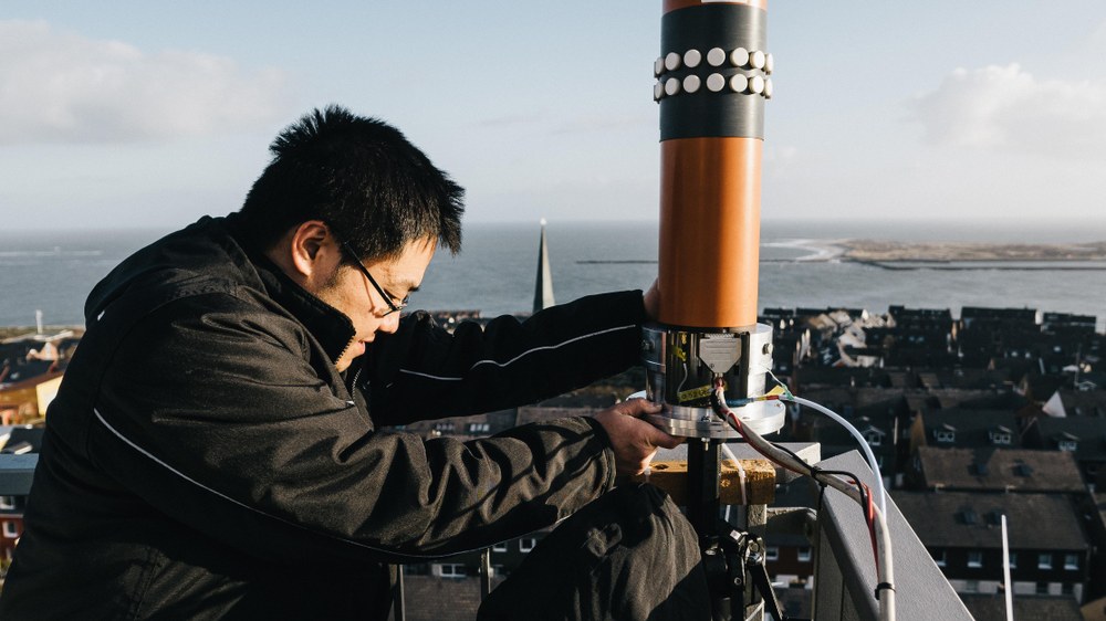
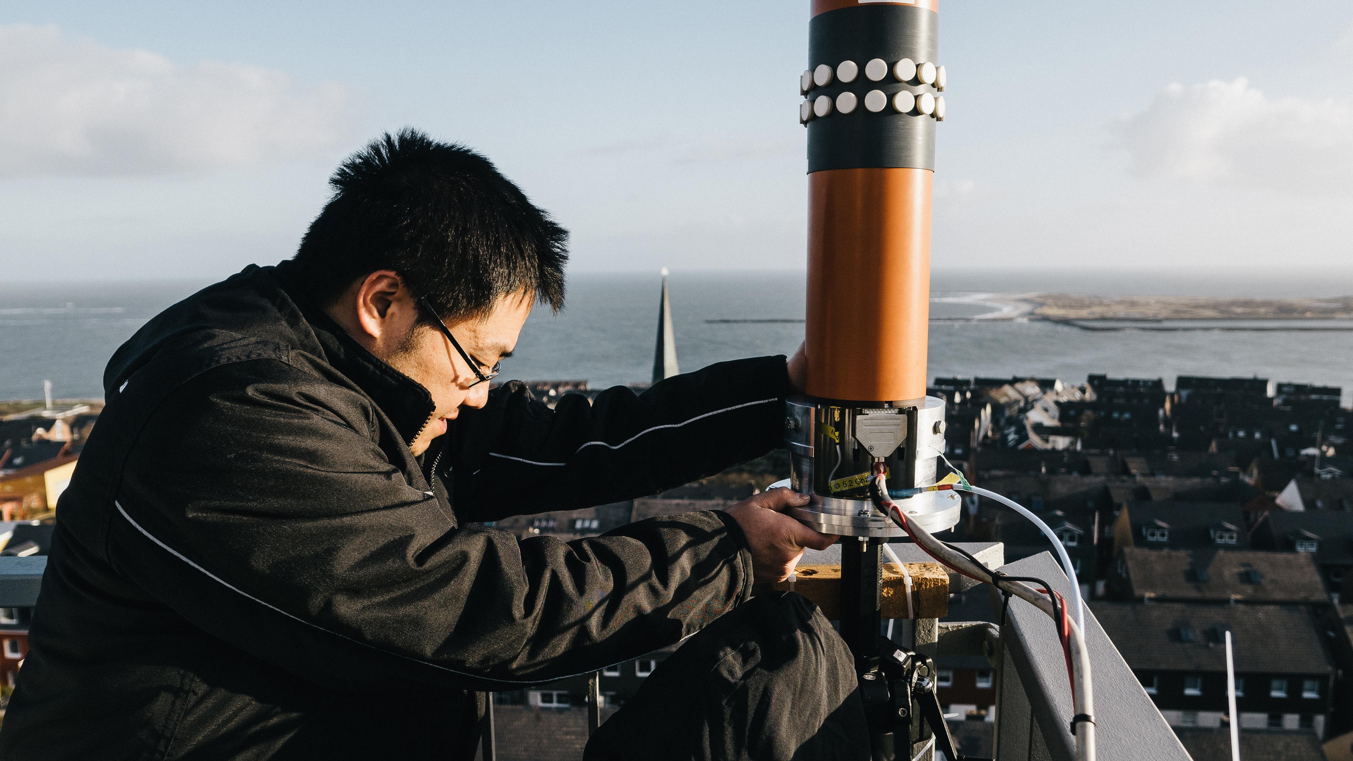
The DLR researchers installed antennas on Heligoland’s lighthouse to investigate broadband communications between ships and the shore. The rescue vessel ‘Hermann Marwede’ travelled into the North Sea for this part of the measurement campaign.
DLR investigates digital transmission channels at broadband frequencies on the high seas
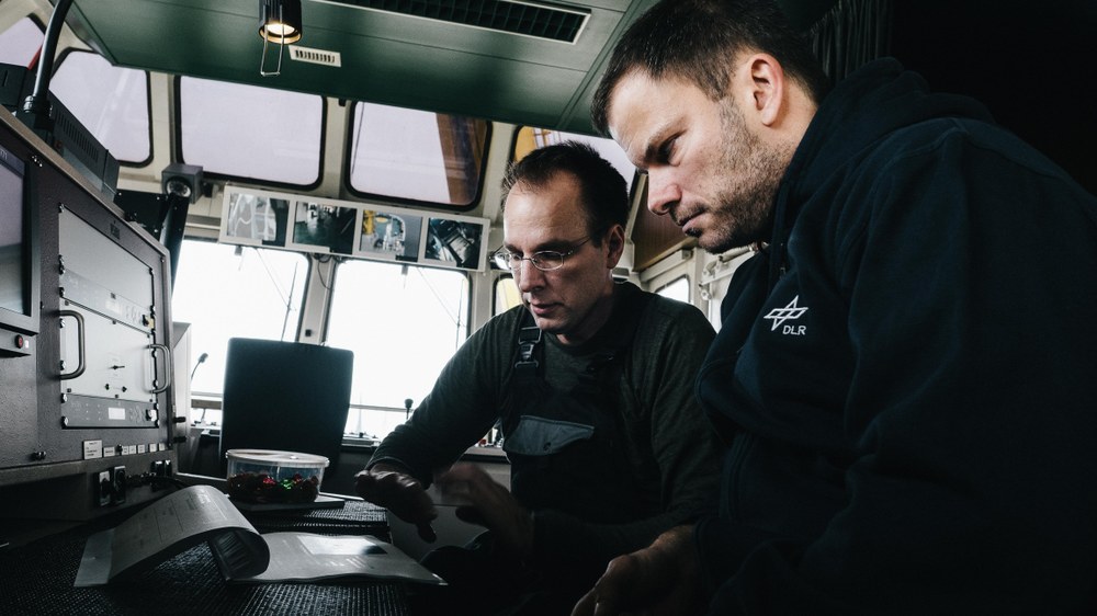
To communicate with one another, ships use radio, light signals or flags –but these channels are not suitable for transmitting large volumes of data. Only expensive satellite communications systems can enable data transfer at higher rates. "At the moment, there are no inexpensive, robust alternatives for sharing large volumes of data in a maritime setting," says Project Manager Simon Plass from the German Aerospace Center (Deutsches Zentrum für Luft- und Raumfahrt; DLR). "This is why we are working on new digital communication technologies for use at sea." In future, it may be possible to transmit large data volumes over broadband channels. A team from the DLR Institute of Communications and Navigation recently conducted a measurement campaign off the coast of Heligoland, which for the first time featured a series of tests to investigate how real conditions at sea affect the transmission of signals at five gigahertz. The campaign called for rough seas with a swell of between three and four metres, the rescue vessel 'Hermann Marwede', operated by the German Maritime Search and Rescue Service (Deutsche Gesellschaft zur Rettung Schiffbrüchiger; DGzRS), the multipurpose ship 'Neuwerk' operated by the Cuxhaven Waterways and Shipping Administration (Wasser- und Schifffahrtsamt Cuxhaven; WSV) and a DLR team to operate the transmission and reception equipment.
Scattering, reflection and shadowing
The DLR researchers asked the captains of both vessels to replicate a variety of scenarios encountered in the North Sea. They involved the 'Neuwerk' and 'Hermann Marwede' travelling parallel to each other at a distance of just 50 metres, crossing paths, and circumnavigating the island of Düne along different routes. "This allowed us to measure how the motion of the sea caused scattering and reflection of the radio signals, and also to register the effect of the island's shadow," explains Ronald Raulefs from the DLR Institute of Communications and Navigation, manager of the measurement campaign. "As things stand, not much is known about how radio signals at these high frequencies propagate at sea." The measurement campaign also included the transmission of signals between the lighthouse on Heligoland and the 'Hermann Marwede' while it was far out at sea. The rescue vessel also travelled 25 kilometres out to a wind farm, enabling the researchers to measure how the rotor blades affected signal scattering.
Improved communications on the high seas
Completed within the DLR Maritime Security Research Group, the project is intended to deliver measurement data that allows the creation of a model to calculate radio signal scatter at broadband frequencies. "This is only the first step," says Raulefs with a certain emphasis. "A second stage could involve using this model to develop ways of reducing interference caused – by waves, for example – to the transmitting and receiving equipment." There is certainly a need for ship-to-ship communication involving large data volumes; for example, rescue vessels could use video links to provide initial medical instructions while travelling to the scene of a disaster. Broadband communication would also allow the German police force to access more extensive data sets during missions at sea. The system would also enable the transmission of maritime traffic information without using satellites.
The researchers from the DLR Institute for Communications and Navigation will be able to make use of radar images acquired by the German satellite TerraSAR-X to complete precise evaluations of the campaign data over the coming months. The DLR Research Centre for Maritime Safety in Bremen provided these images. "The images provide us with an accurate impression of the wave motion around Heligoland," says Plass. Buoys operated by the German Federal Maritime and Hydrographic Agency (Bundesamt für Seeschifffahrt und Hydrographie; BSH) gave the researchers additional information about the swell during the measurement campaign. GPS antennas fitted to the ships recorded the precise locations of the measurement antennas. "We have acquired vast amounts of data in this campaign; it will certainly keep us busy for years."
