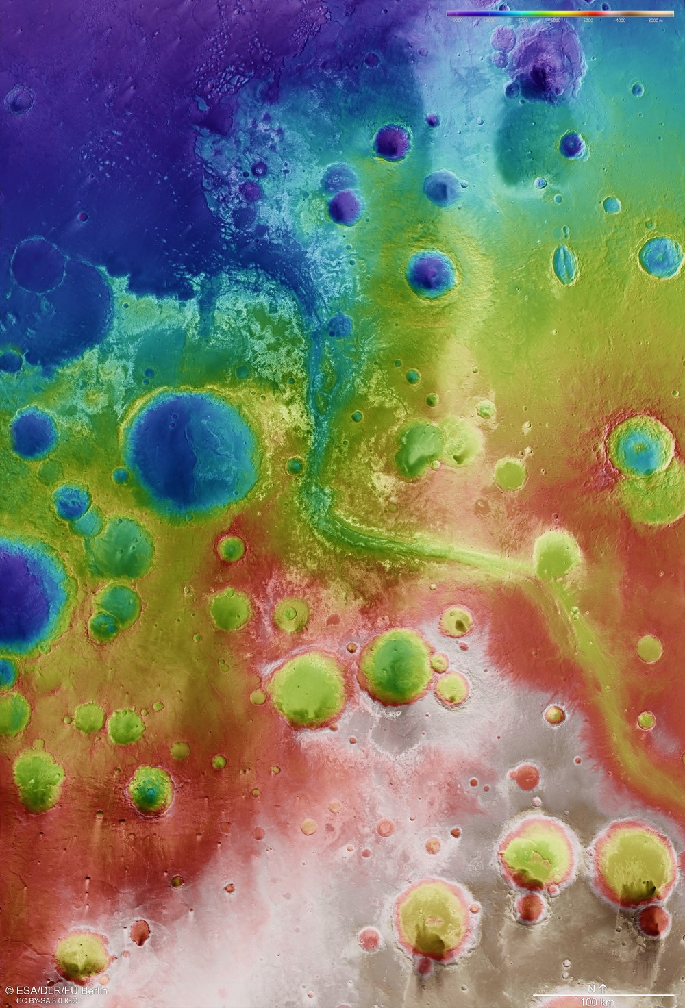
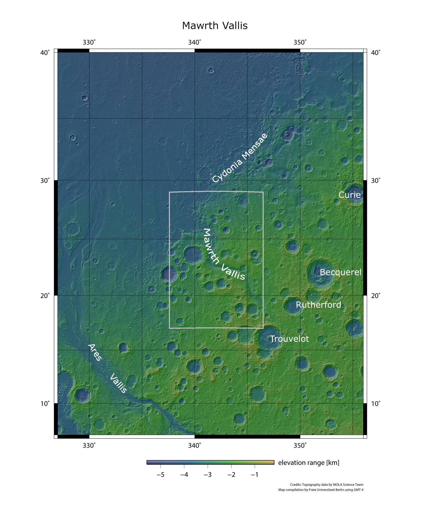
False colour image of the topography of the region around Mawrth Vallis
False colour image of the topography of the region around Mawrth Vallis: Digital terrain models of the Martian surface can be generated with an accuracy of up to 10 metres per pixel from the nadir channel directed vertically onto the Martian surface and the stereo channels of the High Resolution Stereo Camera (HRSC) on Mars Express. In this colour-coded image, the absolute elevations above a reference level, the Aeroid (derived from Ares, the Greek word for Mars), are well depicted. These elevation values can be read based on the colour scale at the top right of the image.
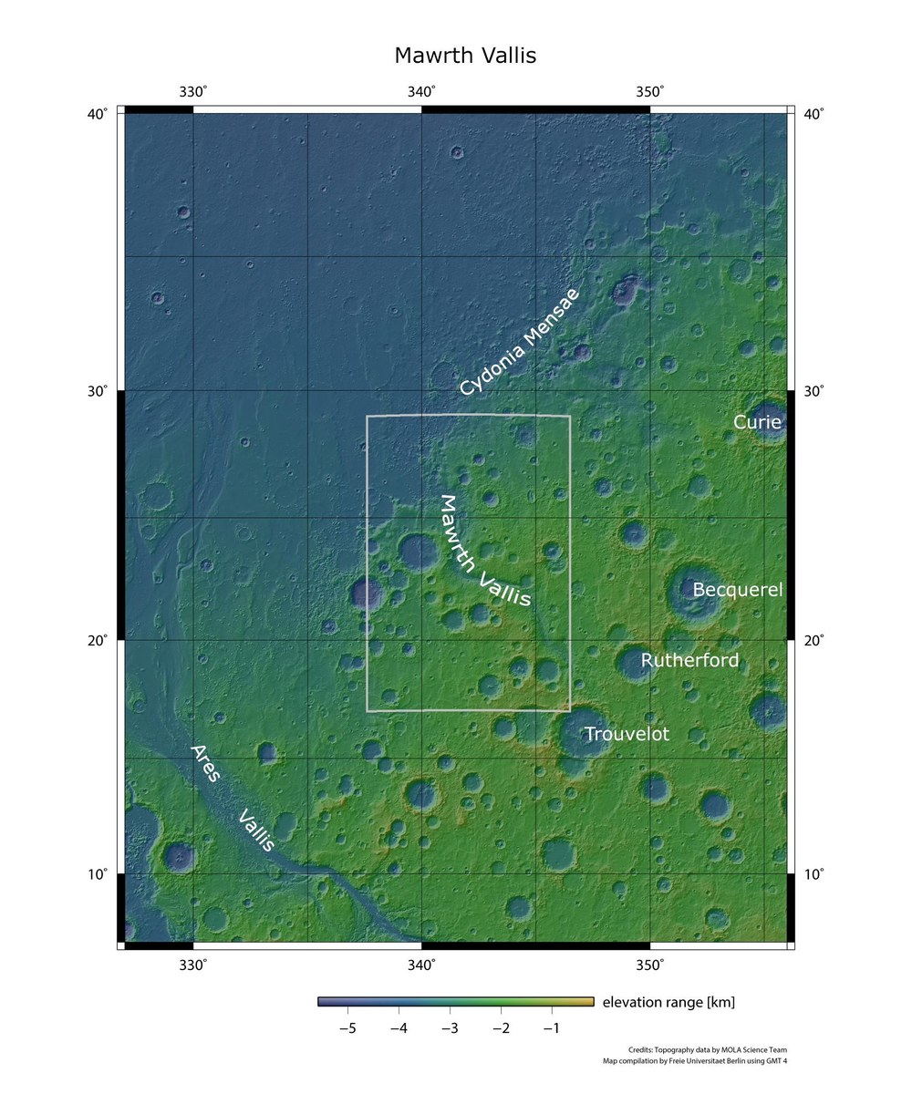
With a length of 600 kilometres and a depth of up to two kilometres, Mawrth Vallis is one of the biggest valleys on Mars and a possible landing site for the ESA ExoMars mission and NASA Mars 2020 missions. It is entrenched in the Arabia Terra highland, which is more than four billion years old, and ends in the great Chryse Planitia lowland region.
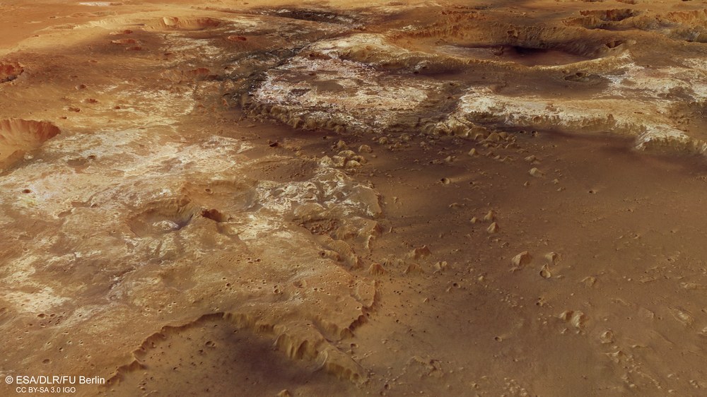
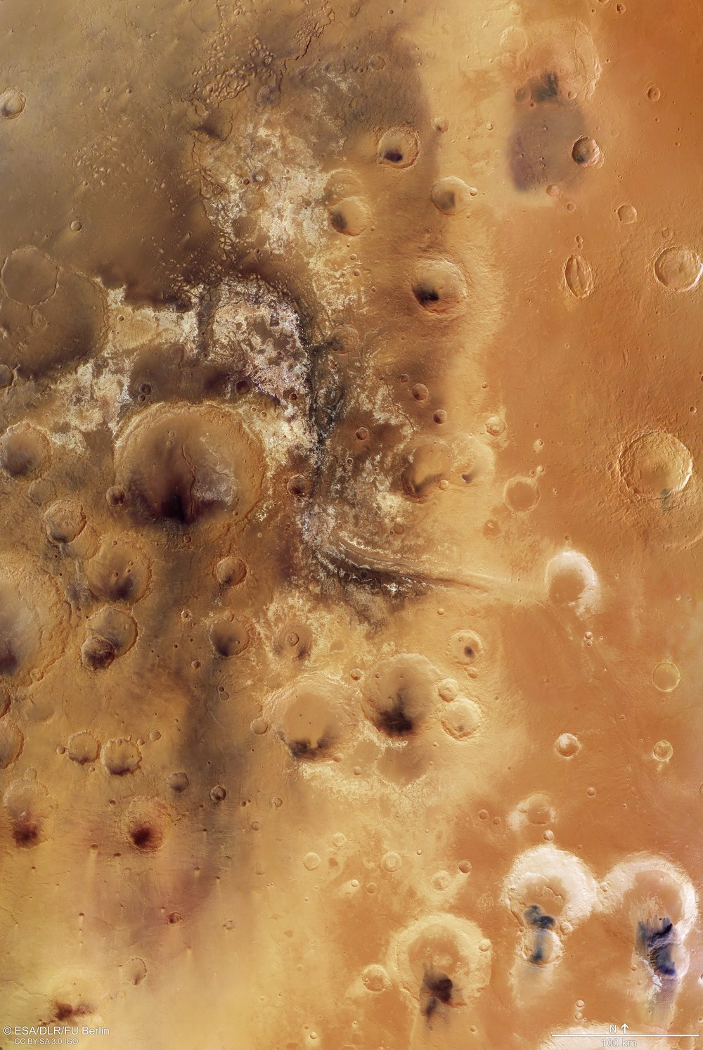
View of the Mawrth valley
View of the Mawrth valley: This image covers an area of around 330,000 square kilometres on the transition from the southern highland of Mars to the northern lowland of Mars. Mawrth Vallis is located in the centre of the image. North is at the top in the image.
The image shown in this article covers an area of around 330,000 square kilometres on the transition from the southern Martian highlands to the northern Martian lowlands. Mawrth Vallis is at the centre of the image. The image shows a bird’s eye view of the region – the perspective from which the High Resolution Stereo Camera (HRSC) on board the European Mars Express spacecraft has been observing the surface of Mars since 2004. It creates image strips that are around 200 to 500 kilometres wide and several hundred to thousands of kilometres long (depending on the altitude of Mars Express). This view of the region around Mawrth Vallis was made possible using a mosaic of nine individual HRSC images. The camera is operated by the German Aerospace Center (Deutsches Zentrum für Luft- und Raumfahrt; DLR).
It once was a potentially habitable place
Light and dark deposits can be seen in and around the Mawrth Vallis outflow valley. The light deposits are layered and are one of the biggest occurrences of clay minerals (sheet silicates) on Mars. In many places, these clays are covered with a layer of dark rock. The almost black deposits in this region are remains of ancient volcanic ash that have piled up into imposing dunes in many places (primarily in impact craters). Investigations using the OMEGA instrument on Mars Express have led to a better understanding of the clay minerals, which may be rich in either iron and magnesium or aluminium. The differing composition of the clay minerals indicates different ages and levels of erosion. Deposits containing sulphates have also been found on the valley floor of Mawrth Vallis, which in turn point to another formation environment.
Sheet silicates on Mars are a clear indication of the effect of liquid water on the surface. Furthermore, they point to neutral environmental conditions – another sign that habitable (life-supporting) conditions may have once been predominant here on Mars. The water that once flowed through the Mawrth Vallis valley was probably present on the surface until approximately 3.6 billion years ago. It is even possible that traces of life persist in the clay deposits, protected from radiation and erosion by the dark, superposing layer. For this reason, astrobiologists are very interested in this Martian region.
False colour image of the topography of the region around Mawrth Vallis
Mawrth Vallis is one of four possible landing sites for the ExoMars mission, which is due to launch in 2020 and will place a European rover and a Russian scientific platform on the surface of Mars. A borer on the rover is expected to take rock samples from the subsurface and analyse them. Other suggested landing sites for the ExoMars mission are Oxia Planum, Aram Dorsum, and Hypanis Vallis.
Image processing
The mosaic was compiled from nine individual orbital strips (1564, 1337, 2229, 1542, 1326, 1293, 2938, 2196, 3297). The region imaged lies at approximately 338 to 346 degrees east and 17 – 29 degrees north. The colour mosaic was created from the nadir channel oriented perpendicular to the surface of Mars and the colour channels of the HRSC; the perspective angle view was calculated from the HRSC stereo channels. The view, encoded in rainbow colours, is based on a digital terrain model of the region from which the topography of the landscape can be derived.
The HRSC experiment
The High Resolution Stereo Camera was developed at the German Aerospace Center (Deutsches Zentrum für Luft- und Raumfahrt; DLR) and built in collaboration with partners in industry (EADS Astrium, Lewicki Microelectronic GmbH and Jena-Optronik GmbH). The science team, which is headed by principal investigator (PI) Ralf Jaumann, consists of over 40 co-investigators from 33 institutions and ten countries. The camera is operated by the DLR Institute of Planetary Research in Berlin-Adlershof. The images shown here were generated by the Institute of Geological Sciences at FU Berlin in conjunction with the DLR Institute of Planetary Research in Berlin.
