MetOp-C weather satellite successfully launched – weather forecasting will become more precise
November 7, 2018
MetOp-C weather satellite successfully launched – weather forecasting will become more precise
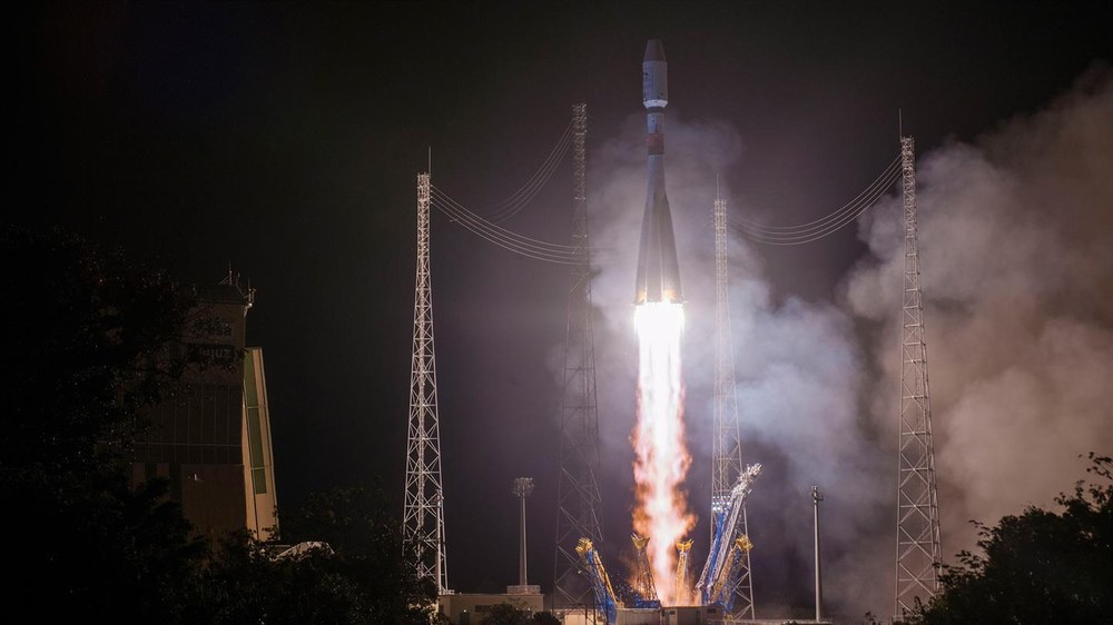
Launch of MetOp-C aboard Soyuz
MetOp-C, the third MetOp satellite, was launched into space on board a Soyuz launcher from Europe's spaceport in French Guiana. The Soyuz, with its 4083-kilogram satellite payload, lifted off on 7 November 2018 at 1:47 CET. Approximately 60 minutes later, Soyuz's upper stage delivered MetOp-C into orbit and contact was established through the Yatharagga ground station in Australia.
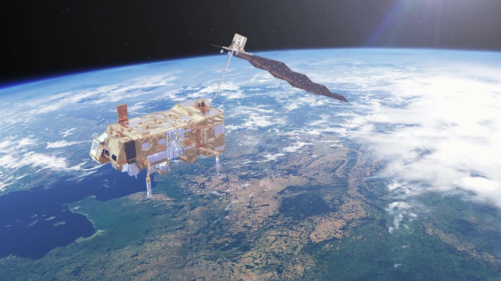
The MetOp-C satellite complements its predecessors MetOp-A and MetOp-B, which have been collecting weather data since 2006 and 2012 respectively. Last but not least, the MetOp series optimises weather forecasting by recording the temperature and humidity from a relatively low 800-kilometre orbital altitude.
One of the instruments on board MetOp-C is the ASCAT, a radar that measures wind speeds and directions over the open sea. The satellite also observes the extent of sea ice and ozone layer in the stratosphere and transmits meteorological measurements from ships, buoys and research stations.
The European weather satellite 'MetOp-C' was launched on 7 November 2018 at 01:47 CET aboard a Soyuz rocket.
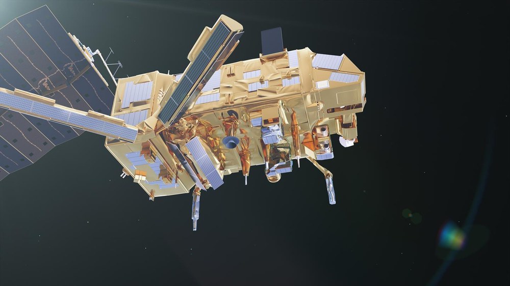
The satellite’s seven main instruments will be used for weather observation and monitoring climate change.
The successor system MetOp-SG is expected to replace MetOp from 2023.
Focus: Space
On 7 November 2018 at 01:47 CET, the European weather satellite MetOp-C was launched on board a Soyuz rocket from the European spaceport in French Guiana. MetOp-C will join two structurally identical satellites, MetOp-A and MetOp-B, which were launched in October 2006 and September 2012, respectively. They are all operated by EUMETSAT, the European Organisation for the Exploitation of Meteorological Satellites. Through the DLR Space Administration, Germany has contributed to approximately 21 percent of the satellite’s development.
The seven main instruments on board the two 'older' satellites have already significantly improved the quality of weather forecasting. Their tasks also include monitoring climate change, for example the hole in the ozone layer. The use of MetOp data helped to make forecasting models 27 percent more accurate in 2017, and the quality of multi-day weather forecasts has seen considerable improvements as a result. MetOp-C will make weather forecasting even more accurate.
"We are responsible for the technical supervision of the MetOp programme, for which the German Federal Ministry of Transport and Digital Infrastructure has provided us with sufficient funding," explains Thomas Ruwwe, MetOp Programme Manager at the DLR Space Administration in Bonn. The payload modules and the ASCAT instrument also come from Germany. They were constructed at Airbus in Friedrichshafen. The Advanced Scatterometer (ASCAT) radar instrument observes the water reflections of the seas. "These wave images allow us to draw conclusions about wind speed and direction," DLR Programme Manager Thomas Ruwwe continues. "They represent important input variables for weather forecasting, while also having applications in maritime route planning.
MetOp-A has long exceeded its planned six-year lifespan, but is still in good condition, while a similar performance is expected from MetOp-B. As such, MetOp-C will initially be operated together with its two 'siblings' in what is known as a tristar configuration. This puts the satellites on the same polar orbit at an altitude of 817 kilometres and 120 degrees apart, allowing the same location on the Earth's surface to be recorded several times a day.
The relatively low orbital altitude – 817 kilometres, as opposed to approximately 36,000 kilometres for geostationary satellites – enables the MetOp instruments to measure a multitude of parameters with significantly greater accuracy than the geostationary Meteosat satellite series. Thomas Ruwwe explains: "The MetOp satellites fly over the poles and collect important observational data from these regions, which can then be used for weather forecasting. The data that geostationary satellites provide about these regions is insufficient." The instruments on board the MetOp satellites measure temperature and humidity profiles as a function of altitude, which is essential for weather forecasting. They also record cloud conditions, the temperature over sea and land, and the concentration of important trace gases, such as ozone in the atmosphere.
The successor system MetOp-SG (Second Generation) is currently in its development phase and is expected to replace MetOp from 2023. This second generation will consist of two types of satellites, MetOp SG-A and MetOp SG-B, with three of each type built. MetOp-SG-A satellites will carry optical instruments on board, including two German contributions: METimage and the Sentinel-5 instrument. For the B-series, the payload will consist primarily of microwave instruments, including the SCA scatterometer, which will also be built in Germany as a successor to the ASCAT. Scatterometers are used to measure the ocean surface roughness. Overall, Germany is involved in around 27 percent of the development of this second satellite generation.
