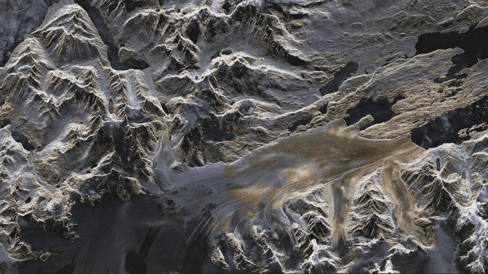
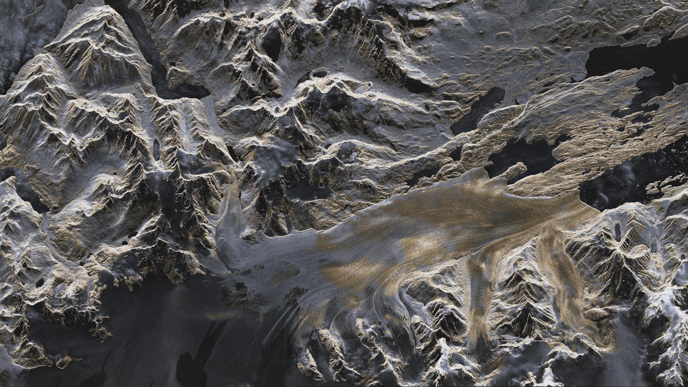
TerraSAR-X image – the Upsala Glacier in Patagonia
Artificially coloured TerraSAR-X image (strip mode) of the Upsala Glacier in Patagonia, Argentina, created using data acquired on 7 January 2008. The colours provide information about the roughness of the terrain. Areas that appear predominantly smooth to the radar are tinted in darker shades of blue and grey. Areas with a coarser surface texture are shown in yellow.
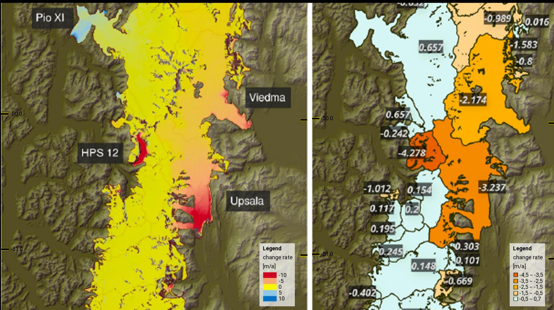
Mass changes in the Southern Patagonian Ice Field revealed by radar
Detail from a map showing the changes in height of the Southern Patagonian Ice Field; the names on the map indicate the most important outlet glaciers. (a) Pixel-based estimation of the mass change over the period 2000 to 2015; (b) estimated average mass change for the area of the glacier catchment area. Elevation models from the Shuttle Radar Topography Mission in 2000 and from the TanDEM-X mission conducted from 2011 to 2015 were used for the analysis.
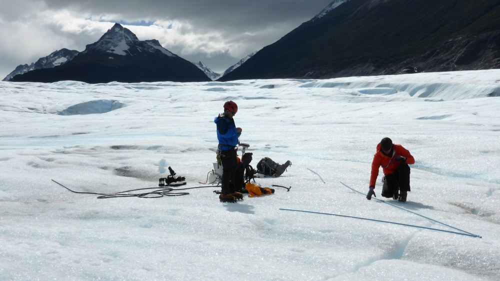
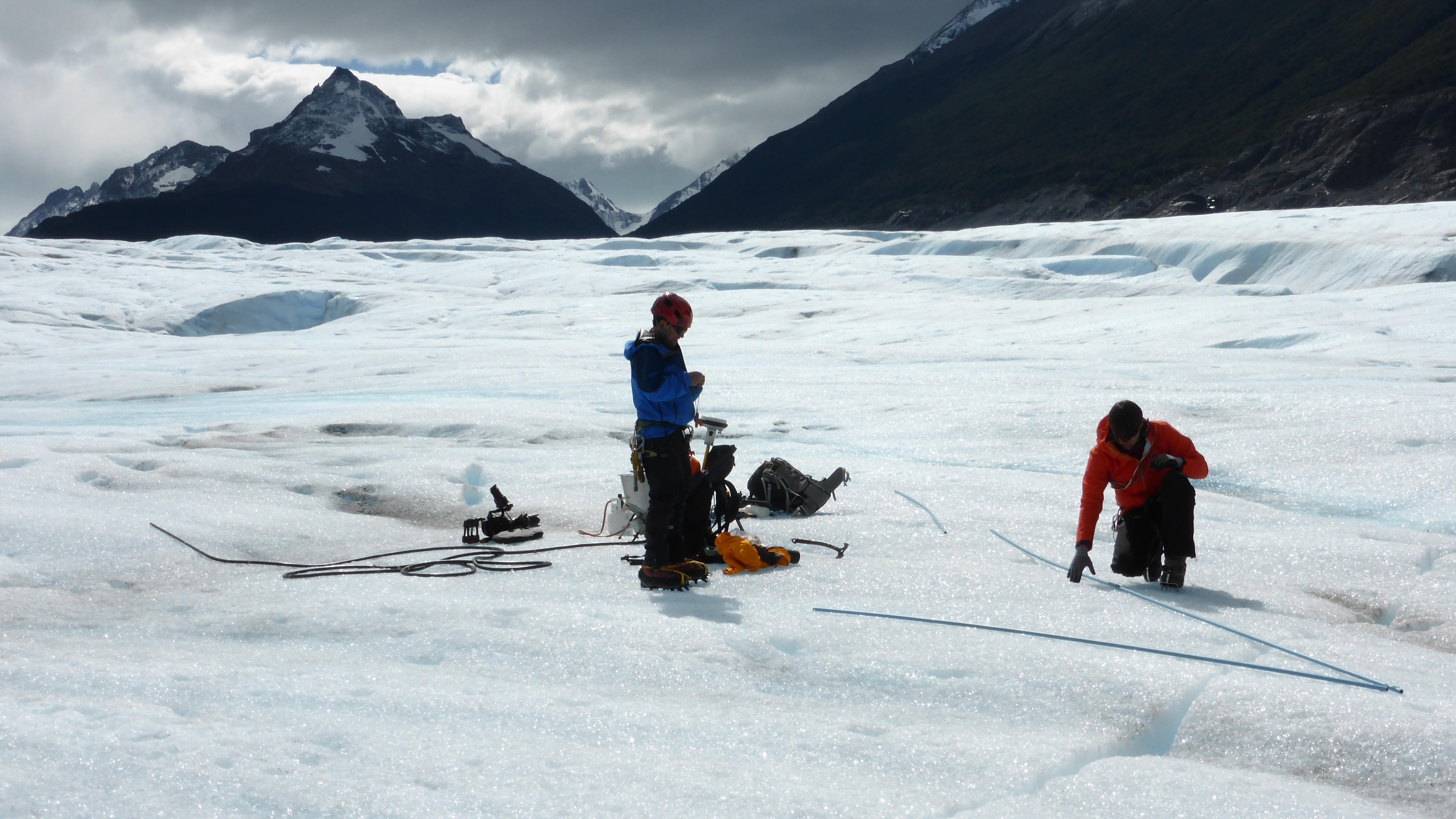
Glaciological ground measurements on the Grey Glacier in Argentina. Poles are drilled into the glacier to measure the rate of melting. Such measurements serve as references for analysis using satellite data.
A precise understanding of glacier evolution requires knowledge of a glacier's exact mass. This is important in South America, in the tropical regions between Bolivia and Venezuela, where meltwater from glaciers provides drinking water during the dry season. However, basic data about mass changes in glaciers are not easy to obtain. Mass losses are also contributing to rising sea levels on a global scale. As a new analysis method using TanDEM-X data shows, this is particularly true for Patagonia.
Prior to the availability of this method, scientists had to measure changes in glacier mass on site, which is difficult for large and inaccessible areas. An example is the Patagonian Ice Fields, which lie in the Andes – on the border between Chile and Argentina – and cover an area of almost 18,000 square kilometres. Alternatively, satellite-based gravitational field measurements can provide information about the mass balance. However, this method is not suitable for glaciers in tropical regions with low ice cover. TanDEM-X now offers the possibility of determining the mass balance of glaciers using radar remote sensing. This has the advantages of being a uniform measuring method and offering a higher degree of precision than ever before. Scientists from the Friedrich-Alexander-Universität Erlangen-Nürnberg (FAU) have developed a special processing method, which they have used to obtain a detailed picture of the mass changes in all of South America's glaciers from radar data for the first time.
Entire glaciers have disappeared
The FAU study shows that the Patagonian Ice Fields have suffered the biggest losses – in addition to the mass losses in the large ice sheets, entire glaciers have already disappeared. Between 2000 and 2015, Patagonia's Ice Fields shrank by around 17.4 gigatonnes. This equates to a decrease of 19.3 cubic kilometres per year and exceeds even the mass losses of glaciers located in the tropics. Analysis of the TanDEM-X data confirms previous investigations and reveals a dramatic change, which was previously only confirmed for areas in Bolivia and Peru.
The TanDEM-X terrain models record height differences with an accuracy of one metre, allowing even individual glaciers to be accurately measured. Geographers working with Matthias Braun and Tobias Sauter in the fields of remote sensing, geoinformation and physical climatology at FAU are using these data from the 2011–2015 period and comparing them with data acquired by the Shuttle Radar Topography Mission, which took place in 2000. Using a complex procedure, they used the differences to calculate the height changes for the glaciers and hence the changes in their mass. By using the high-resolution TanDEM-X data and the new processing method, the FAU researchers were thus able to analyse the large Patagonian inland ice sheets separately from the surrounding glaciers for the first time. The results of the extensive study were published in the journal Nature Climate Change and may be included in the next report of the Intergovernmental Panel on Climate Change.
Continuation of TanDEM-X and Tandem-L
The global terrain model derived from data acquired by the TanDEM-X mission is currently being updated, with the researchers from the FAU hoping to benefit even more from these data in future. They are looking to extend their analysis to other regions and update it over time. The geographers are also excited about Tandem-L, the follow-up mission to TanDEM-X. Tandem-L aims to map Earth's landmass on a weekly basis. In the L-band frequency range, at a wavelength of 23.6 centimetres, the radar signals of the new satellites would be able to penetrate through the vegetation and into the ground. Radar tomographic images will form part of the Tandem-L mission, thus ensuring even more accurate coverage of glacier masses. In future, FAU scientists will be able to observe the glacier regions of South America with high temporal and spatial precision and thus gain further valuable insights.

