Glaciers are melting faster and with more consequences than expected


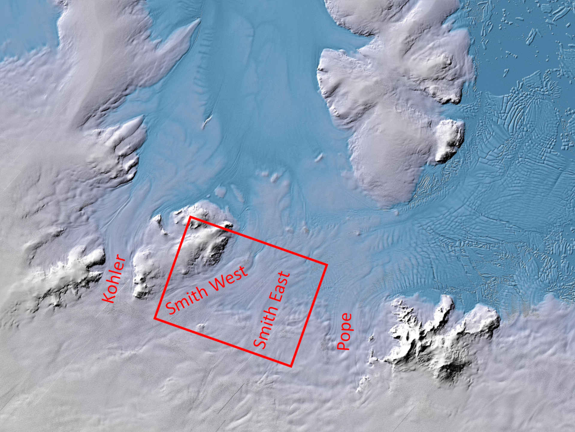
- In West Antarctica, the Smith, Pope and Kohler glaciers are melting faster than predicted.
- Critical area – the free-floating undersides of the glaciers are melting fastest.
- West Antarctica ice masses could raise the overall sea level by up to 1.2 metres.
- Focus: Space, Earth observation, global change, TanDEM-X
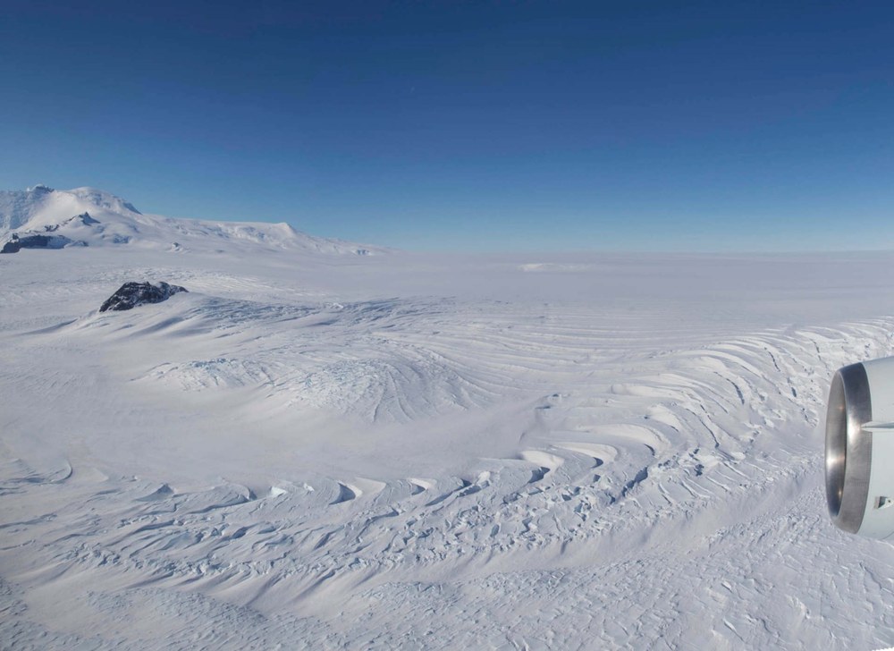
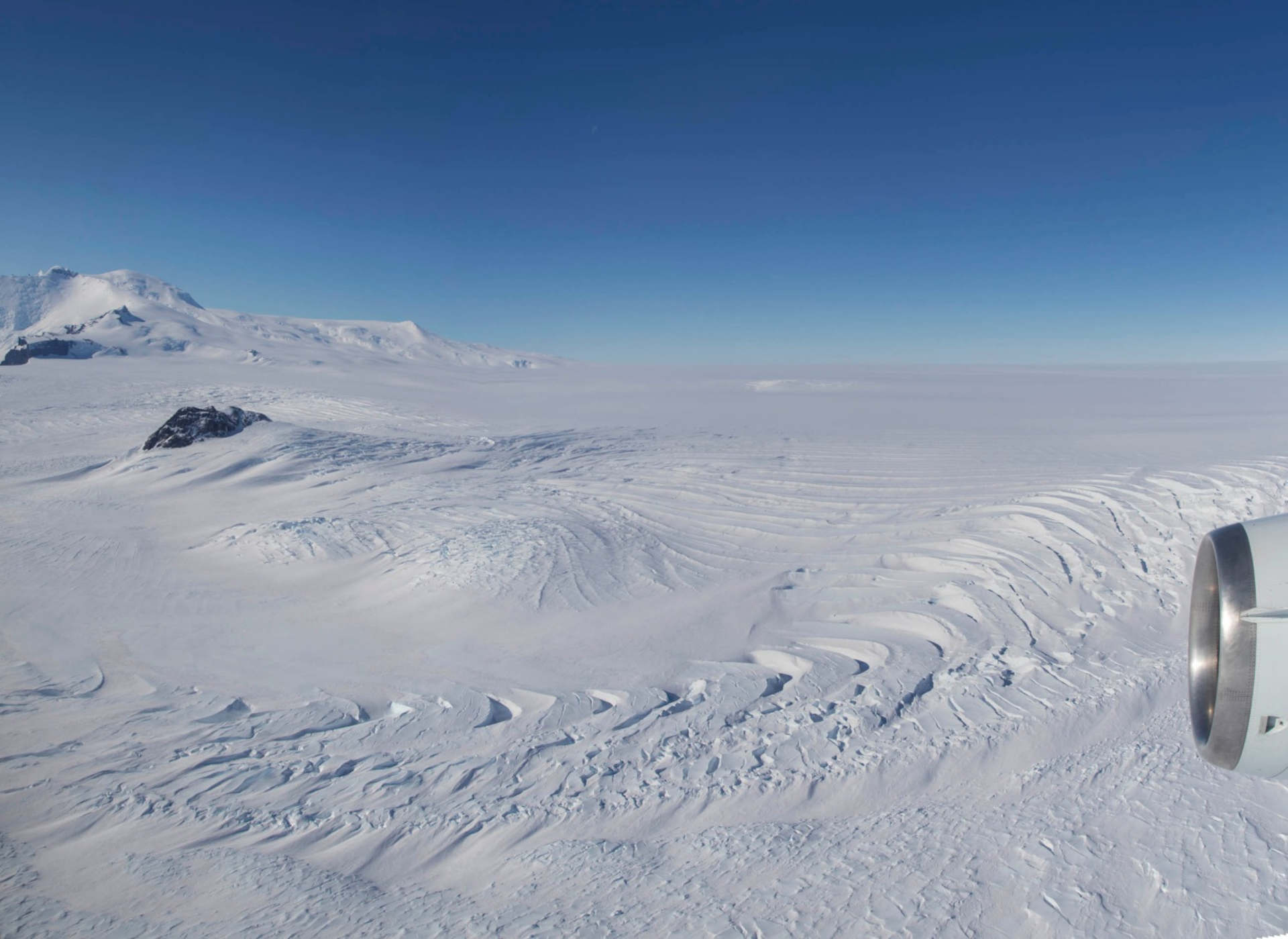
Developments at the South Pole are raising new concerns. A group of smaller glaciers, named Pope, Smith and Kohler, are melting faster than expected. So far, the neighbouring giant glaciers, Thwaites and Pine Island, have been the focus of research because they are extremely fragile and could raise global sea levels by up to 1.2 metres. The German Aerospace Center (Deutsches Zentrum für Luft- und Raumfahrt; DLR) has identified and analysed the changes in West Antarctica, in cooperation with international research partners. The causes of the rapid melting of the smaller glaciers were discovered using specialised radar data acquired by the TanDEM-X and COSMO-SkyMed satellite missions.
These findings are important for obtaining a better understanding of glacier processes and predicting the development of the entire Antarctic. Climate researchers will then be able to calculate with greater precision how much sea levels will rise, and which protective measures will be most effective. The results of this new study have now been published in the scientific journal 'Nature Geoscience'. This work is the result of a collaboration between the University of Houston, the DLR Microwaves and Radar Institute, the University of California, the Université Grenoble Alpes and the Italian Space Agency (Agenzia Spaziale Italiana; ASI).
Complex melting processes
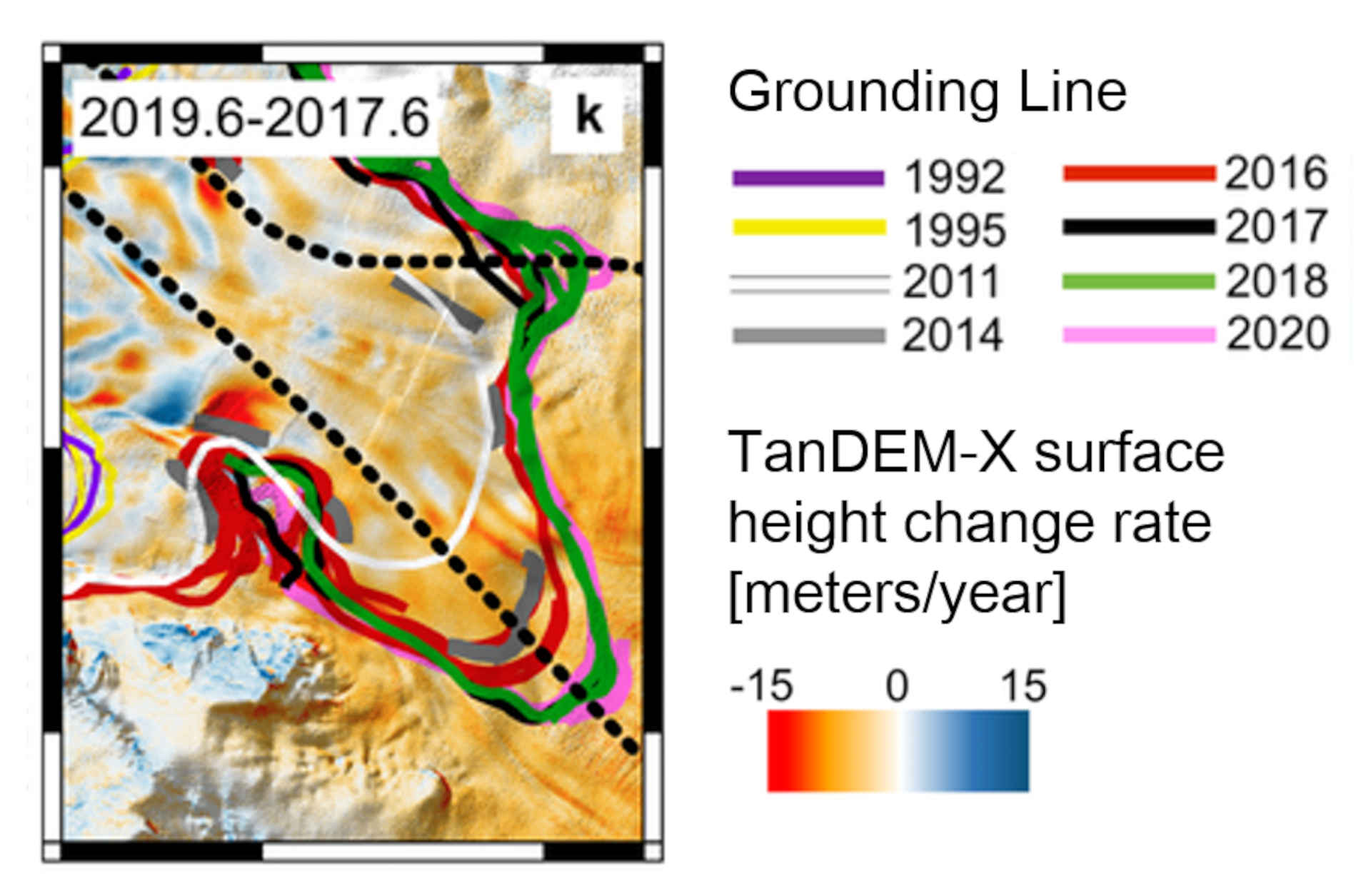
The Pope, Smith and Kohler glaciers have shrunk significantly over the last 30 years. They have become thinner, lost ice shelves to the ocean and retreated further inland. What is striking here is the retreat of the grounding line, the boundary at which the ice loses contact with the land surface and begins to float on the sea. Because of this, the radar experts focused their attention on this transition area. In this way, they were able to detect drastic changes in the Pope Glacier for the first time; it retreated at a rate of 11.7 kilometres per year within just three months during 2017.
Earth observation satellites have become indispensable for glacier and climate research. "In the past, it was necessary to wait for several years in order to retrieve useful data and it was only possible to observe long-term trends. Nowadays, we can look at retreats on a monthly basis and we are able to capture a whole new level of details that will help improve glacier models and in turn refine sea level rise estimates," explains DLR guest scientist Pietro Milillo from the University of Houston, Texas. With a targeted analysis of TanDEM-X time series, they were even able to track changes every two weeks instead of every four weeks.
This new study provides another important piece of the puzzle for glacier and climate research. This is because the physical melting processes of the Pope, Smith and Kohler glaciers are identical with those of the other glaciers around the Amundsen Sea. With their high mass losses, the enormous Thwaites and Pine Island glaciers could destabilise the rest of West Antarctica, with devastating consequences for life on Earth. If future climate models take into account how much a floating ice sheet melts from below, they could also determine the retreat of glaciers even more precisely.
Key process – melting of the free-floating glacier undersides
The undersides of glaciers are hidden from view, so the loss of ice cannot be measured directly. Using TanDEM-X digital elevation models, the scientists have now been able to accurately determine this hidden melt rate. For example, while the Smith Glacier melted at approximately five metres per year over land between 2011 and 2019, the melt rate on the free-floating underside of the glacier was about 22 metres per year. At certain locations, the Smith Glacier had melt rates of more than 100 metres per year, with a peak of 140 metres per year in 2016.
Several studies with climate models confirmed that the computer calculations of the grounding line only agree with the actual measurements if they include the new values of the undermelt rate. In addition, the new radar data and findings have been instrumental in helping the International Thwaites Glacier Collaboration prepare measurement campaigns and select suitable sites for test drilling.
"In order to determine the melting rates, DLR has generated more than 240 digital TanDEM-X elevation models that map West Antarctica with high precision from 2011 to 2019," says co-author Paola Rizzoli from the DLR Microwaves and Radar Institute. This involves a well-rehearsed production process – the German Space Operations Center is responsible for operating TerraSAR-X and TanDEM-X and commands the twin satellites to acquire the required images. The radar data are received by the German Remote Sensing Data Center at its ground stations in Neustrelitz (Germany), Inuvik (Canadian Arctic) and GARS O'Higgins (Antarctica). The DLR Remote Sensing Technology Institute delivers the data to the automated TanDEM-X processing chain. The interferometric processing, geocoding and calibration of the TanDEM-X images is implemented at the DLR Microwaves and Radar Institute.
L-band – the future
Germany's leading role in radar research and radar technologies will enable the development of a new generation of radar satellites that expand the urgently needed database for research and the global community. This can close gaps in knowledge and help develop solutions for global societal challenges. This technical as well as scientific expertise can be further expanded for future satellite missions, particularly in L-band.
Radar satellites with a longer-wavelength frequency range have the advantage that they can also 'see' through vegetation to the ground. In the polar regions, a radar mission in the L-band could map glacier structures and dynamic processes such as ice melting even more precisely. Germany could continue to set new standards in Earth observation, observe global change with a new level of quality and enable important recommendations for action.