Shipwreck of the 'Endurance' found – safe navigation thanks to satellite data
March 10, 2022
Shipwreck of the 'Endurance' found – safe navigation thanks to satellite data
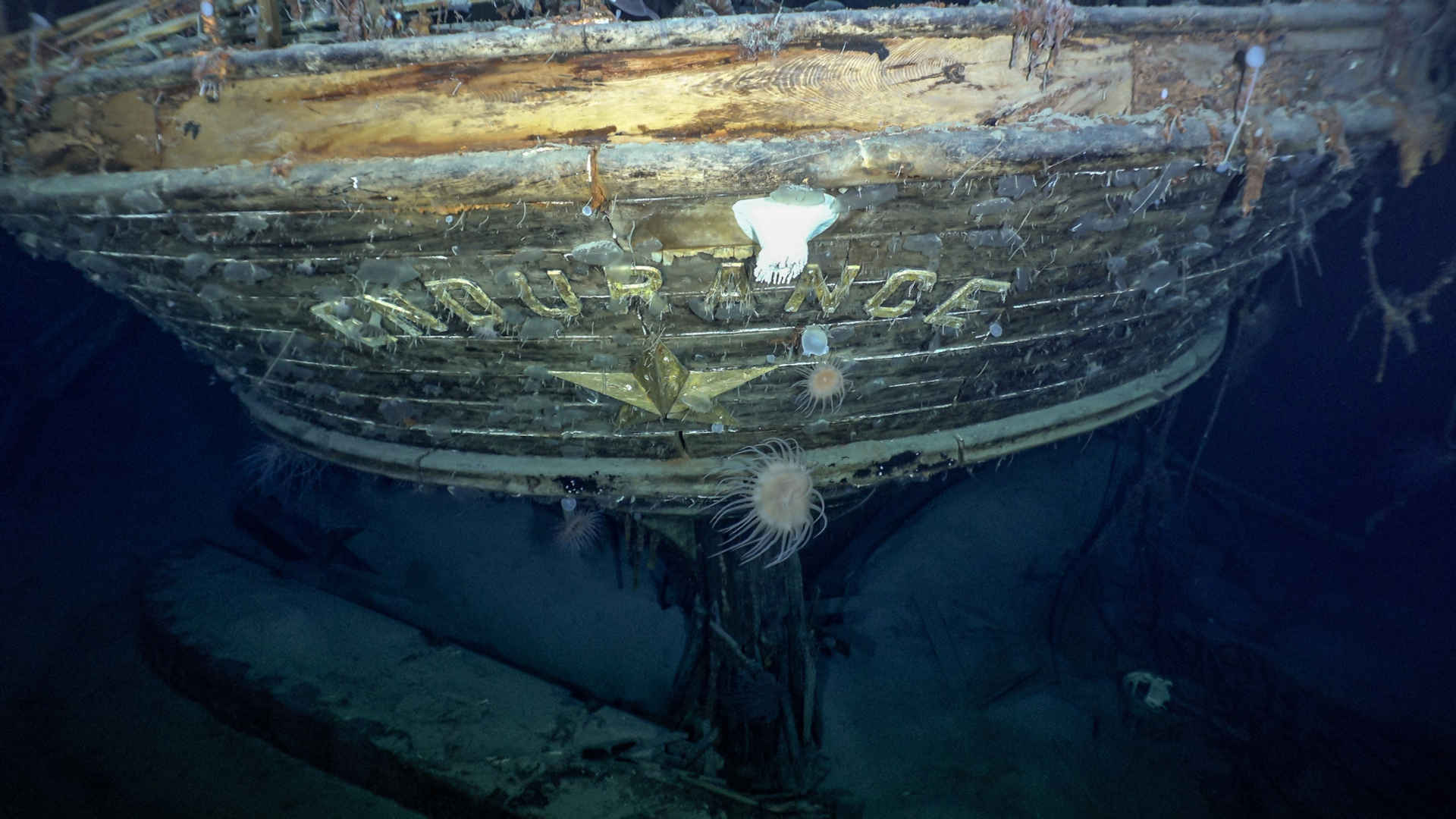
Wreck of the Endurance at a depth of 3008 metres
Images of the lost polar research ship 'Endurance' at a depth of 3008 metres were acquired with the help of submersible robots. In the ice-cold waters of the Weddell Sea, the wreck of the ship has been so well preserved that even after 100 years its name is still clearly visible.
Image: 1/5, Credit:
Falklands Maritime Heritage Trust, National Geographic
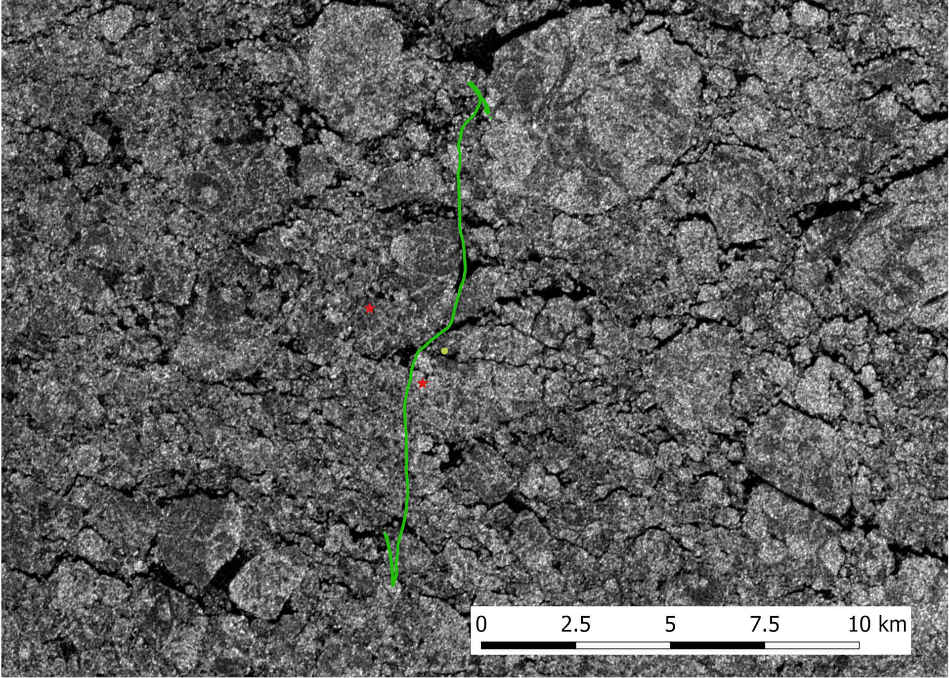
TerraSAR-X image for route planning during the Endurance22 expedition
The radar satellite TerraSAR-X makes different structures in the sea ice visible and supports ship navigation in polar regions. The Antarctic 'Endurance22' expedition used TerraSAR-X data as a basis for daily course selection. In this view, the course of the expedition ship S.A. Agulhas II is plotted in green over the radar image. Areas of open water appear in black, ice appears in white.
'Endurance' – Ernest Shackleton’s research ship – which sank in 1915, has been found in good condition.
TerraSAR-X satellite images helped navigate the expedition ship.
DLR researchers studied the properties of sea ice during the expedition.
Focus: Spaceflight, Earth observation
Over a century ago, Ernest Shackleton's ship Endurance sank in Antarctica, trapped and crushed by the ice. The crew survived and the incredible rescue operation made the polar explorer's expedition legendary. The wreck has now been located with the support of the German Aerospace Center (Deutsches Zentrum für Luft- und Raumfahrt; DLR). DLR provided TerraSAR-X satellite images that enabled safe navigation through the ice-covered Weddell Sea. DLR researchers on board the expedition’s ship also studied the properties of sea ice to improve navigation in polar regions.
Sea ice is constantly changing. Winds and ocean currents can compress large masses of ice within hours and close open channels. If the ice is under pressure, floes can push over and under one another or extend vertically. Such pressure ridges are often impassable even for icebreakers. Radar satellites like TerraSAR-X provide images of the Earth's surface as well as the surface of the ice and show different structures in the sea ice. Due to the active radar antenna this is possible even under overcast conditions and at night. These images are extremely valuable for the navigation of ships operating in polar regions.
TerraSAR-X satellite data and sea ice drift
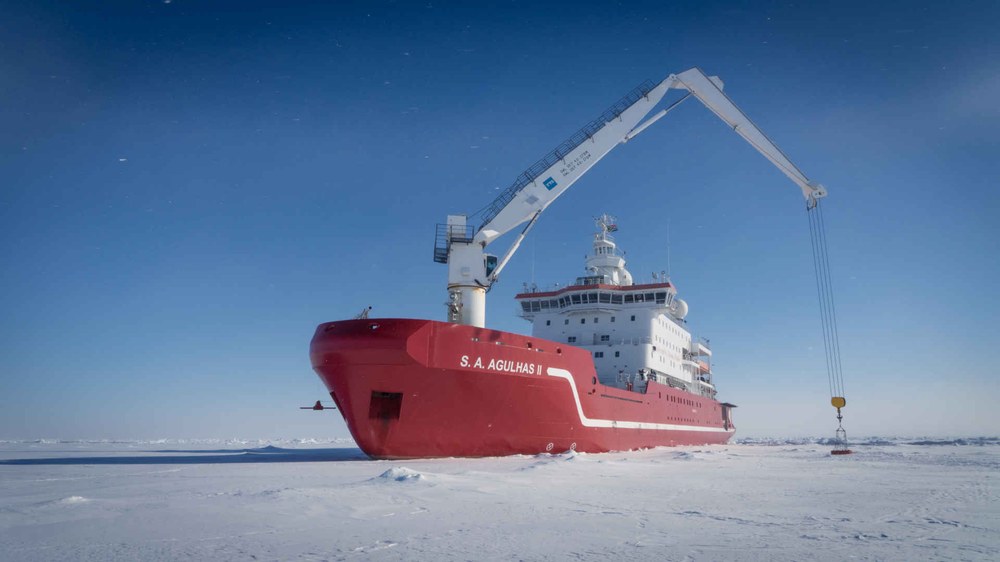
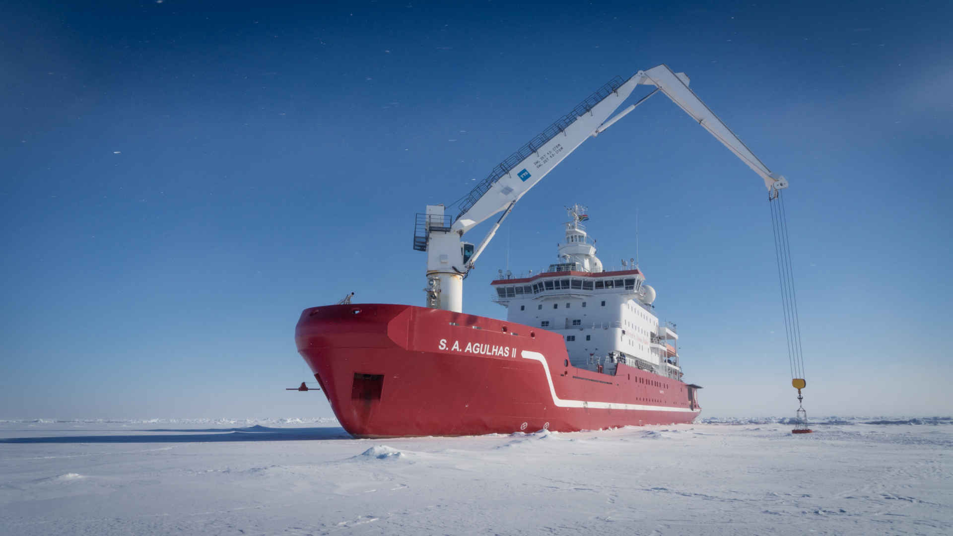
The Endurance22 expedition with its icebreaker 'S.A. Agulhas II' relied on this. Thanks to the high-resolution satellite data, they were able to find a way through the labyrinth of channels between thick sea ice floes. Two researchers from DLR's Earth Observation Center (EOC) and the DLR Microwaves and Radar Institute were on board. They used every flyover of TerraSAR-X to acquire images for the S.A. Agulhas II. This enabled them to keep an eye on the sea ice conditions. Thanks the satellite's near-polar orbit, they sometimes received images multiple times a day. Algorithms from the EOC's Maritime Safety and Security Lab Bremen also calculated the sea ice drift in high resolution, which provided valuable additional information on site. The remote sensing experts on board also received support from the DLR ground station in Neustrelitz.
In the current research projects EisKlass2 and FastCast2, DLR researchers wanted to take it even further. Instead of using individual daily radar images for navigation, the sea ice is to be classified in terms of navigability using new algorithms and projected into the future on an hourly basis using forecast models to calculate concrete route suggestions for ships. In order to develop the necessary algorithms, the DLR researchers collected in situ measurement data on the S.A. Agulhas II. This data includes, for example, recordings from an infrared camera to better analyse sea ice characteristics.
Spectacular find in the Weddell Sea
In early February 2022, the Endurance22 expedition set sail from Cape Town to track down Shackleton's polar ship with modern technology. The Endurance has now been found at a depth of 3008 metres and about six and a half kilometres south of the location last registered by Captain Frank Worsley in 1915. The wooden wreck lies upright in the water and is in excellent condition, as the photographs taken by the submersible robots reveal. Even the 'Endurance' lettering on the stern is still clearly visible. The expedition brought together world-leading marine archaeologists, engineers, technicians and sea-ice scientists on the icebreaker and research vessel S.A. Agulhas II. However, the Endurance will not be salvaged. It is under strict protection of the Antarctic Treaty as part of the world heritage. The expedition team is documenting the discovery of the century with photographs, video recordings and 3D images of the seabed. The journey back is scheduled for the end of March – with spectacular images and unique scientific data for future generations.


