Providing assistance worldwide with aerial maps
December 5, 2022 | DLR participates in disaster management exercise of I.S.A.R. Germany
Providing assistance worldwide with aerial maps
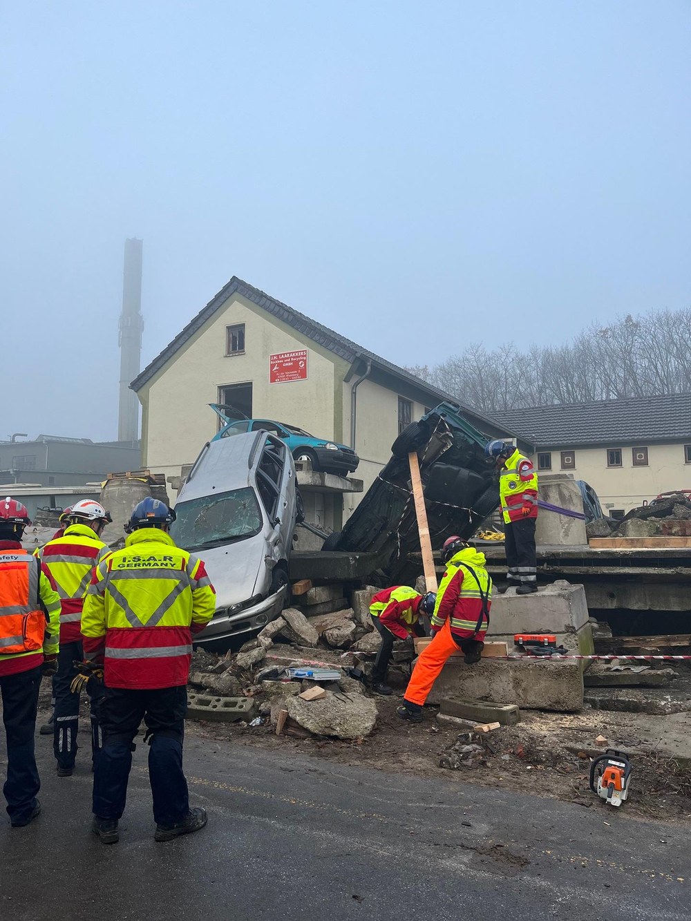
Full-scale exercise by I.S.A.R. Germany in Weeze
The operation included, among other things, the localisation and rescue of injured persons, transport to the treatment room and medical care on site.
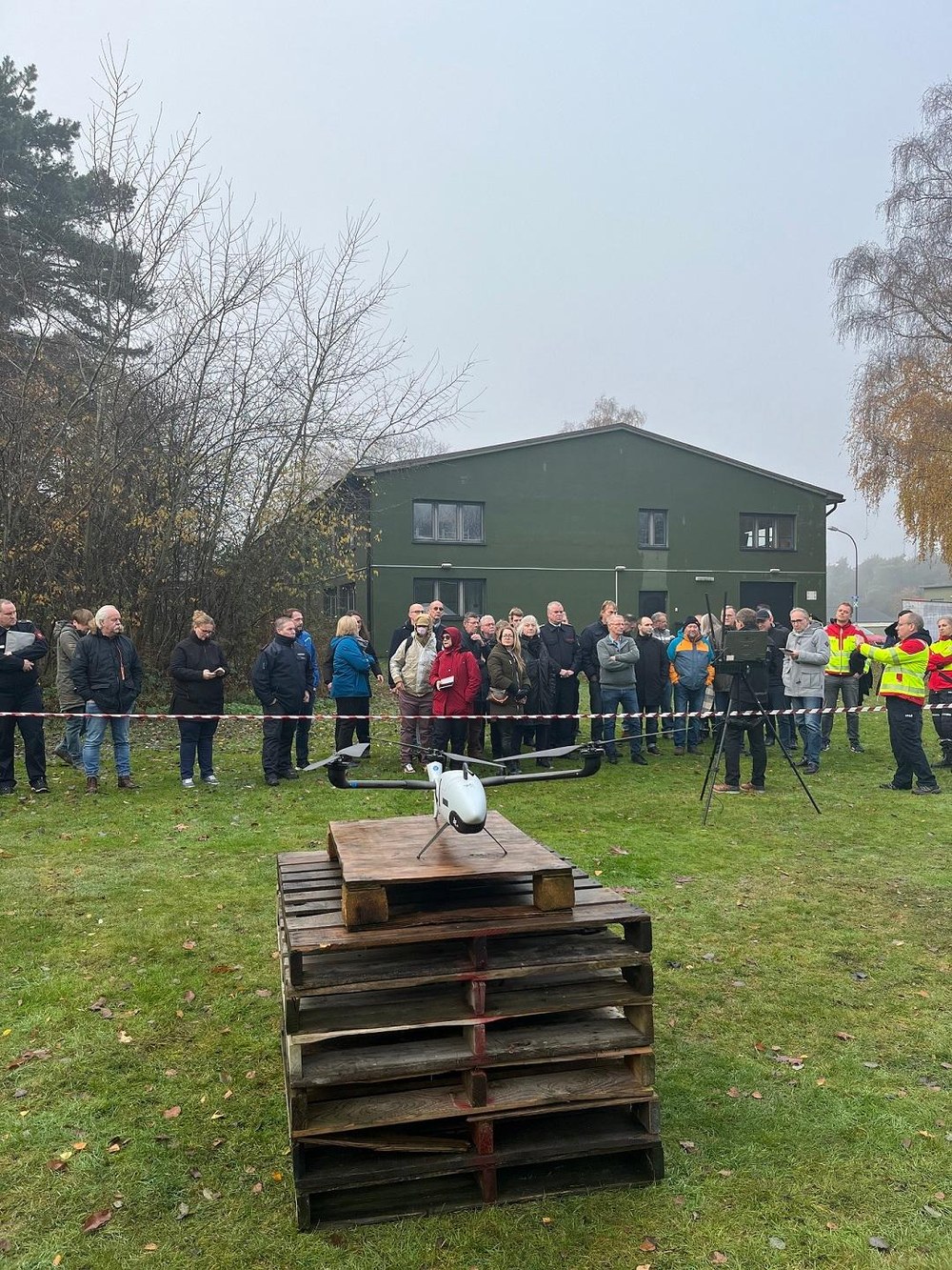
Exercise for situational awareness with the help of drones
Live mapping enabled the emergency forces on the ground to quickly gain an overview of the disaster and operation area and thus contribute to situational awareness.
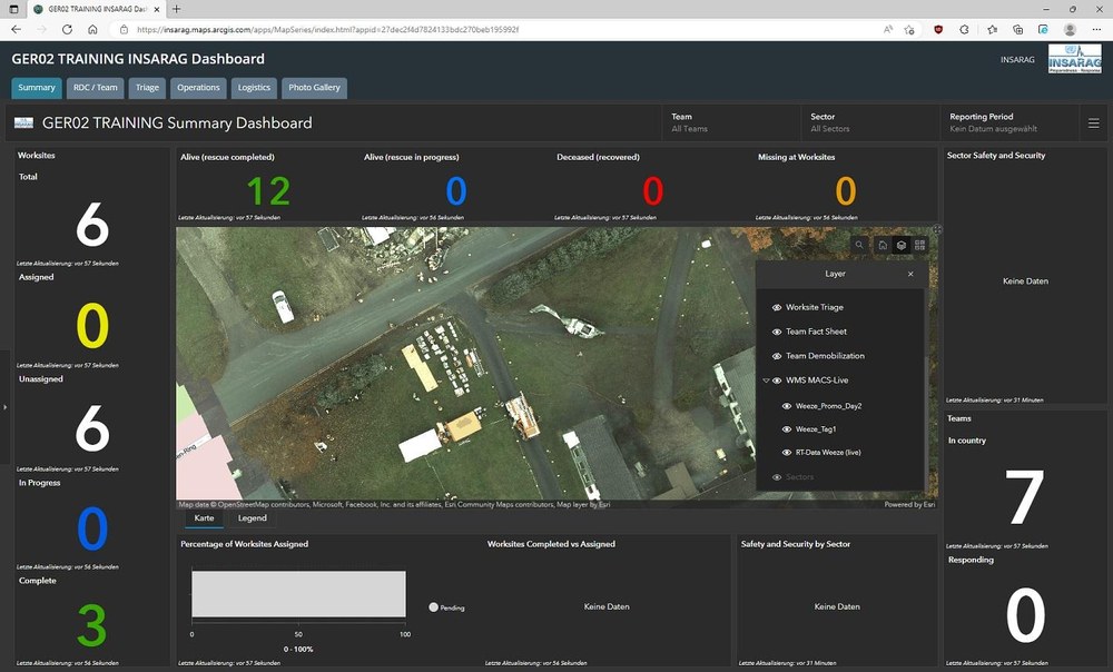
Display of real-time situation maps during the full-scale exercise in Weeze
A primary goal of the cooperation is the direct integration of the real-time situation maps created by DLR into the UN's central information platform, the ISARAG Coordination Management System (ICMS). This decisive step was also demonstrated for the first time during the exercise.
Since 2016, the German Aerospace Center (Deutsches Zentrum für Luft- und Raumfahrt; DLR) and the non-profit aid organisation I.S.A.R. Germany have been cooperation partners. Together, they test and deploy new technical developments for crisis and disaster management. At the end of November 2022, the DLR Institute of Optical Sensor Systems participated in a full-scale SAR (Search and Rescue) exercise conducted by I.S.A.R. Germany at the Training Base Weeze. For the first time, the aerial maps created by DLR were integrated into the United Nations’ central information platform.
Exercising assistance in the event of a helicopter crash and landslides
The exercise in Weeze involved various simulated and realistic deployment scenarios. For example, they tested rescue procedures in the event of a helicopter crash and a landslide. The operation included locating and rescuing injured persons, transporting them to the emergency room and providing medical care on site. As part of the full-scale exercise, the team from the Department of Security Research and Applications of the DLR Institute of Optical Sensor Systems provided twofold support.
For the first time, DLR staff took part in a full-scale I.S.A.R. exercise as part of the advance team. According to I.S.A.R. Germany, this consists of a team of currently six disaster relief workers from various disciplines (management, detection, recovery, medicine) who travel to a potential country of deployment in the first eight to twelve hours immediately after an event in order to assess the situation on site, offer possible assistance to official agencies and liaise with the actors for the necessary authorisations. This serves the purpose of receiving an official request for assistance in order to be able to activate the I.S.A.R. main team. This team is then usually dispatched to the disaster area 24 to 36 hours after the event.
In addition, the DLR colleagues used the drone-based system developed at the Institute for real-time situational awareness. Live mapping enabled the relief workers on the ground to quickly gain an overview of the disaster and operational area and thus contribute to situational awareness. "The use of drones and the data and information they provide serve as a relevant basis for efficient operational management in the disaster area. In particular, the speed with which reliable information is quickly transmitted to us through aerial reconnaissance represents a decisive advantage and provides massive support for our rescue teams in the field," says Daniela Lesmeister, President of I.S.A.R. Germany.
Situation picture in real time
A successful transmission of the situation image in real time, independent of existing infrastructure, was also demonstrated for the first time via the Starlink satellite network of the US space company SpaceX. This capability allows situation maps created with DLR's Live Mapping Systems to be shared with response teams and information platforms worldwide, regardless of location and in real time - even during international missions and in the event of damaged telecommunications infrastructure.
A primary goal of the cooperation is to directly integrate the real-time situation maps created by DLR into the UN's central information platform, the INSARAG Coordination Management System (ICMS). This decisive step was also demonstrated for the first time during the exercise. From now on, the aerial maps will be automatically sent to all Urban Search and Rescue (USAR) teams in the country, their situation units in the home countries and the UN Operations and Crisis Centre. In this way, DLR is making an important contribution to the effective use of its technologies in international relief operations. The cooperation agreement between I.S.A.R. Germany and DLR was renewed for another five years in May 2022.
About INSARAG
The International Search and Rescue Group (INSARAG) is a global network of more than 90 countries and organisations under the United Nations umbrella. It sets standards for USAR teams and develops methods and guidelines for the coordination of international assistance. I.S.A.R. Germany is one of 61 UN INSARAG certified aid organisations worldwide.
Contact
Melanie-Konstanze Wiese
Corporate Communications Berlin, Neustrelitz, Dresden, Jena and Cottbus/Zittau
