A view of Iceland from space

A view of Iceland from space
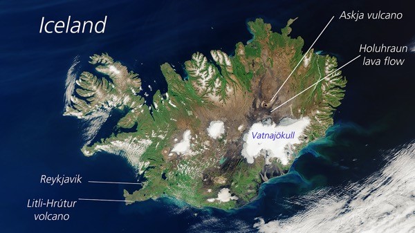
A rare, cloud-free view of Iceland from space, imaged by the European Copernicus Sentinel-3 satellite almost three years ago on 14 August 2020 (note the partly snow-covered heights in this summer month in the northern part of the island). It shows the two areas investigated by the VERITAS air-and-field campaign in August 2023. The Holuhraun lava flow was emplaced by the 2014 eruption east and southeast of famous Askja Volcano, covering an area of 100 square kilometres, approximately the area of Manhattan Island in New York City. After one week of field measurements, accompanied by simultaneous radar recordings from the air, the expedition returned to the Reykjanes Peninsula where it investigated the Litli-Hrútur volcano eruption that started on 10 July 2023.