Mountains from Space, an illustrated book by Deutsches Zentrum fuer Luft- und Raumfahrt (DLR), the German Aerospace Center. Publication date was September 2005, Retail price: € 50,00, 244 pages (incl. 3 gatefolds), 148 colour photos plus 128 caption images and 80 maps. Format: 28,8 x 28,8 cm.
Published in September 2005, 'Mountains from Space' features 244 large-format pages with breathtaking satellite images giving a spectacular new perspective on the mountains of planet Earth. The images were taken from space and the book is published - appropriately - by the German Aerospace Center (DLR) and publishing house Frederking & Thaler Verlag.
Earth Observation is the space technology that allows us to acquire information about Earth and makes it possible to take these fascinating images. Satellites use various measuring processes to gather wide-ranging geodata which are then converted into high-quality images using complex data processing. Familiar sights, when viewed from the perspective of a satellite, take on a completely new aspect, and the observer is spellbound by their aesthetic beauty.
One keystone of German space exploration is 'Mission Earth.' Science and technology are brought together for the benefit of humankind, with the goal of sustainably preserving Earth's natural resources. Mountaineer Reinhold Messner first met up with scientists from the DLR in 2004. He was stunned by mountain images that were new, even to him: peaks and ranges seen from space, taken for research purposes yet also of inspiring beauty. Thus the 'Mountains from Space' book project came about.
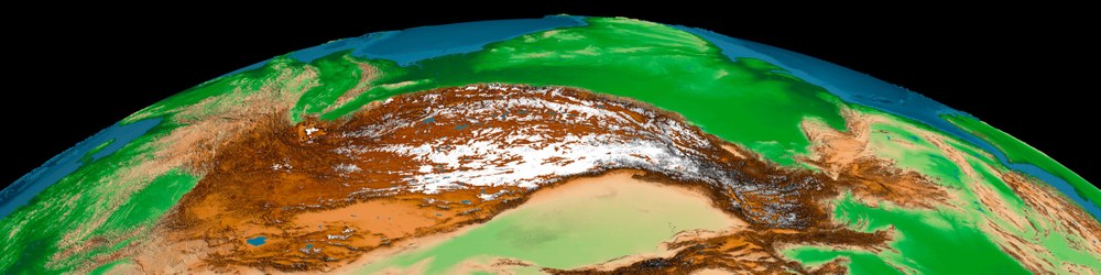
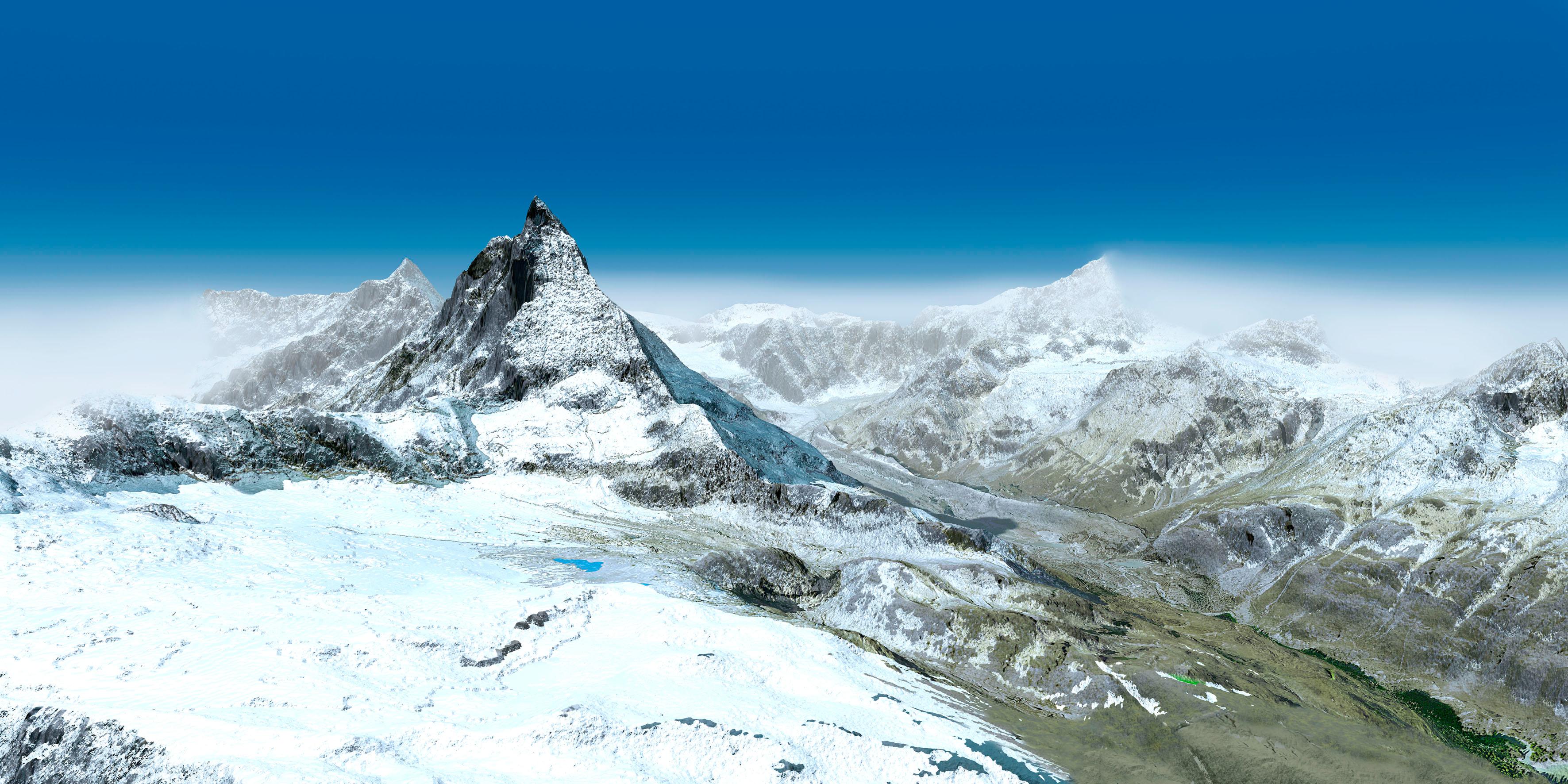
Satellite images offer revolutionary new perspectives of the mountains on our planet: a view of the entire Alpine range from the north; the Matterhorn in a stunning computer-generated angled view; the whole of the Himalayas and the Andes in one single image; or a view of the Hawaiian archipelago, including its underwater contours.
Nine scientific commentaries shed light on the geographical, geological, climatological, ecological and cultural importance of these mountains. Renowned mountaineers such as Sir Edmund Hillary, Stephen Venables and Maurice Herzog describe their personal experience of the mountains, accompanied by a poetic contribution by Christoph Ransmayr. This is a completely new way of looking at the world's mountains, the backbone of the continents and the one of the most varied habitats on our planet.
About the authors
Stefan Dech is Professor of Remote Sensing at the University of Würzburg and Director of the German Remote Sensing Data Centre (DFD) at Oberpfaffenhofen, one of DLR's institutes. The unique pictures in this book were created under his guidance.
Reinhold Messner is one of the world's most well-known mountaineers; he was the first person to ascend all fourteen 8000-metre peaks and Mount Everest without the use of oxygen.
Rüdiger Glaser is Professor of Geography at the University of Freiburg, where he is head of the Institute for Physical Geography. He is an expert in climate history and was responsible for writing the scientific commentaries for this book.
Ralf-Peter Märtin is a journalist and author. His cultural history of climbing in the Himalayas: "Nanga Parbat - Wahrheit und Wahn des Alpinismus" ("Nanga Parbat - Truths and Illusions of Mountaineering") is considered the standard work on the subject.


