MACS camera – aerial reconnaissance and wildfire support
High-tech eyes for the airborne situation picture
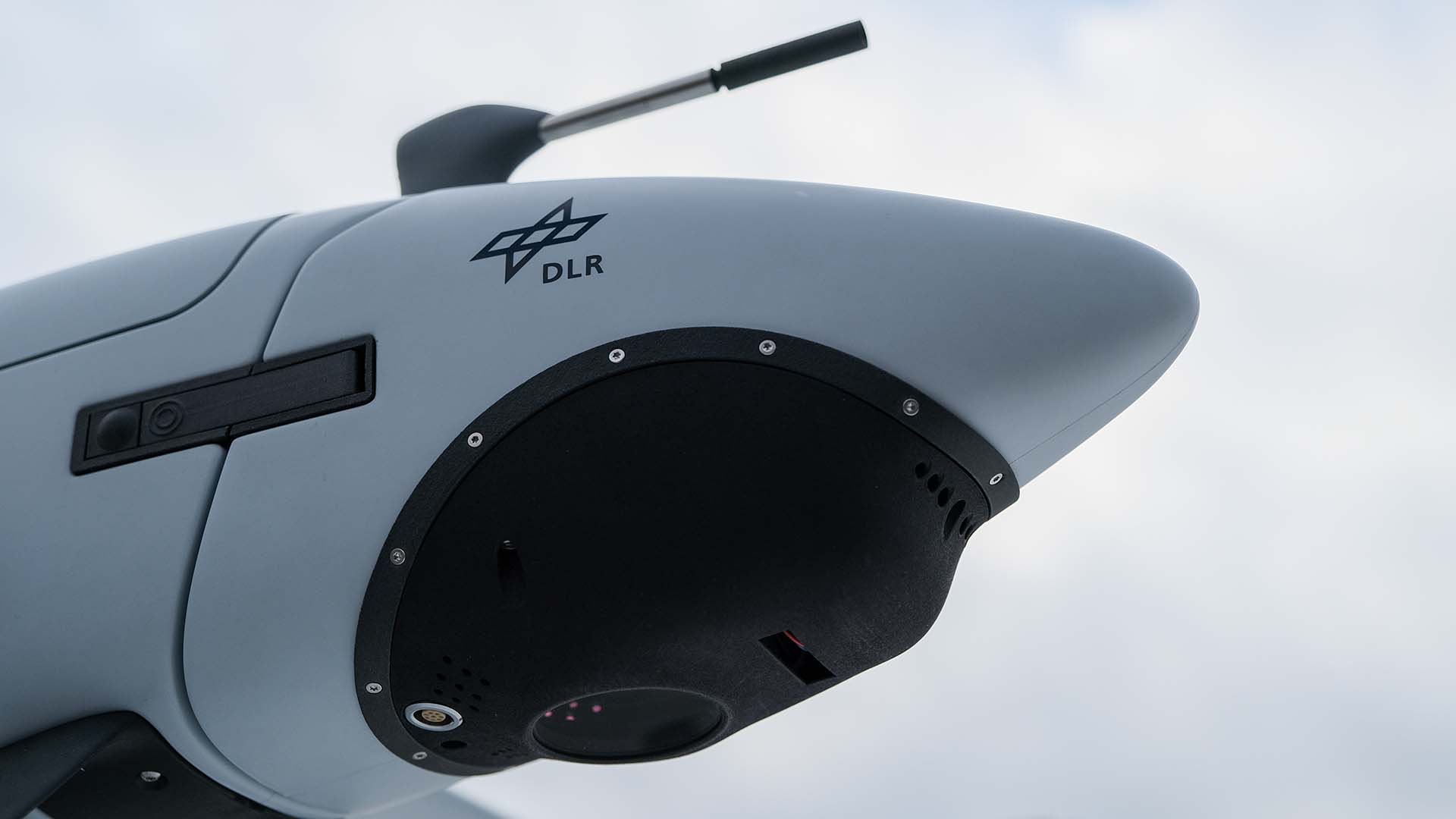
MACS-nano on board a drone
The DLR MACS-nano camera system installed on a drone from Quantum Systems, a cooperator since 2021 through the Live-Lage visual detection technologies research project.
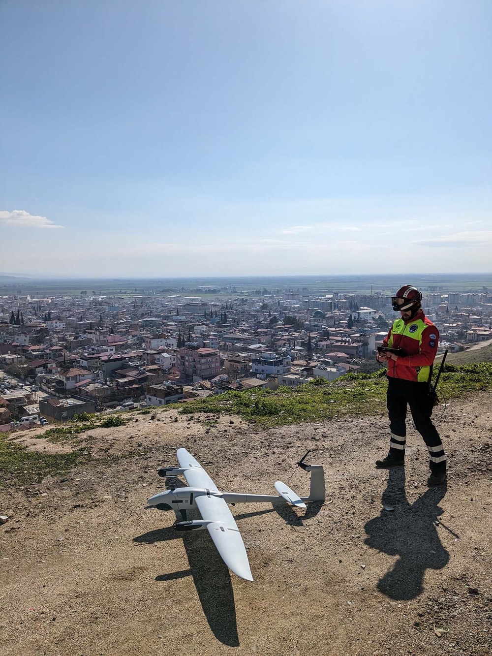
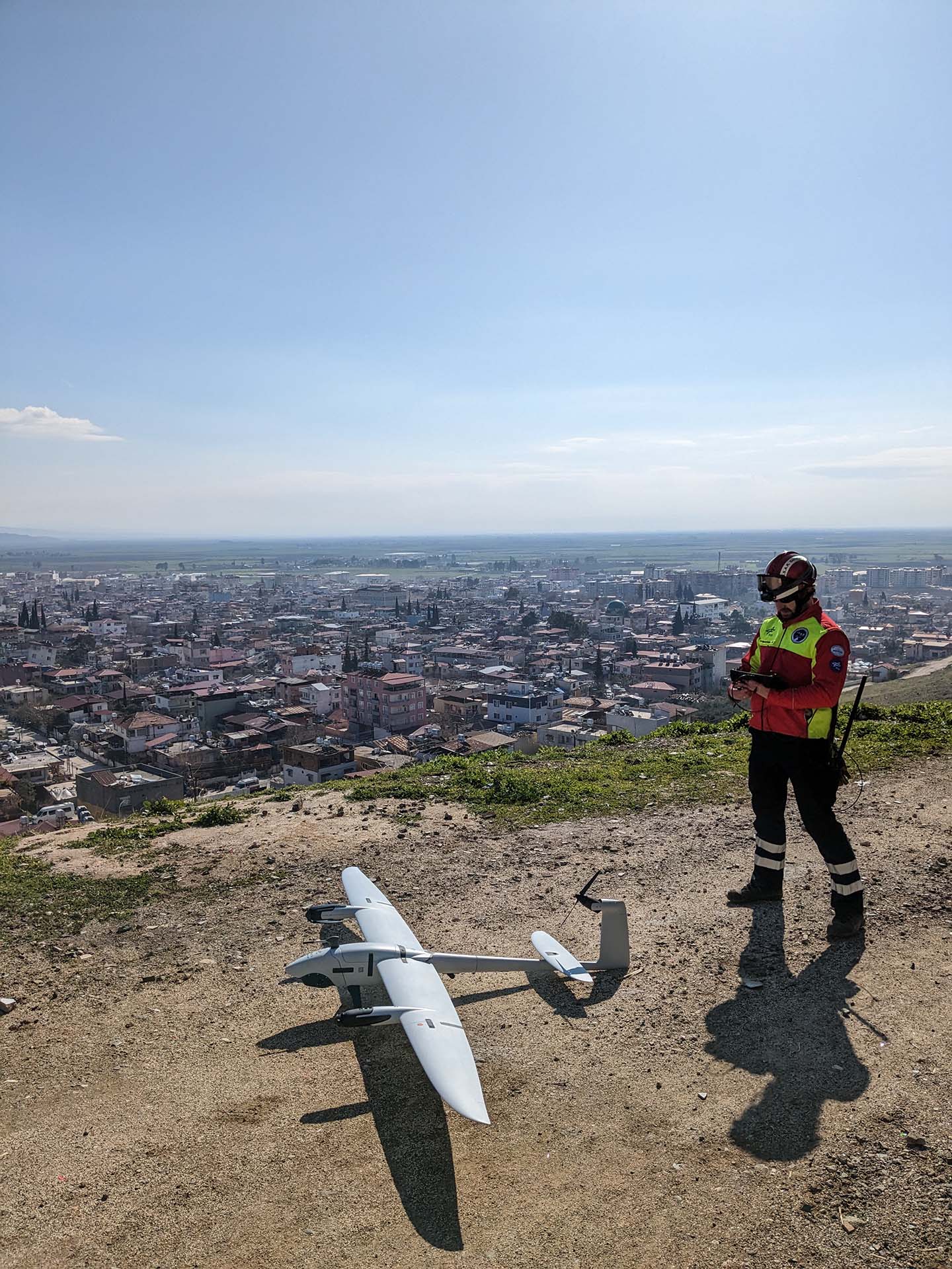
MACS deployment in Türkiye – situation assessment in the earthquake zone
Reconnaissance in Türkiye: At the beginning of 2023, two colleagues from the DLR Institute of Space Research were on site with the aid organisation ISAR Germany to support emergency services with airborne situation assessment using DLR's MACS (Modular Aerial Camera Systems).
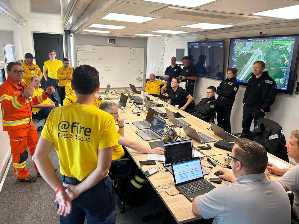
In the operations centre, all relevant information comes together. Colleagues from OPTSAL are directly involved and explain the possibilities of airborne situation assessment with MACS (Modular Aerial Camera Systems). The Optical Technologies for Situational Awareness Lab, or OPTSAL for short, is an innovation lab at the DLR Institute of Space Research in Berlin. OPTSAL provides a fully equipped situation room and a development lab for integrated hardware and software development.
Image: 8/8, Credit:
Eurocommand
For almost 20 years, the Security Research and Applications Department at the DLR Institute of Space Research has been developing highly innovative digital camera systems for crewed and autonomous flying platforms. Under the name MACS (Modular Aerial Camera Systems), an entire family of systems for different applications has been created. Key features include a high degree of technological maturity and operational readiness, which is why MACS have been used for years in demanding Earth observation missions and, above all, for security applications worldwide. In 2014, for example, DLR's MACS produced the most accurate 3D model of Mount Everest. MACS also map global change processes in glacier and permafrost areas and provide urgently needed situation pictures during natural disasters – for example after the 2021 floods in Germany's Ahr Valley or recent earthquakes in Türkiye.
From research to application
With the Optical Technologies for Situational Awareness Lab (OPSTAL), the Institute promotes technology transfer and knowledge exchange in airborne reconnaissance, bringing together a wide range of stakeholders. Cooperation with partners from research, industry and public authorities offers significant potential, both in terms of advancing technical solutions and for the targeted building and exchange of knowledge and experience. The situation assessment of wildfires has been a core topic at OPTSAL for several years. Together with our application collaborators, the airborne camera systems are regularly tested – including in real-life operations. They provide valuable real-time information in emergency and fire situations. Technological developments to support wildfire response are also a recurring theme in OPTSAL workshops, where emergency services regularly emphasise the need for and critical value of airborne and drone-based reconnaissance.
Development and progress hand in hand
Airborne systems give emergency services a decisive advantage in operational firefighting – compared with satellites, they achieve a much higher resolution (down to a few centimetres) making them suitable for detecting smaller fires and even embers. They also offer crucial advantages in terms of flexibility and agility, as they can react quickly and specifically to highly dynamic operational situations.
Since 2024, all of DLR’s MACS systems have been equipped with an infrared sensor for heat detection in addition to image sensors in the visible range. With our smallest drone-based camera system, 'MACS-nano dual', real-time aerial images can now also be captured in the infrared range. This development marks an important step for the future of wildfire reconnaissance. Thermal images provide essential data on the temporal development and spread of fires, contribute to firefighting success and – using modern image analysis methods, can even detect fires that are obscured by tree canopies and smoke clouds.
Strong partnerships for successful deployment
Deployment can only be successful with strong, reliable cooperation partners. In the field of fire remote sensing, DLR has been cooperating with various players for many years, including Eurocommand GmbH and the fire services in Duisburg and Berlin. The most recent cooperation in this area is with the international relief organisation '@fire'. Since 2024, DLR has been cooperating with the international aid organisation to test airborne camera systems for wildfires as part of OPTSAL.
The @fire team specialises in fighting wildfires in particularly difficult situations. One focus is on air support – whether by firefighting helicopters and aeroplanes or reconnaissance equipment such as MACS-equipped drones. The common goal of @fire and OPTSAL is to develop and further optimise suitable structures, methods, processes and standards.
Even before the cooperation with @fire was officially announced, we were able to demonstrate the added value of our technologies in a real-world application. When a large wildfire near the UNESCO World Heritage Site of Wörlitzer Park broke out in September 2024, the OPTSAL team was called in to help. Our MACS-nano dual drone-based camera system mapped the spread of the fire during the night and helped to locate previously undetected embers. The incident command confirmed the significant added value of this technology for coordinating forces on the ground. MACS was similarly helpful during wildfire episodes in Berlin-Grunewald, Lübtheen and Lieberoser Heide.
To ensure that such deployments work smoothly and bring real added value, the OPTSAL team regularly tests teams and technologies in training exercises. Various exchange formats for partners and users – such as digital workshops or on-site presentations and demonstrations in state-of-the-art infrastructures – also serve knowledge transfer. We are also continuing to advance research into new methods for optical wildfire detection, where sensor-based artificial intelligence (AI) methods are playing an increasingly important role.

