Fifteen years of disaster relief from space – global patterns and trends


Today, the analysis and use of satellite images is commonplace. Just 15 years ago, however, only a handful of specialists worked with these valuable data. Since then, a particular niche expertise has rapidly developed – the use of satellite data for disaster management. An international team of experts led by the German Aerospace Center (Deutsches Zentrum für Luft- und Raumfahrt; DLR) has analysed the historical development of satellite-based emergency mapping. In the current special issue of the Science Magazine, the researchers are presenting global patterns alongside historic and emerging trends in this field.
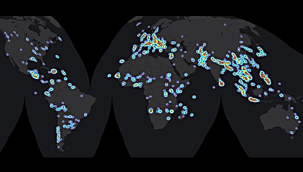
To complete their analysis, the scientists studied more than 1000 disaster relief activations around the world between 2000 and 2014, creating a unique database in the process: "This database – which is in essence a cadastre of global satellite-based emergency mapping – allows us to study global patterns and trends in the community. This way, we can provide even better support in emergency situations, while also improving our global decision-making and cooperation. It would be extremely instrumental to further maintain this database so we can keep an eye on future trends and devepments" says lead author Stefan Voigt from the DLR Earth Observation Center (EOC) in Oberpfaffenhofen.
Rising demand, greater capacity
Government agencies, research institutions, humanitarian organisations, relief workers and increasingly also media – the number of users and service providers across the globe is numerous today. In comparison: in 2000, satellite-based emergency mapping was requested seven times in total around the world; by 2014 the number of 'activations' had risen to 123. In its study, the team led by the remote sensing expert Stefan Voigt addressed several questions, including the following: how quickly are satellite image maps available in the event of emergencies? Does the satellite imaging process take place where it is needed most urgently? Is global satellite-based emergency mapping fulfilling its purpose?
The response time during an emergency – from the request to the delivery of the first data product – is currently two-and-a-half days on average. Here, data acquisition still poses the greatest challenge. In most cases, it takes two days to free up a suitable satellite, to reprogram it for the target area, and to make the data available to the analysts. Under favourable circumstances, the satellite data are available sooner, sometimes allowing an availability of maps within even 24 hours.
A spatial analysis reveals: the greater the population, the greater the frequency of emergency mapping, which suggests that resources go to the areas of greatest need. This becomes particularly clear in the case of Asia, a continent with a high population density, which also experiences more natural disasters than other regions. Expectedly, the majority of satellite assignments for disaster management are deployed for disaster management in Asia.
Entire constellations of Earth observation satellites are now being launched to space for this exact purpose. The European Earth observation programme 'Copernicus' and its Sentinels, which continues to expand, provides a service to support disaster management. The rising demand and quality of emergency mapping has prompted a continuous increase in the number of related services around the world. The analysis process has also seen massive improvements thanks in many research projects in this domain. Overall, this will enable additional applications in the future, including monitoring drought and other slow onset disasters. Nevertheless, the study published in Science indicates that the rapid development in recent years will also require greater international cooperation to better align the international workflows and mapping procedures.
International standards and cooperation
Seeking to achieve faster use and collation of the individual data products in emergency situations, DLR began collaborating with similar organisations as far back as 2011 to create the International Working Group on Satellite-based Emergency Mapping (IWG-SEM).Here, the international specialists working in this field define common standards for the generation of satellite-based emergency mapping products, and therefore strengthen international collaboration in this area. The study emphasises the importance of the goals set by this International Working Group.
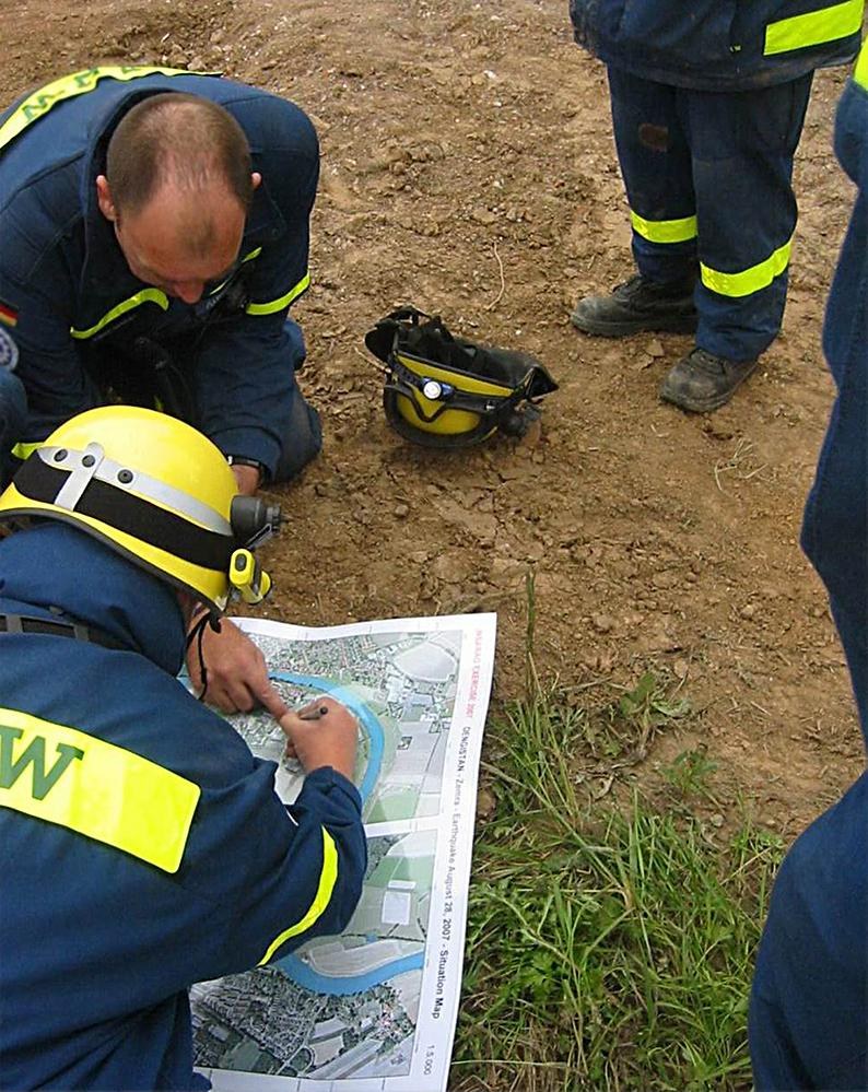
Thus, the remote sensing experts continue the pioneering work they have been pursuing for many years now: At the DLR Centre for Satellite-based Crisis Information (ZKI), founded in 2004 in Oberpfaffenhofen, research results are directly transferred into the operational application for emergency mapping and vice versa – not least due to its involvement in the 'International Charter Space and Major Disasters', which DLR has supported for many years. The Charter is a network of international satellite data providers supporting disaster management with rapid and informal provision of satellite imagery.
Just as with emergency mapping activations, the study 'Global trends in satellite-based emergency mapping' is the result of close international cooperation: The 17 authors are highly recognised experts in the field and work for leading institutions: the DLR Earth Observation Center, Information Technology for Humanitarian Assistance, Cooperation and Action (Italy), Human Rights Watch (Switzerland), European Commission - Joint Research Centre (Italy), U.S. Geological Survey (USA), Gulich Institute ‐ Córdoba National University/CONAE (Argentina), Japan Aerospace Exploration Agency(Japan), Asian Institute of Technology (Thailand), UN Office for Outer Space Affairs(Austria), National Disaster Reduction Center of China (China), Geneva International Centre for Humanitarian Demining (Switzerland), National Space Research and Development Agency (Nigeria), Centre National d'Études Spatiales (France), Regional Centre for Mapping of Resources for Development (Kenya), European Space Agency (Belgium), Université Catholique de Louvain (Belgium).