Waves on the ice – Canadian 'ice road' trucks in TanDEM-X's 'radar eye'
March 13, 2019
Waves on the ice – Canadian 'ice road' trucks in TanDEM-X's 'radar eye'
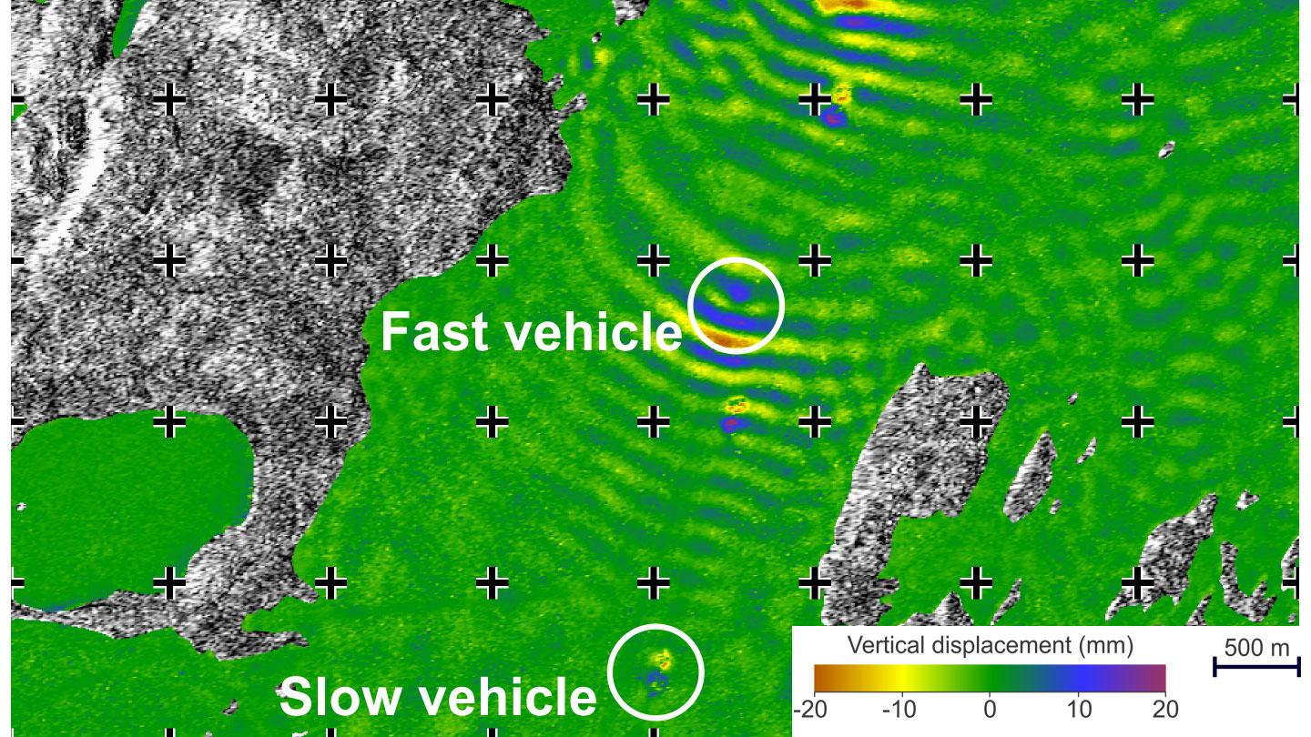
Uplift and subsidence map derived from TanDEM-X data
On this uplift and subsidence map derived from TanDEM-X data (only over the surface of lake ice), the large wave-like displacements of the ice cover indicate fast moving vehicles; smaller ones (bottom of image) reveal slower ones.
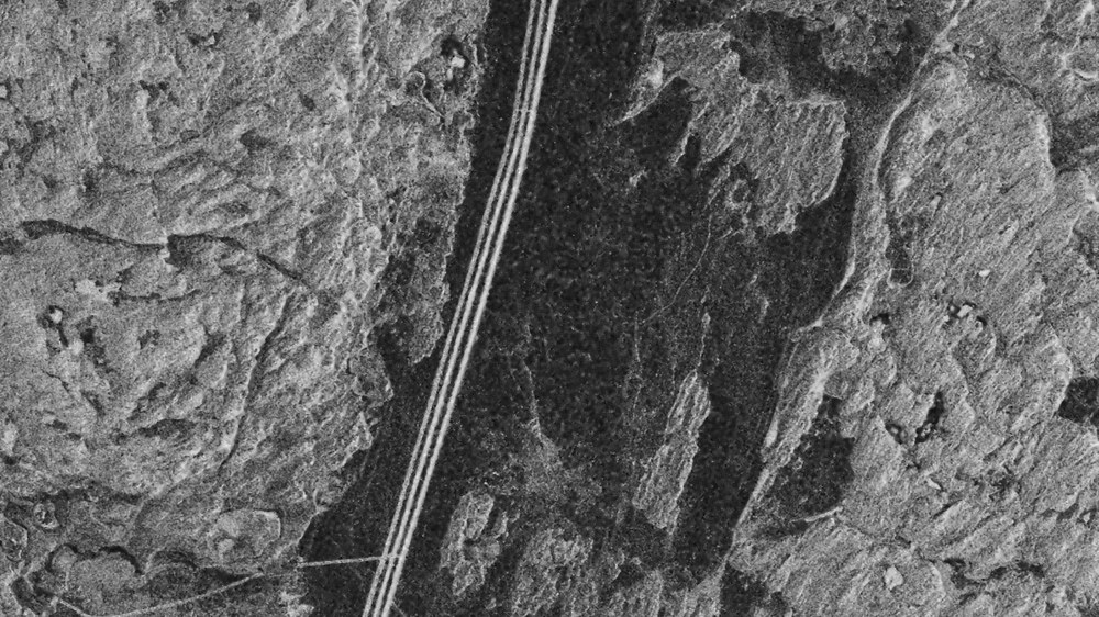
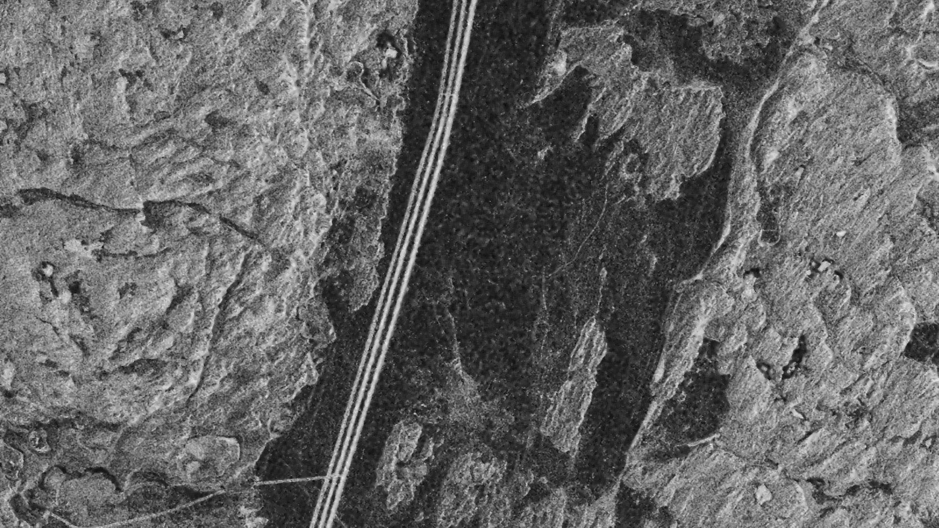
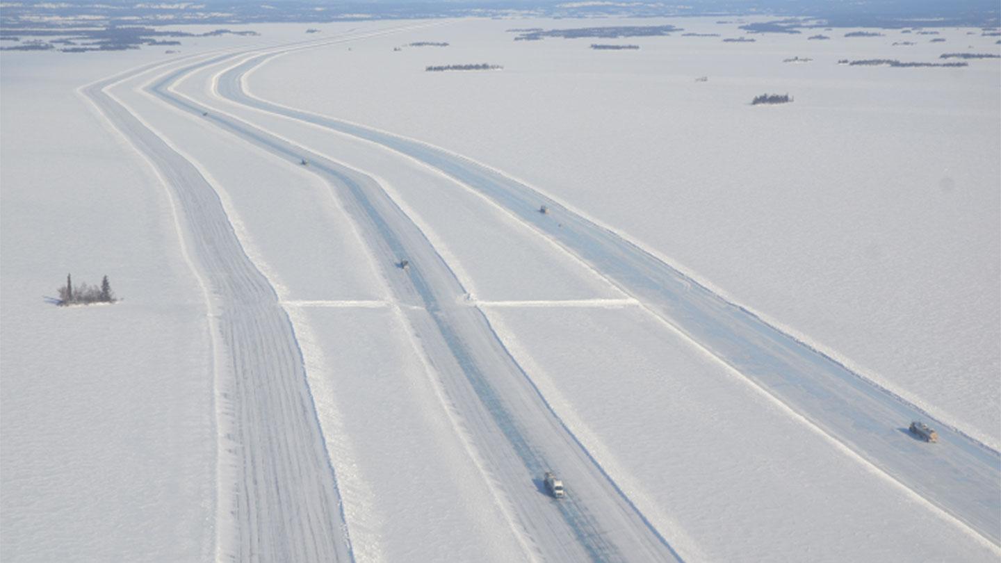
The TanDEM-X radar intensity map clearly shows the three lanes created by the Ice Road Trucks. The reason for this is the increased surface roughness of the three lanes. It makes them appear brighter than their surroundings. North is at the top of the image.
A study by the Canada Center for Mapping and Earth Observation investigated how TanDEM-X could support ice road management with a focus on the northwestern territories of Canada.
Two TanDEM-X data sets were used to create an image revealing wave-like displacements of the ice sheet. These are caused by the Ice Road Trucks that transport goods across the frozen lakes in Canada during the winter months.
Focus: Earth observation, TanDEM-X
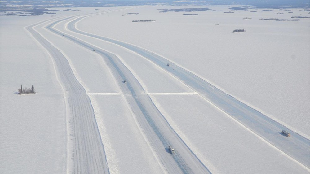
Ice road truckers in Canada – symbolically 'at the end of the world' – with their massive trucks travelling over the frozen lakes in the Canadian northwest, are well known around the world thanks to numerous TV programmes. The ice roads are open for only a few weeks per year. During this time, thousands of tonnes of freight are moved across these 'ice highways', as the frozen lakes in winter act as seasonal roads and provide an effective and economical way to reach remote communities and businesses in the coldest regions. Nevertheless, the business remains risky – and climate change is compounding the difficulties faced by those using the ice roads.
In a study, Joost van der Sanden from the Canada Centre for Mapping and Earth Observation investigated the benefits of TanDEM-X in supporting ice road management. The radar image (Image 1) shown here illustrates one result of the work – fast-moving vehicles create undulating elevations and depressions in the ice cover. Especially over shallow waters, these can lead to the ice breaking up and thus endanger the safe passage of traffic. The study focused on the Tibbitt to Contwoyto winter road in the Northwest Territories of Canada.
The image was generated using two TanDEM-X datasets acquired 10 seconds apart, using differential SAR interferometry. This time interval makes it possible to detect vertical displacements of the ice cover caused by traffic, on a centimetre scale with a high level of density detail, and at an accuracy that cannot be achieved by any other technology.
Radar satellites such as TanDEM-X are useful tools for gathering information and supporting ice road management due to their ability to acquire high-precision images of the ice roads in the winter darkness and despite adverse weather conditions. The radar technology makes it possible to collect weather-independent data, as it does not depend on optical sensing – snowfall, rain and darkness do not influence radar imaging. Due to to their relatively long wavelength, radar satellites make it possible to ‘look inside’ the ice and perform observations about the quality and composition of the ice cover.
The study showed that TanDEM-X data can support the investigation and management of ice roads – specifically, such data can prevent trucks from breaking through the ice, which is referred to as the moving vehicle problem. The DLR winter campaign PermASAR, which will take place in northern Canada during March 2019, will supply state-of-the-art X-, C- and L-band radar data sets that will, among other things, support ice road management through radar-based Earth observation.
TanDEM-X – what next?
A potential follow-up mission to TanDEM-X has already been developed by DLR – the Tandem-L mission concept envisages two radar satellites operating in the L-band (23.6-centimetre wavelength), to detect dynamic processes on Earth's surface – globally and systematically.
The aim of Tandem-L is to map the Earth's entire landmass on a weekly basis. At the moment, TanDEM-X needs one year to accomplish this mapping task. The mission will set new standards for Earth observation, monitor global changes with enhanced quality and enable the making of important recommendations for action. With this new technology, the three-dimensional structures of areas of vegetation and ice could be recorded, and deformations measured over large areas with millimetre accuracy.

