April 14, 2020 | Fresh food and reliable crisis information
DLR technologies for humanitarian aid
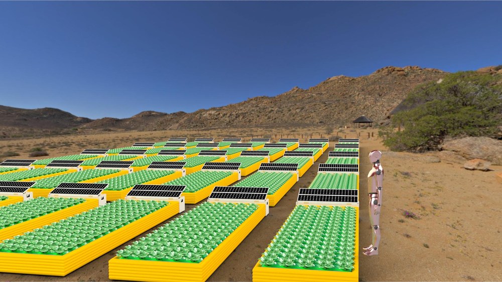
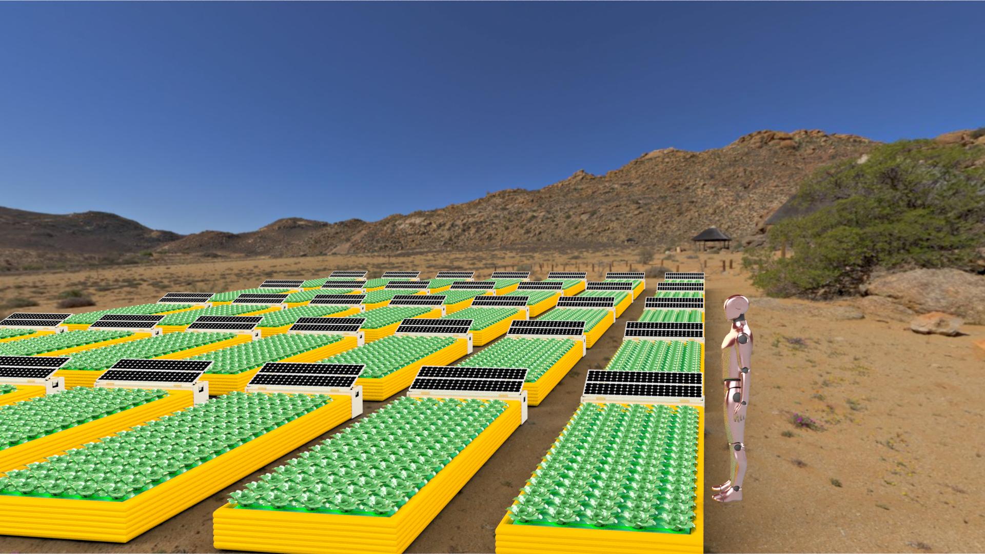
MEPA units deployed in the field
Mobile, deployable plant cultivation units (Mobil Entfaltbare PflanzenAnbaueinheit; MEPA) can be deployed individually or arranged in arrays to serve larger communities.
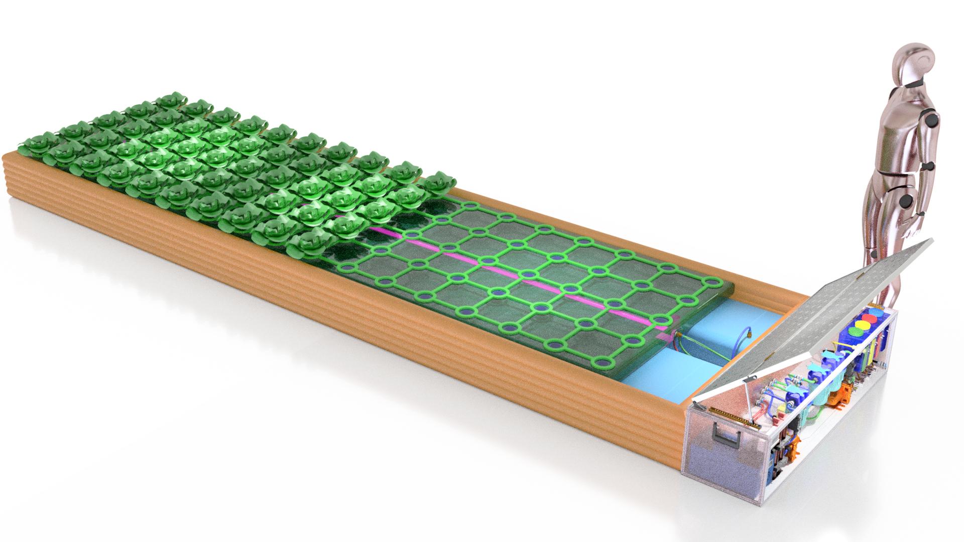
DLR's mobile deployable plant cultivation unit (Mobil Entfaltbare PflanzenAnbaueinheit; MEPA) enables the production of fresh food during humanitarian emergencies. This image shows the simplest of a total of three cultivation systems. This ‘minimal system’ provides a seven-square-metre cultivation area and is designed to produce a yield of 85 heads of lettuce, weighing approximately 42 kilograms per harvest cycle. The MEPA system is based on hydroponics and is equipped with a solar-powered automated support unit.
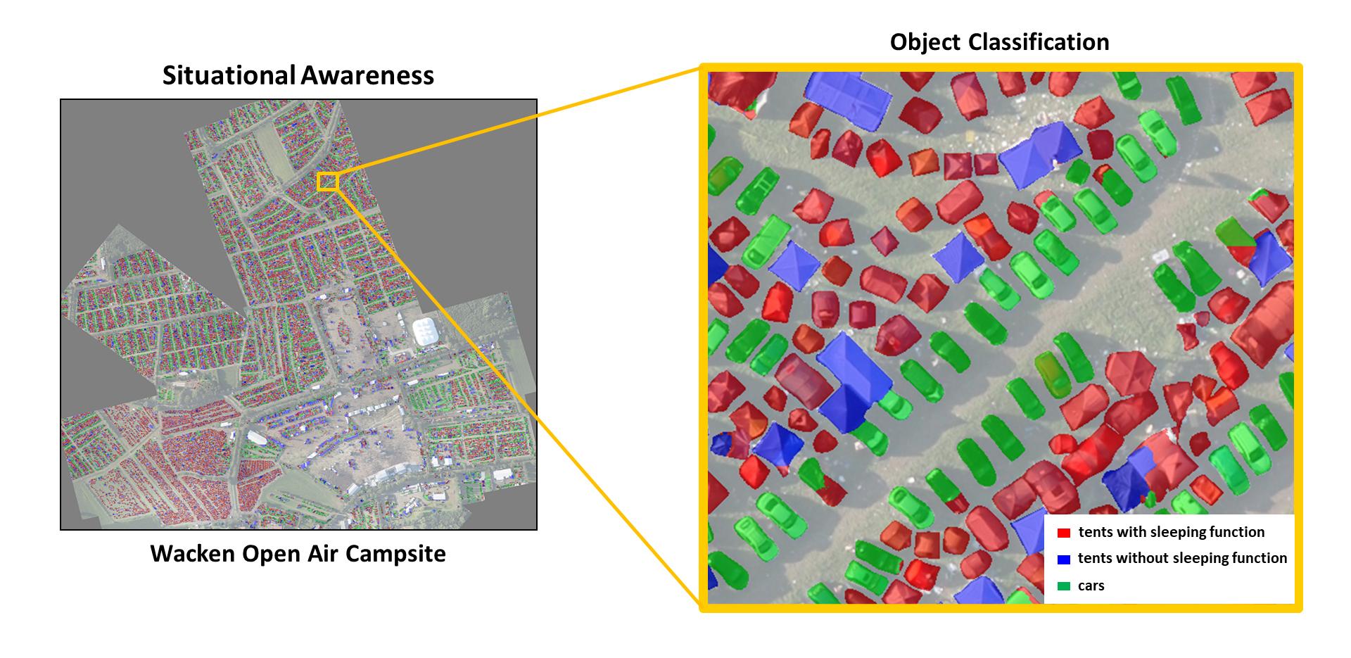
Wacken Open Air – major event situation assessment
The 'Wacken Open Air' music festival attracts over 70,000 visitors every year. To enable the organisers to better assess the current situation on the festival site, DLR produced a situation map. Tents and cars were automatically detected and classified based on aerial images. The DLR Earth Observation Center contributed its 3K camera system, which has a resolution of 13 centimetres, and near-real-time data processing. In future, these technologies could also be used in the humanitarian field, for example, to record the situation in refugee camps or to evaluate objects in disaster areas.
DLR conducts projects in close cooperation with international humanitarian aid organisations.
Development of the data service 'Data4Human' and the mobile plant cultivation unit 'MEPA'.
Focus: Space, Earth observation
Technologies developed for spaceflight must function under extreme conditions. Not only do systems and equipment need to be robust, safe, compact, lightweight and easy to use, but they must also function reliably and sometimes autonomously. Satellite technologies also provide a rapid and comprehensive view of Earth from above. These special properties also prove useful on Earth, not least for dealing with natural disasters and other extreme situations. In 2019, the German Aerospace Center (Deutsches Zentrum für Luft- und Raumfahrt; DLR) launched an initiative to make space technologies usable for humanitarian aid and systematically develop them further. The first two 'Humanitarian Technologies' projects have now begun. These include the mobile, deployable plant cultivation unit MEPA (Mobil Entfaltbare PflanzenAnbaueinheit) and the Data4Human project, which develops special data services for humanitarian aid.
MEPA – mobile greenhouses
In humanitarian crisis situations, supplying food is one of the most crucial tasks undertaken by international aid organisations. However, fresh foods such as fruit or vegetables tend to be either scarce or completely unavailable. A medium-term source of nutrition is often required for the people at the crisis site. The aim of DLR's MEPA project is to provide a means of producing fresh food in emergency situations – in refugee camps, after catastrophic floods or earthquakes, during droughts or in confined, overpopulated areas.
The DLR experts have designed three systems for use in areas affected by disasters. What all of these plant cultivation units have in common is that they do not require soil, are reusable, and enable rapid production, with the first harvest after just four to six weeks. In addition, they are easy to use, and can be deployed on a standalone basis.
Over the next two years, the DLR team will specify, build and test the MEPA systems on site. To ensure that the designs meet actual needs, the researchers are working in close coordination with the United Nations World Food Programme (WFP), the German Federal Agency for Technical Relief (Bundesanstalt Technisches Hilfswerk; THW), Plan International and the non-governmental humanitarian aid organisation ADRA.
Data4Human – data service for emergency personnel
Among other things, humanitarian aid organisations need up-to-date status information if they are to take important decisions and initiate appropriate measures in crisis situations. Often, however, this information is simply unavailable. Access to openly accessible, reliable sources of data, at local, regional and even global levels, is a matter of pressing concern for those involved. DLR's Earth Observation Center (EOC) and the DLR Institute of Data Science are making their expertise in this area available as part of the Data4Human project. Together with humanitarian aid organisations, they are developing analysis methods and tools to provide data from satellites, aircraft, drones, ground-based sensors and web-based sources.
In the field of data processing, DLR is contributing machine learning methods, which, for example, enable damage analysis of critical infrastructure after a natural disaster. Combining 'physical' Earth observation by satellites with 'digital' Earth observation on the internet also provides a technological enhancement. When merged, this data could be used to better monitor refugee flow and human rights violations, or to analyse crop losses in Africa. Satellite data and geodata are increasingly set to be combined with automatically collected, web-based information. In addition, data from sources such as news portals and social networks are to be evaluated.
The researchers are also working with the United Nations Development Programme (UNDP) and other humanitarian aid organisations on further data analysis, such as documenting reconstruction after a disaster or the effectiveness of humanitarian aid. DLR's remote sensing experts and data scientists have now teamed up with the German Red Cross and the Humanitarian Open Street Map Team (HOT-OSM) to support these diverse topics. The Data4Human project will run until the end of 2021.


