The Alps have lost approximately 17 percent of their total ice volume – more than 22 cubic kilometres – since the turn of the millennium.
The FAU research team combined data from the three Earth observation missions TanDEM-X, SRTM and Landsat.
Similar glacier studies generally assume that the size of glaciated areas will remain constant during an observation period. This can lead to a significant underestimate of the actual mass balance, particularly in highly dynamic regions.
Focus: Space, Earth observation, global change
A research team from Friedrich-Alexander-Universität Erlangen-Nürnberg (FAU) conducted the first study of area and elevation changes for all Alpine glaciers over a period of 14 years. This involved comparing three-dimensional terrain models obtained from the German radar satellite mission TanDEM-X and the German-US Shuttle Radar Topography Mission (SRTM) between 2000 and 2014. The team combined the elevation models with optical images from NASA’s Landsat satellites. They found that the Alps have lost approximately 17 percent of their total ice volume since the turn of the millennium. The team recently published the results of their study in the journal Nature Communications.
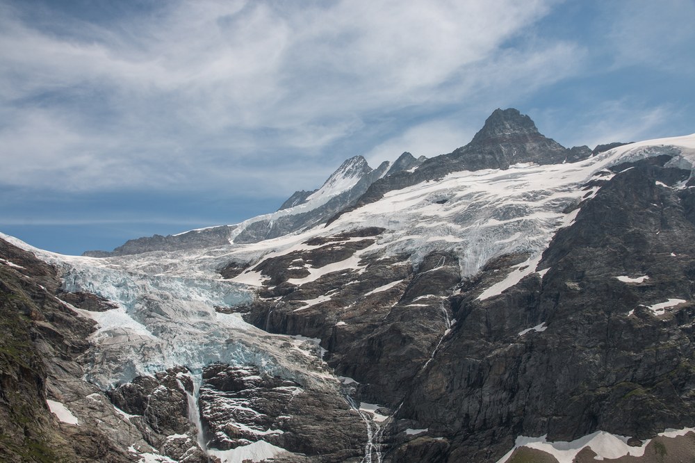
A 17-percent loss in ice volume is equivalent to more than 22 cubic kilometres. With the exception of the highest elevations in the Central Alps, the melting of ice is now affecting higher glacier regions, and the trend is continuing.
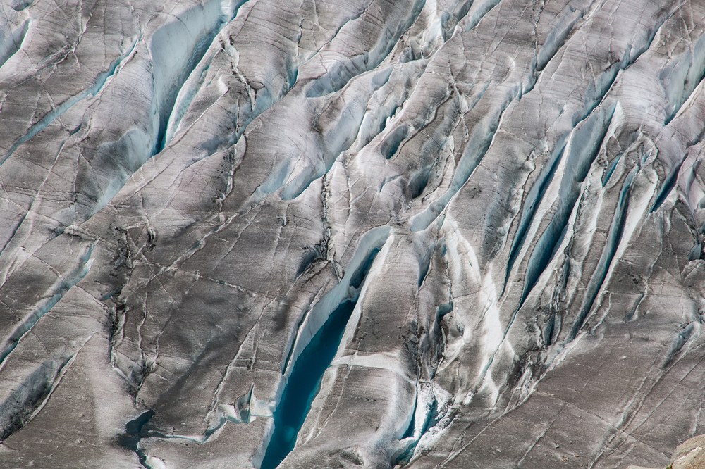
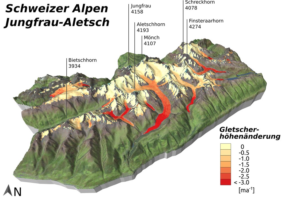
The most significant losses were recorded in the mountain massifs of the Swiss Alps. The large valley glaciers of the Bernese Alps alone lost approximately 4.8 gigatons of ice mass between 2000 and 2014. On average, the ice thickness decreased by 0.72 metres each year, which corresponds to a volume of almost five cubic kilometres. Local melting rates were several times higher in the lower reaches of the glaciers. One example is the Great Aletsch Glacier, the largest in the Alps. The surface near the glacier terminus contracted by five metres or more each year due to melting.
The team from the FAU Institute of Geography obtained its findings by combining data from the three Earth observation missions TanDEM-X, SRTM and Landsat. The key benefit of this method was that it enabled an almost simultaneous comparison of area and elevation measurements. Similar studies from other mountainous regions around the world generally assume that the glaciated surface remains constant throughout the observation period. This can lead to a significant underestimation of the actual mass balance, particularly in highly dynamic glacier regions such as the Alps.
The TanDEM-X radar satellite mission
The TanDEM-X mission is a public-private partnership (PPP) between DLR and Airbus Defence and Space, carried out with funding from the German Federal Ministry for Economic Affairs and Energy (Bundesministerium für Wirtschaft und Energie; BMWi). DLR is responsible for scientific exploitation of the TanDEM-X data, planning and execution of the mission, control of the two satellites and generation of the digital elevation models.
The DLR Microwaves and Radar Institute, the DLR Remote Sensing Technology Institute (IMF) and the German Remote Sensing Data Center (DFD) in Oberpfaffenhofen are involved in the TanDEM-X mission. Together, they cover all disciplines that are relevant to the mission: sensor technology, mission design, high-precision operational data processing and provision of optimised products to meet user requirements. They are also responsible, in collaboration with DLR’s German Space Operations Center, for the infrastructure – known as the ground segment – required to operate the satellites and for processing the data.
Click here for a review of 10 years of TanDEM-X, the outlook for the possible future of Earth observation, service links to the TDX Science Server, and access to the 90-metre elevation model, which is free of charge for scientific purposes.
