On the trail of methane sources in Scandinavia


- Methane is the most important anthropogenic greenhouse gas after carbon dioxide.
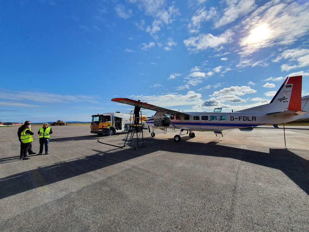
- Research aircraft and balloons take off for coordinated measurement flights around Kiruna in northern Sweden.
- A space-qualified version of DLR's CHARM-F lidar is to be used on the MERLIN satellite mission for global methane detection from 2027.
- Focus: Aeronautics, spaceflight, climate change
The Arctic is warming much faster than other parts of the world. Among other things, permafrost is thawing in regions north of the Arctic Circle and releasing methane, a greenhouse gas that has a much greater effect than carbon dioxide. Subpolar wetlands also emit methane. The international research campaign MAGIC 2021 (Monitoring of Atmospheric composition and Greenhouse gases through multi-Instrument Campaigns) is taking place from 14 to 27 August 2021. Based in Kiruna, Sweden, approximately 80 researchers will record climate gas sources and sinks in Scandinavia. Three measurement aircraft, 20 balloons and three Earth observation satellites are providing data about the region. The German Aerospace Center (Deutsches Zentrum für Luft- und Raumfahrt; DLR) is participating with in-situ measurements using their Cessna Grand Caravan and a newly developed airborne lidar instrument for methane and carbon dioxide detection. A space-qualified version of this lidar will also be used from 2027 onwards in the Methane Remote Sensing Lidar Mission (MERLIN) for global methane detection from space. The demonstrator being used during MAGIC 2021 supports the preparations for this German-French mission. A total of 17 research teams from seven countries are involved in the MAGIC 2021 campaign under the leadership of the French space agency CNES (Centre national d'études spatiales) and A total of 17 research teams from seven nations are involved in the MAGIC 2021 campaign under the leadership of the French space agency CNES (Centre national d'études spatiales) and French National Centre for Scientific Research CNRS (Centre national de la recherche scientifique).
Carbon dioxide (CO2) and methane (CH4) are the two most significant anthropogenic greenhouse gases. In particular, the input of methane into Earth’s atmosphere has still not been sufficiently researched. In Scandinavia, there are various methane sources that either originate from human activities (extraction and distribution of gas and oil) or are of natural origin (wetlands, peat bogs, lakes). In these wet regions, organic degradation processes take place in the absence of air, producing methane naturally.
"These data are extremely important for climate research. Because these emissions are insufficiently quantified," explains Susann Groß, Head of DLR’s Space Research and Technology Division. "Continuous measurements in the region are rather rare due to the low population density, the long winter and the weather conditions. The researchers want to understand the influence of the natural methane sources and how they change with global warming."
In addition, the high latitudes are considered a sink for atmospheric carbon dioxide. Here the researchers are interested in whether the uptake of carbon dioxide in the biosphere is reduced by the strong warming of the Arctic and whether the Arctic ecosystem is changing from a sink to a source.
From the boundary layer near the ground to the stratosphere
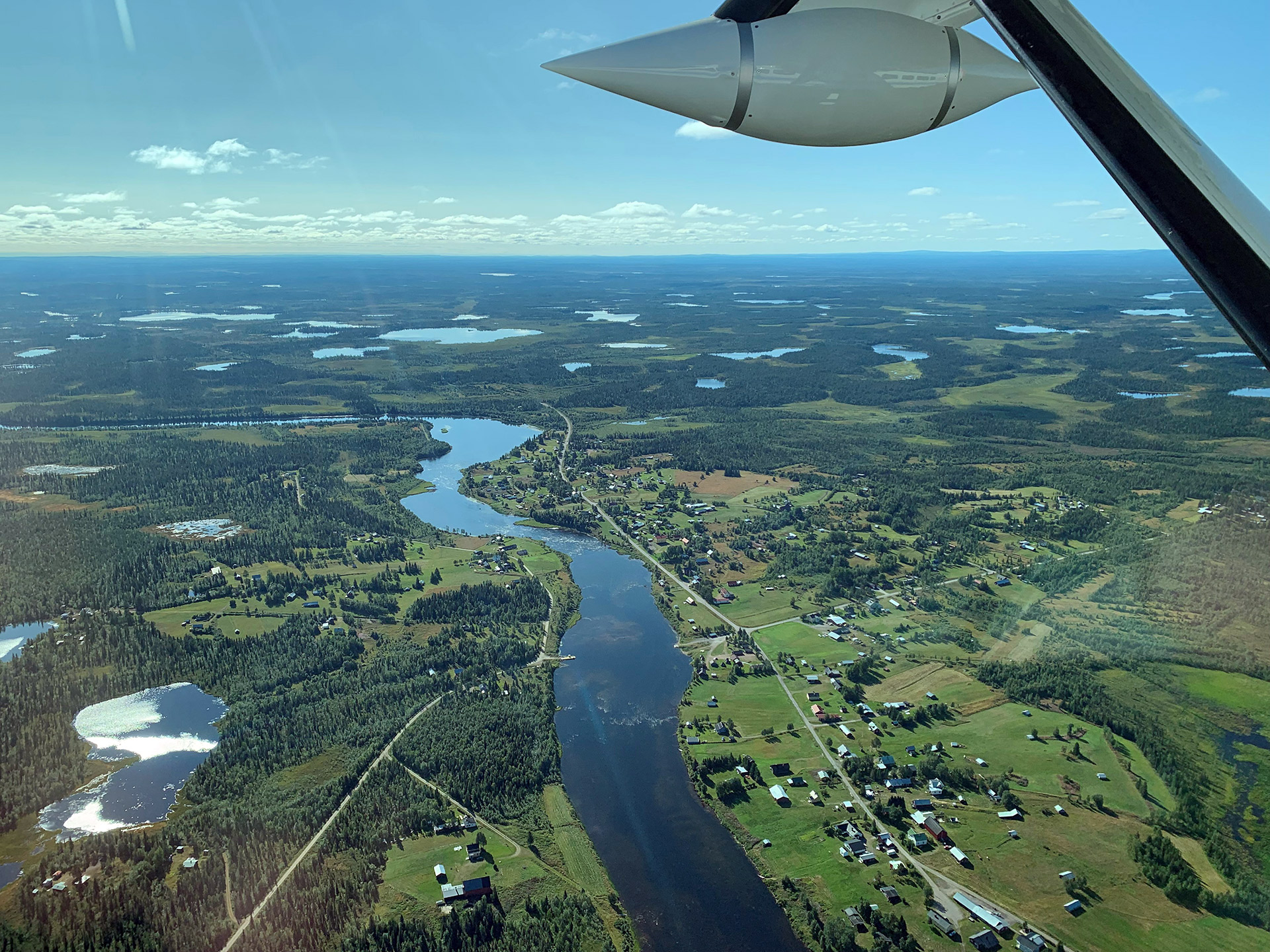
The scientists are recording the climate-influencing gas concentrations from the boundary layer near the ground up to the stratosphere at three levels. As part of the campaign, they will launch balloons into the stratosphere up to altitudes of 40 kilometres, which will record the concentrations with remote sensing and in-situ instruments. A French ATR-42 research aircraft is flying at altitudes of around six kilometres and is carrying the DLR ‘CH4 Atmospheric Remote Monitoring’ (CHARM-F) lidar on board for the first time. This measures methane and carbon dioxide concentrations by means of laser backscatter underneath the aircraft. Flying low along the boundary layer near the ground, DLR’s Cessna directly measures the concentrations at an altitude of around 500 to 1500 metres. A Twin Otter operated by the British Antarctic Survey (BAS) complements these measurements by surveying the land surface and its temperature, using a passive remote sensing instrument from NASA’s Jet Propulsion Laboratory. The coordinated measurements will be jointly evaluated within the framework of the Arctic Methane and Permafrost Challenge (AMPAC) initiative.
Smallest differences in concentration reveal methane sources
“We want to find out where the methane emissions in northern Scandinavia come from and where they are transported to,” explains Andreas Fix from the DLR Institute of Atmospheric Physics. “At the same time, we are testing our high-precision lidar. Its technology will be used on the German-French climate satellite MERLIN for continuous methane monitoring from space.” This technology makes it possible to measure methane and carbon using its own light source, a laser, independently of solar illumination, from a great distance and with high accuracy. The first-time combination of the greenhouse gas lidar with a lidar from the French research organisation ONERA, which simultaneously measures the wind field from on board the ATR-42, is particularly interesting. In this way, the researchers hope to be able to directly determine greenhouse gas fluxes from the aircraft.
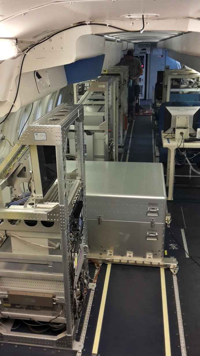
A common challenge in measuring greenhouse gases is their extremely small concentration differences, because even close to strong sources, the values are usually only less than one percent higher than the background concentration. An extremely sensitive and precise measurement is made possible by in-situ methane measurements close to the ground. “Via the air intakes of the DLR Cessna, we record the concentration of the climate gases methane and carbon dioxide with our instruments directly at the location of the aircraft,” explains Anke Roiger from the DLR Institute of Atmospheric Physics. “At the same time, we measure the three-dimensional wind field. This allows us to link increased concentrations and sources on the ground, as well as to estimate their source strength.”
The DLR Cessna can be used within a radius of 300 kilometres around Kiruna in northern Sweden. “For the measurement flights under visual flight rules over the vast forest areas of northern Scandinavia, we need a sufficiently high cloud base and good visibility to fly in coordination with the other aircraft in the research campaign,” says test pilot Marc Puskeiler from DLR’s Flight Experiments Facility. “Challenges for flight planning are the flight patterns, which are often modified at very short notice, sometimes while still in flight, and the few airfields for diversionary landings and refuelling stops in this very sparsely populated area.” Weather conditions permitting, the DLR Cessna is flying in coordination with the French ATR-42 and the British Twin Otter. The first results from the mission are expected in 2022.
Magic 2021 research campaign
The Monitoring Atmospheric composition and Greenhouse gases through multi-instrument Campaigns (MAGIC) initiative was launched in 2017 to better understand the distribution in the atmosphere and the associated emissions of the two most important anthropogenic greenhouse gases, carbon dioxide (CO2) and methane (CH4). After three preparatory campaigns over recent years in mainland France, the 2021 campaign is taking place in northern Norway, Sweden and Finland with a special focus on natural and anthropogenic methane emissions. Observations from the OCO-2 (NASA), Sentinel-5P (ESA) and MetOp (ESA-EUMETSAT) satellites will also be incorporated into the research work.
In this large-scale international research campaign, the French institutions Centre national de la recherche scientifique (CNRS), Centre national d'études spatiales (CNES) and Office national d'études et de recherches aérospatiales (ONERA) are working together with the German Aerospace Center (DLR), the Swedish Space Corporation, the Finnish Meteorological Institute, the University of Groningen, King’s College London, the British Antarctic Survey and NASA’s Jet Propulsion Laboratory. Funding is mainly provided by CNES, CNRS and ESA, with contributions from EUMETSAT and DLR.
German-French MERLIN climate mission
The German-French small satellite Methane Remote Sensing Lidar Mission (MERLIN) is a climate mission that will observe the greenhouse gas methane in Earth’s atmosphere. Using a lidar instrument, MERLIN will detect and monitor the greenhouse gas in Earth’s atmosphere from an altitude of approximately 500 kilometres. The mission is scheduled to begin in 2027. The goal of the three-year mission is, among other things, to create a global map of methane concentrations. In addition, the mission should provide information about the regions of the Earth where methane is introduced into the atmosphere (methane sources) and the areas where it is removed again (methane sinks).