April 1, 2022 | German environmental satellite closes a gap in modern Earth observation
German satellite EnMAP launches successfully
Launch of Falcon 9 with German environmental satellite EnMAP
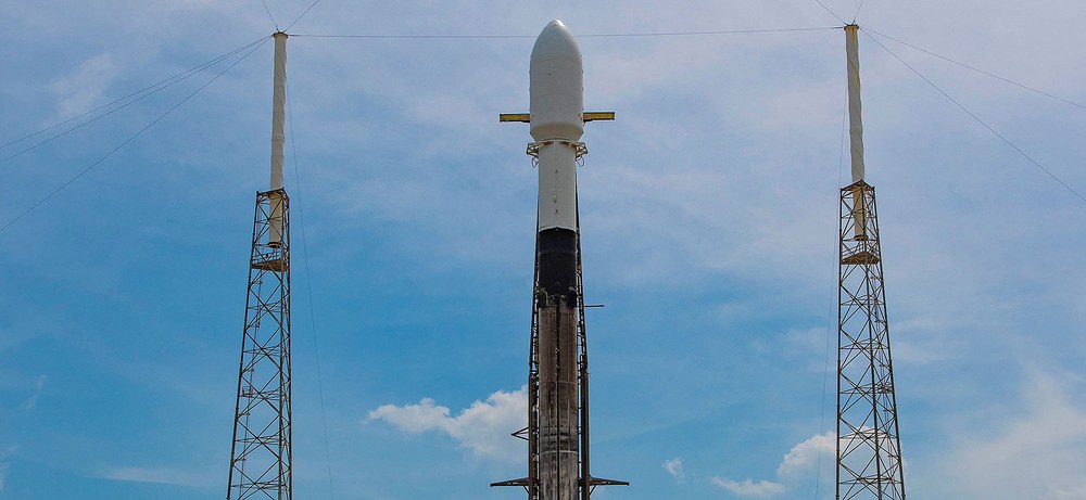
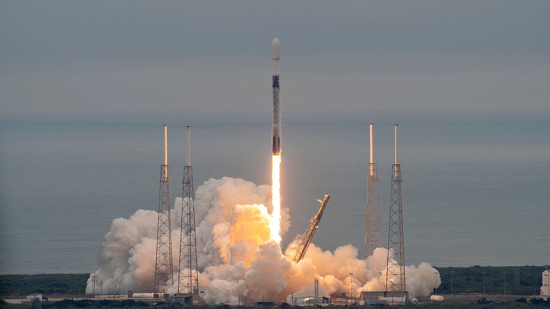
On 1 April 2022 at 18:24 Central European Summer Time (12:24 local time), the German environmental satellite EnMAP was launched from Cape Canaveral in Florida into space on board a Falcon 9 rocket of the US space company SpaceX.
The German hyperspectral satellite EnMAP will observe Earth from an altitude of approximately 650 kilometres and provide important information in the fight against climate change and environmental destruction.
At 18:24 CEST on 1 April (12:24 local time), the first German-developed hyperspectral satellite (EnMAP) successfully launched on board a SpaceX Falcon 9 rocket from Cape Canaveral in Florida.
The mission is being managed by the German Space Agency at the German Aerospace Center (DLR) in Bonn on behalf of the Federal Ministry for Economic Affairs and Climate Action (BMWK).
OHB-System AG was commissioned to develop and build the satellite and the hyperspectral instrument. Meanwhile, the ground segment has been developed and will be operated by DLR in Oberpfaffenhofen. The German Research Centre for Geosciences (GFZ) in Potsdam is the scientific coordinator for the mission.
It all began in 2003 with a competition announced by the German Space Agency at the German Aerospace Center (Deutsches Zentrum für Luft- und Raumfahrt; DLR) as part of the National Space Programme. The task was to design and build a new type of hyperspectral instrument and a satellite to carry it, and to test both the instrument and its satellite for several years in the harsh conditions of space. At the same time, an (inter)national community of scientists was formed to define the user requirements and objectives for the first German hyperspectral mission, which was also to be the first of its kind in Europe. What data about Earth should be collected with EnMAP, and for what purpose? This is how the special environmental satellite – the abbreviation stands for Environmental Mapping and Analysis Program – was created.
At 18:24 CEST on 1 April 2022, EnMAP, which is about the size of a small car and weighs one tonne, embarked on its journey into space from Cape Canaveral in Florida. It is the largest payload on board a Falcon 9 rocket from US space company SpaceX. EnMAP will record Earth from a distance of 650 kilometres using 242 spectral channels.
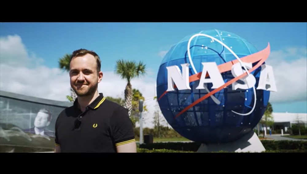
The hyperspectral satellite EnMAP will collect data on the state of our home planet for at least five years. Project leader Sebastian Fischer looks back on the satellite's development. (German)
The excitement grows: Environmental satellite EnMAP about to be launched with SpaceX from Florida
Your consent to the storage of data ('cookies') is required for the playback of this video on Youtube.com. You can view and change your current data storage settings at any time under privacy.
The excitement grows: Environmental satellite EnMAP about to be launched with SpaceX from Florida
The hyperspectral satellite EnMAP will collect data on the state of our home planet for at least five years. Project leader Sebastian Fischer looks back on the satellite's development. (German)
Credit:
German Space Agency at DLR
"With the launch of EnMAP, Germany is making an indispensable contribution to climate protection. Its innovative hyperspectral sensor technology will really let us see Earth with different eyes. We will discover details that were previously hidden, which will enable us to detect changes in the environment in good time and thus protect the climate and environment more effectively. In this way, EnMAP will help us make global land use more sustainable, reveal the consequences of climate change and counteract the progressive destruction of the environment. With EnMAP, Germany is making an important contribution to European space technology for the benefit of our planet," says Anna Christmann, Federal Government Coordinator for German Aerospace Policy at the Ministry for Economic Affairs and Climate Action (Bundesministerium für Wirtschaft und Klimaschutz; BMWK).
"Hyperspectral remote sensing makes it possible to quantify the properties of materials on Earth's surface. The possible areas of application range across agriculture, forestry and land utilisation, the observation of bodies of water, geology and urban land use, as well as geohazards and natural threats," explains Anke Kaysser-Pyzalla, Chair of the DLR Executive Board. "Conventional satellite data can provide reliable qualitative information, for example on land cover and its spatial distribution. However, high-resolution spectral data are required to obtain quantitative information concerning, for example, the supply of nutrients to crops or the water quality in lakes, or to identify soil minerals."
"With the launch of EnMAP, we are closing a gap in modern Earth observation. Our journey towards this achievement has been extremely important for advancing German space science and industry, as the mission has required new developments in many areas that have pushed at the limits of what is technically feasible. The end result is a satellite that will benefit us all. The data from EnMAP can, for example, help to sustainably improve yields in agriculture and ensure food security for a growing world population," says Walther Pelzer, DLR Executive Board Member and Head of the German Space Agency at DLR in Bonn, which is managing the EnMAP mission on behalf of the BMWK.
From the launch to the initial data
EnMAP was launched atop a SpaceX Falcon 9 rocket together with 39 other rideshare payloads, some of which are comparatively small. The launch took place from Space Launch Complex 40 (SLC-40) at the Cape Canaveral Space Force Station site in Florida. EnMAP’s journey marks the 145th launch of a Falcon 9 rocket. The first stage flew for the seventh time into space. With Crew-1 and Crew-2, the booster has already launched astronauts safely to the International Space Station (ISS) twice. A landing on one of the Autonomous Spaceport Drone Ships (ASDS) will make it possible for this stage to be refurbished for another launch in the future.
The satellite separated from its launcher just 15 minutes after lift-off. First contact was established over a ground station in Svalbard, Norway, 60 minutes later. EnMAP will now be commissioned, the systems powered up and the target orbit adjusted. This will be followed by a phase to verify the correct functioning of the satellite. "In this phase, we will be looking closely at whether the quality of the initial data meets our expectations. Six months after launch, the mission will then enter its operational phase. At this point, scientists will be able to specify the areas of Earth that they would like to have mapped by EnMAP's 'eyes' at particular times of the year," explains Sebastian Fischer, EnMAP Project Manager at the German Space Agency at DLR.
The data will be acquired by the satellite and then downloaded to Earth via the DLR ground stations in Neustrelitz, Germany, and Inuvik, Canada, during the satellite's overflights. However, these raw data are not yet directly suitable for the users; they have to be processed to add information about location and orientation. This is the only way for scientists to determine where each pixel is located on the ground. The German Remote Sensing Data Center (Deutsches Fernerkundungsdatenzentrum; DFD) and the Remote Sensing Technology Institute (Institut für Methodik der Fernerkundung; IMF) at DLR will process, archive and validate the data so that they can be made available to the global scientific community free of charge.
How EnMAP sees Earth
But how does EnMAP actually obtain this important data? Every material on Earth's surface reflects sunlight in a characteristic way, producing a spectral signature. EnMAP can recognise, differentiate and map these 'coloured fingerprints' using its instrument. The motto of the mission is 'Our Earth in more than just colour' because each EnMAP image is divided into numerous small wavelength ranges – many more of them than human eyes can perceive. "Each individual range provides an image that gives scientists specific information about the state of our Earth. For instance, we can gauge and determine the health of plants with precision from space. This satellite perspective allows farmers to keep every corner of their fields in view. They can then use this data to make targeted decisions about how and where to fertilise and irrigate. This preserves resources in the long term and also delivers greater yields," explains Fischer.
EnMAP – the German environmental mission and its partners
The EnMAP environmental mission is managed by the German Space Agency at DLR in Bonn on behalf of the Federal Ministry for Economic Affairs and Climate Action (BMWK). OHB System AG was commissioned to develop and build the satellite and its hyperspectral instrument. The German Research Centre for Geosciences (Deutsche GeoForschungsZentrum; GFZ) in Potsdam is the scientific lead for the study.
Three DLR institutes and facilities have been commissioned to set up and operate the ground segment. The German Space Operations Center in Oberpfaffenhofen will conduct and monitor satellite operations, while the German Remote Sensing Data Center and the DLR Remote Sensing Technology Institute will archive, process and validate the received satellite data and make them accessible to users in the scientific community. Companies and public authorities will also be able to view the data and use them to prepare future services. The use of EnMAP hyperspectral data by universities and scientific institutions and the development of special applications will be supported by BMWK funding programmes.

