InSight locates marsquakes in the Cerberus Fossae region

InSight locates marsquakes in the Cerberus Fossae region
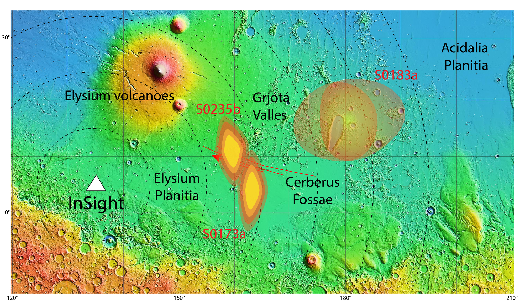
The SEIS seismometer on NASA’s InSight lander recorded a total of 174 low-intensity marsquakes between February and the end of September 2019. With the help of models of the propagation of seismic waves in the Martian subsurface, the probable source of two larger quakes (s0235b and s0173a) could be determined quite accurately, and of that another quake (s0183a), which produced fewer clear signals, with somewhat reduced accuracy. The marsquakes occurred in the Cerberus Fossae region, a young volcanic area about 1700 kilometres east of the InSight landing site located in Elysium Planitia. Red lines show known fault zones. The topographical map is based on laser altitude measurements performed by NASA’s Mars Global Surveyor spacecraft (1999-2006) and shows height differences from approximately minus 3000 metres (blue-green) to plus 7000 metres (summit of Elysium Mons), related to a reference surface referred to as an areoid. This is a modelled elliptical surface of equal gravitational attraction, which is used on Mars as a ‘zero’ level in the absence of sea level.