Mexico City
Mexico City
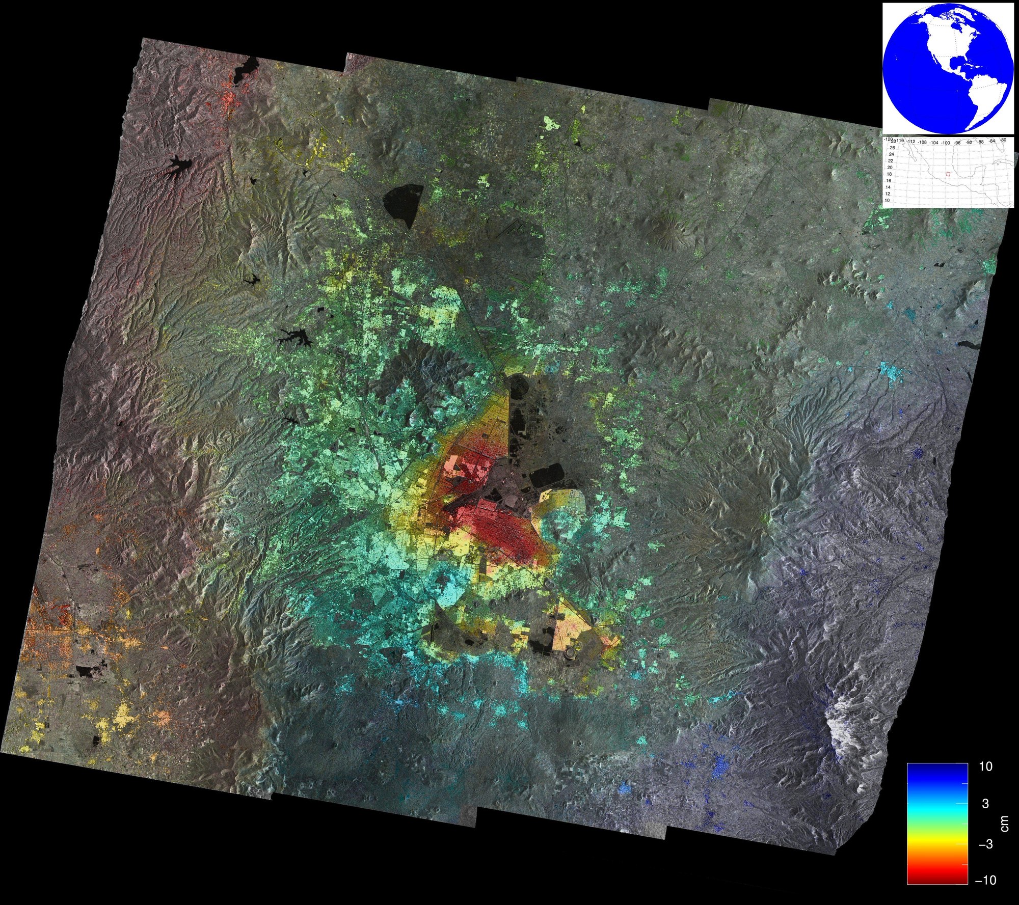
For the last four months, the German Aerospace Centre's (DLR) radar satellite, TerraSAR-X, has been imaging Mexico City from space. Amongst other things, the images show that even within this imaging period, the ground has sunk by as much as 10 centimetres in some places. Areas of the Mexican capital in which TerraSAR-X has recorded the greatest changes in ground level are coloured dark red. The green areas indicate those in which no change has been detected by the superposition of the radar images between 20 September 2009 and 30 January 2010. One of the reasons for this subsidence is the extraction of groundwater.
To create this an image, the TerraSAR-X radar equipment was operated in a special 'wide-angle mode', the 'ScanSAR mode', in which a strip of land 100 kilometres wide can be depicted in one piece. As the radar is usually capable of 'illuminating' a significantly smaller area of land – about 30 kilometres across, a special trick has to be used in order to obtain a greater strip width. For this purpose, the radar beam is repeatedly swung from short to long range, so that, first of all, a small area measuring 25 x 3 kilometres is illuminated at close range. Then, more distant areas – offset by 25 kilometres – are illuminated, until four partial strips of the image have been scanned. The process is then repeated. Finally, a montage is produced from the individual scenes. The cost of the larger scene is a reduction in resolution from three metres to sixteen metres, but this causes no restrictions for numerous applications. Such a recording mode is made possible by the electronically steered phased-array antenna, which facilitates the rapid and inertia-free movement of the radar beam.
The image of Mexico City was created by means of a refined scanning method known as Terrain Observation by Progressive Scans (TOPS) mode, which avoids the weakness of the classic ScanSAR – the varying illumination of individual surface patches. The result is an image without any variations in brightness.

