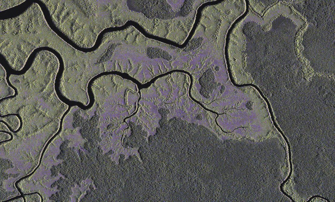
TerraSAR-X image of Gabon, 60 kilometres south east of the capital Libreville


TerraSAR-X image of Gabon, 60 kilometres south east of the capital Libreville
This image from the German Aerospace Center (Deutsches Zentrum für Luft- und Raumfahrt; DLR) TerraSAR-X satellite shows an area of the West African country of Gabon. The forest cover spans 210,000 square kilometres – 70 percent of the country's entire land area. The satellite image shows an uninhabited area around 60 kilometres south east of the capital, Libreville, in the vicinity of the Komo River delta. The flat surface of the river itself reflects the radar signals away from the satellite and appears as a dark area in the image. The forested area, on the other hand, has a rough texture when seen from space, which returns the radar signal to the TerraSAR-X at varying intensities. Such images enable scientists at the Friedrich Schiller University of Jena, to contribute to the United Nations' Global Forest Resources Assessment. This is the first time radar imaging from space has been used for this purpose.