Topographical map of Phlegra Montes

Topographical map of Phlegra Montes
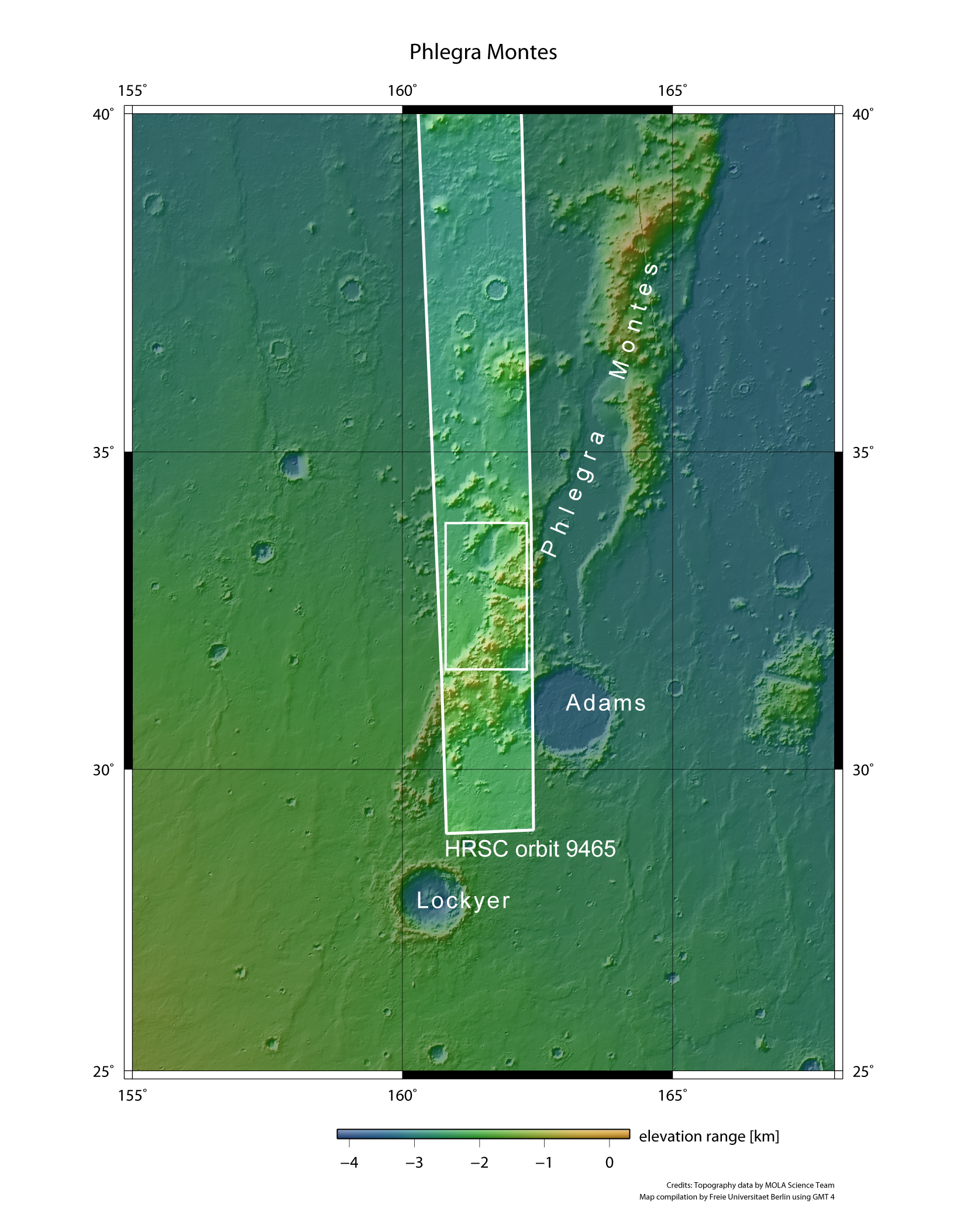
Phlegra Montes is a mountainous massif that stretches for several hundreds of kilometres to the northeast of the Elysium volcanic region. It forms the boundary between Utopia Planitia to the west and Arcadia Planitia to the east.
ESA's Mars Express spacecraft flew over the region on 1 June 2011 at an altitude of around 400 kilometres during orbit 9465, and the HRSC instrument on ESA’s Mars Express spacecraft imaged a long strip. The images in this article are located in the framed area, covering a region around 73 kilometres wide and 140 kilometres long – some ten thousand square kilometres or roughly the size of the Tyrol.