Nadir image of the northern scarp of Ius Chasma showing areas of interest

Nadir image of the northern scarp of Ius Chasma showing areas of interest
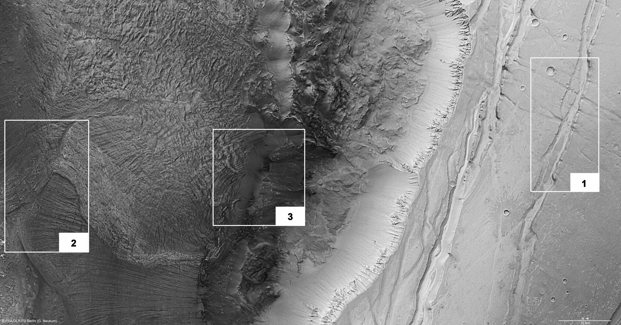
The nadir channel of the High Resolution Stereo Camera (HRSC) system, which has its field of view oriented vertically onto the planet’s surface, delivers the highest image resolution of all the camera channels. During orbit 2149, ESA’s Mars Express spacecraft was about 250 kilometres above Ius Chasma, resulting in an image resolution of 13 metres per pixel. The imaged area measures about 120 kilometres by 60 kilometres. Parallel to the direction of the main fault of Ius Chasma, other extension faults can be seen in the adjacent Martian highlands; these faults are intersected at right angles by side faults (detail 1). Several overlapping, large-scale landslides are visible below the escarpment of Ius Chasma (detail 2). The remains of an ancient landslide have been overlaid by younger rock masses (detail 3).
Copyright note:
As a joint undertaking by DLR, ESA and FU Berlin, the Mars Express HRSC images are published under a Creative Commons licence since December 2014: ESA/DLR/FU Berlin, CC BY-SA 3.0 IGO. This licence will also apply to all HRSC images released to date.