TerraSAR-X radar satellite image of salt flats


TerraSAR-X radar satellite image of salt flats
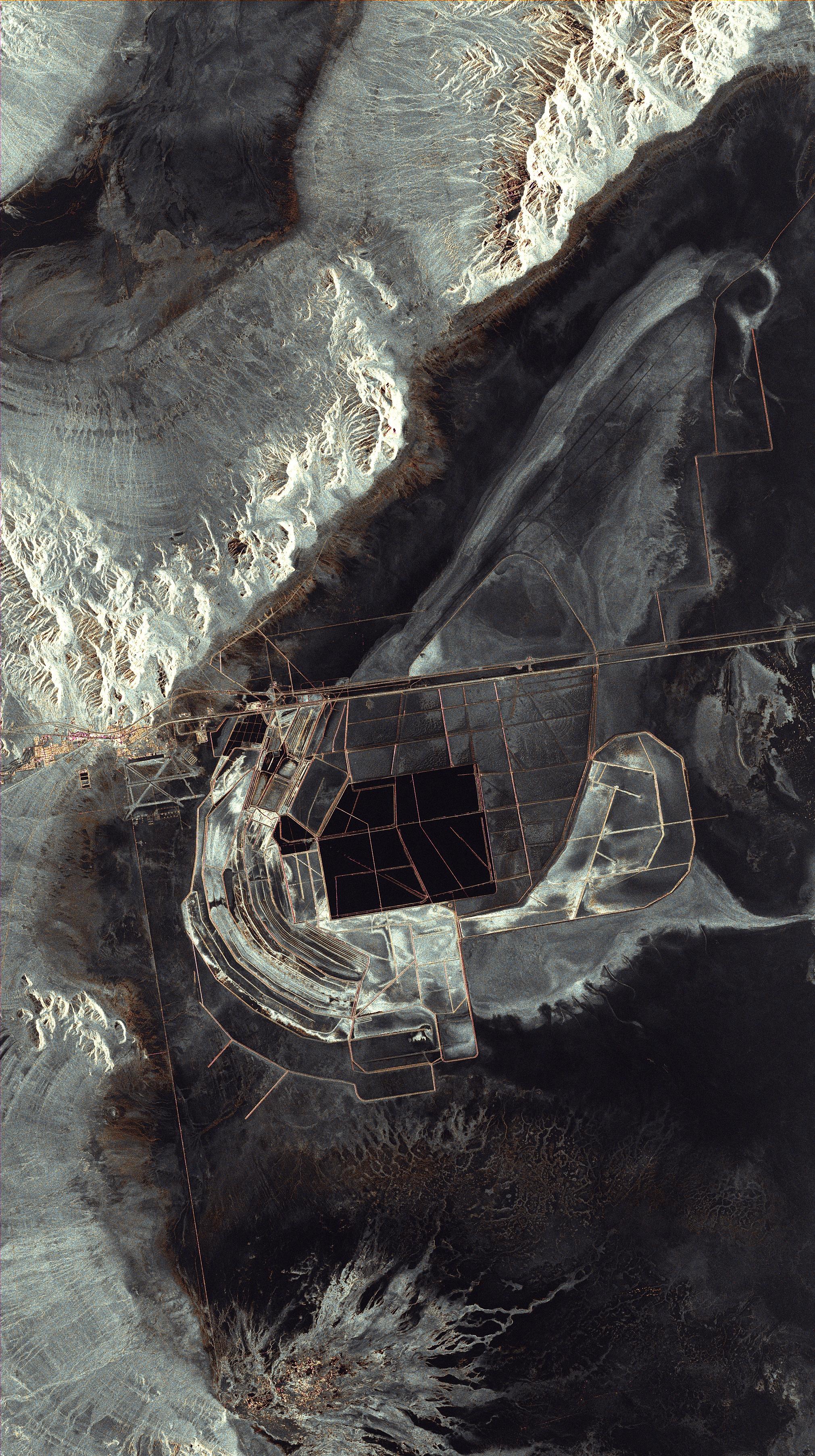
The German Aerospace Center's (Deutsches Zentrum für Luft- und Raumfahrt; DLR) TerraSAR-X radar satellite orbits Earth at an altitude of 514 kilometres. It acquired this image of the Bonneville Salt Flats in the USA at 13:40 local time on 23 June 2009. The black represents areas of water, where radar signals transmitted by the satellite are reflected away by the smooth surface of the water. The city of Wendover is conspicuous in the upper half of this space radar image, with the orange colouring indicating a strong increase in the local variance of the return signal, due to direct or multiple reflections off the buildings and streets.