Topographic map of Olympus Mons

Topographic map of Olympus Mons
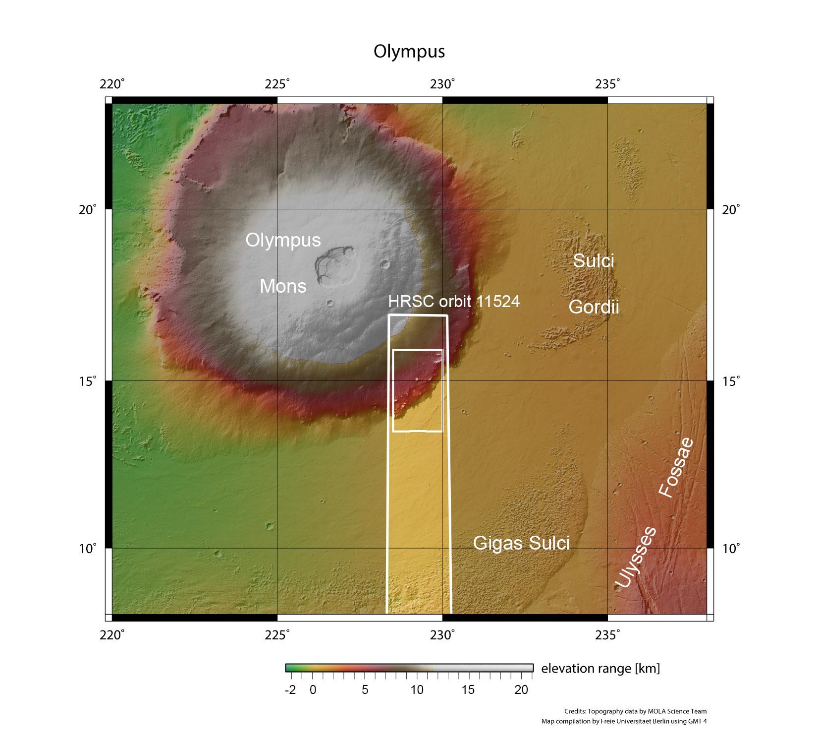
On 21 January 2013, the High Resolution Stereo Camera (HRSC), operated by the German Aerospace Center (Deutsches Zentrum für Luft- und Raumfahrt; DLR) on board ESA's Mars Express spacecraft, imaged the southeast portion of the Olympus Mons shield volcano, the largest volcano in the Solar System, located approximately 200 kilometers southwest of the Sulci Gordii region. The images presented here show the area contained within the inner box.