Topographic image of Mistretta crater on the highland plateau Daedalia Planum

Topographic image of Mistretta crater on the highland plateau Daedalia Planum
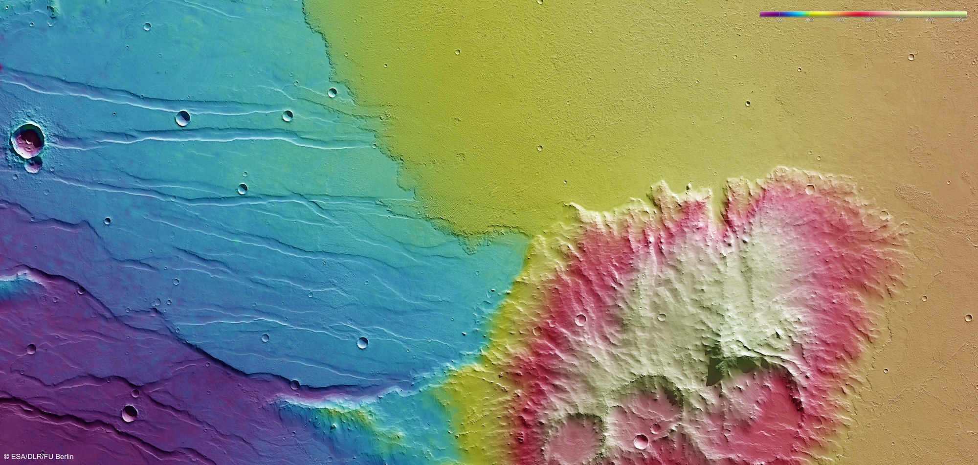
Topographical terrain models can be computed using stereo image data from the HSRC camera system, which is operated by DLR. In the absence of 'sea level', the elevation data is referenced to an areoid – a modelled equipotential surface on which everything experiences the same gravitational attraction towards the centre of the planet. Mistretta Crater and the highland plateau of Daedalia Planum that surrounds it were flooded by lava flows on two separate occasions. In this false colour image (elevation key at top right), the flow front of the younger lava flow (light green) is strikingly distinct.
Copyright note:
As a joint undertaking by DLR, ESA and FU Berlin, the Mars Express HRSC images are published under a Creative Commons licence since December 2014: ESA/DLR/FU Berlin, CC BY-SA 3.0 IGO. This licence will also apply to all HRSC images released to date.