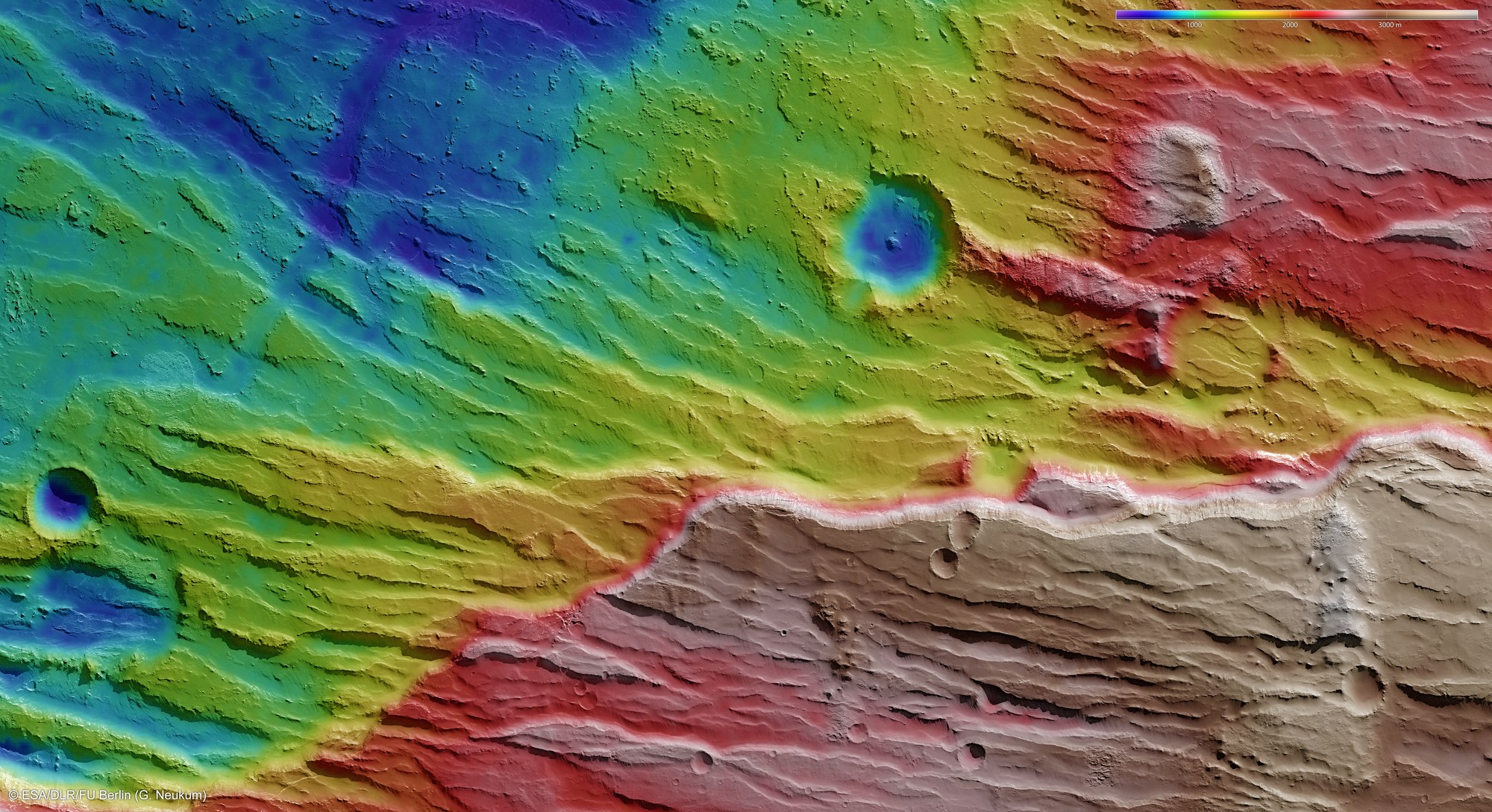
Topographical image of Claritas Rupes

Topographical image of Claritas Rupes
Topographical terrain models are computed using stereo image data from the HSRC camera system, which is operated by DLR. In the absence of 'sea level', the elevation data is referenced to an areoid – a modelled equipotential surface on which everything experiences the same gravitational attraction towards the centre of the planet. The impressive Claritas Rupes escarpment can be seen in this false colour image (image key at upper right).
Copyright note:
As a joint undertaking by DLR, ESA and FU Berlin, the Mars Express HRSC images are published under a Creative Commons licence since December 2014: ESA/DLR/FU Berlin, CC BY-SA 3.0 IGO. This licence will also apply to all HRSC images released to date.
Copyright note:
As a joint undertaking by DLR, ESA and FU Berlin, the Mars Express HRSC images are published under a Creative Commons licence since December 2014: ESA/DLR/FU Berlin, CC BY-SA 3.0 IGO. This licence will also apply to all HRSC images released to date.