Radar image of Wallerfing in the L-band


Radar image of Wallerfing in the L-band
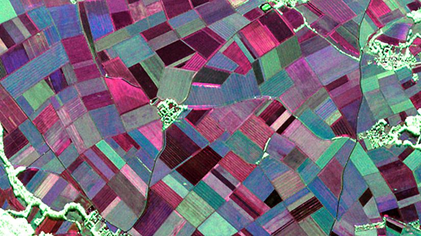
Fully polarimetric RGB image of the Wallerfing test region, created using data acquired in the L-band (23 centimetre wavelength) on 22 May 2014. The brighter the appearance of an object in the radar image, the rougher its surface is or the more complex its structure. For example, trees and woods appear green to white here, as they change and scatter the incoming radar signal strongly at different polarisations. Radar sensors using this longer wavelength can penetrate the ground. Hence, the red and blue colours in particular indicate the soil properties beneath the vegetation.