Topographical image map of part of Nili Fossae

Topographical image map of part of Nili Fossae
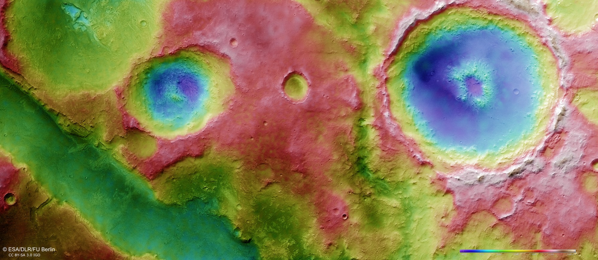
Topographical terrain models are derived from the stereo image data from the HRSC camera system operated by DLR. This enables differences in altitude to be shown graphically in the depicted landscape. North is to the right in the image. The difference in altitude between the deepest points (dark blue) and the highest regions (light grey/beige) is about three thousand metres. This image clearly shows a part of one of the valleys of Nili Fossae that is almost 100 kilometres long and runs in a nearly straight line (lower left). The topographical profile of the various impact craters in the surrounding upland is also clearly apparent.
Copyright note:
As a joint undertaking by DLR, ESA and FU Berlin, the Mars Express HRSC images are published under a Creative Commons licence since December 2014: ESA/DLR/FU Berlin, CC BY-SA 3.0 IGO. This licence will also apply to all HRSC images released to date.