Topographical context map of Arda Valles and surrounding area


Topographical context map of Arda Valles and surrounding area
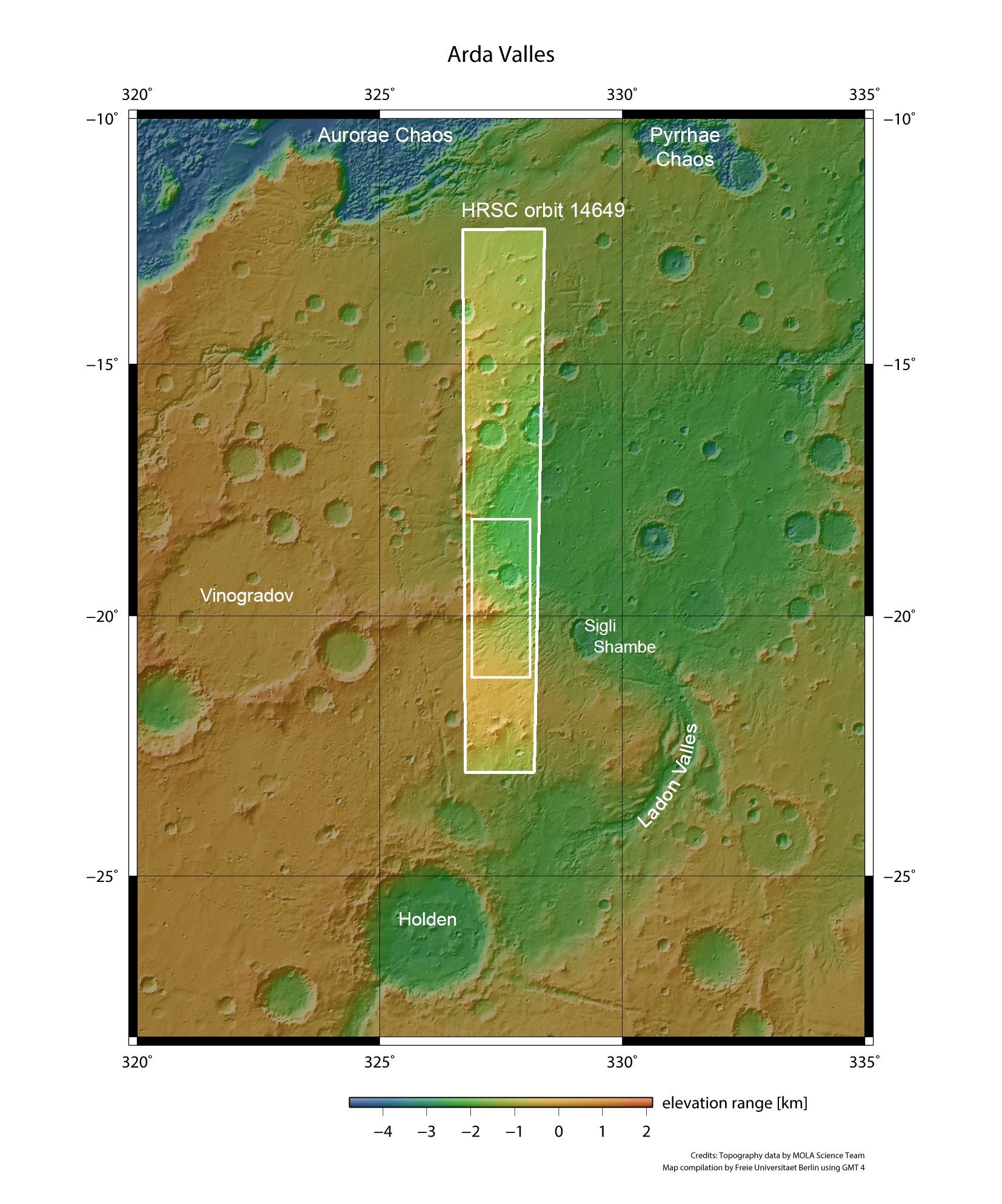
Arda Valles, named after a river in ancient Thrace, is located some 260 kilometres north of Holden Crater on Mars. Holden had a through flow of water originating from the south, which drained out via Ladon Valles to the north, in the direction of a large, unnamed and heavily-weathered impact basin. The water that flowed through Arda Valles streamed through the southeastern edge into this large, sediment-filled basin. The images of Arda Valles were acquired on 20 July 2015 by the DLR-operated High Resolution Stereo Camera (HRSC) on board the European Mars Express spacecraft, during orbit 14649.