False colour image of the topography of the Acheron Fossae

False colour image of the topography of the Acheron Fossae
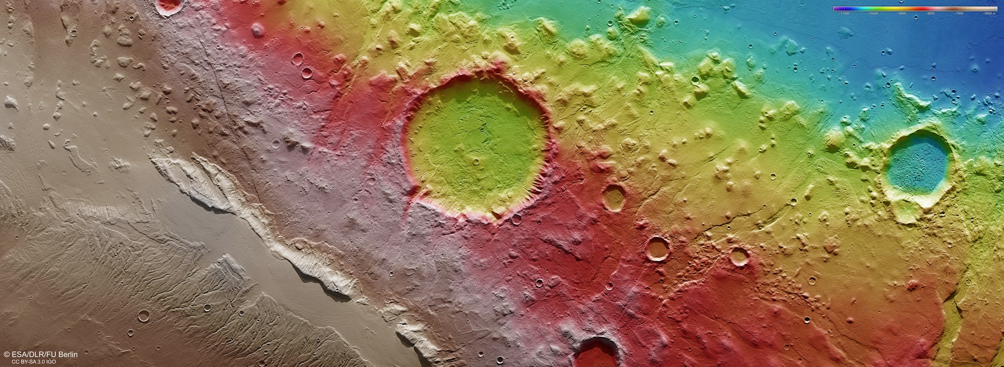
Digital terrain models of the Martian surface can be generated with an accuracy of up to 10 metres per pixel from the nadir channel directed vertically onto the Martian surface and the oblique views of the stereo channels of the High Resolution Stereo Camera (HRSC) on Mars Express. In this colour-coded image, the absolute elevations above a reference level, the Aeroid (derived from Ares, the Greek word for Mars), are well depicted. These elevation values can be read based on the colour scale at the top right of the image.