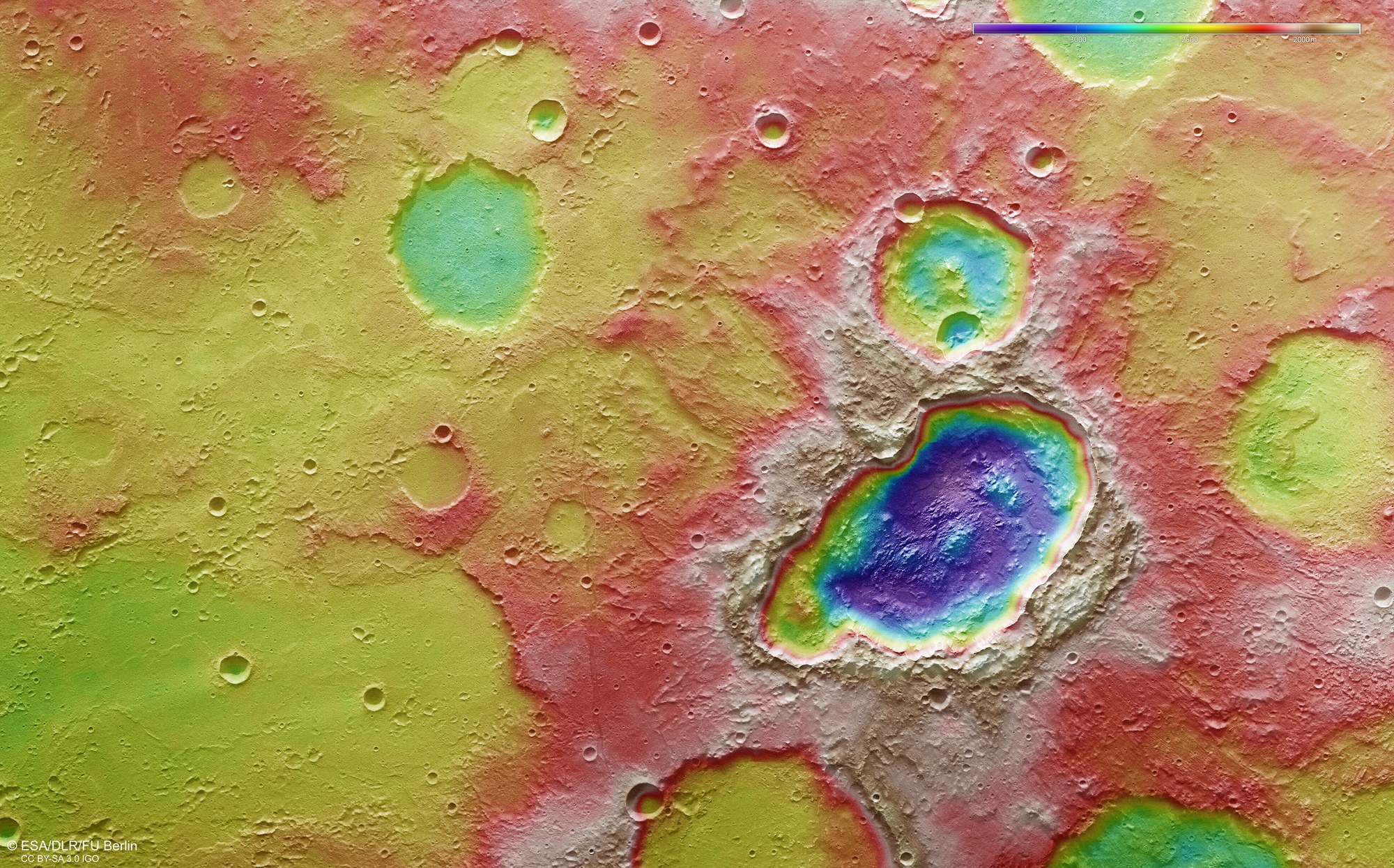
False colour representation of the topography of the triple crater in the Terra Sirenum region

False colour representation of the topography of the triple crater in the Terra Sirenum region
Digital terrain models of the Martian surface are generated with an accuracy of up to 10 metres pixel from the nadir channel directed vertically onto the Martian surface and the stereo channels of the HRSC camera. In this colour-coded illustration, the absolute elevations above a reference level, the Areoid (derived from Ares, the Greek word for Mars), which corresponds to sea level on the Earth, are well depicted. These elevation values can be read based on the colour scale at the top right of the image. The coloured differences in altitude clearly show the depth of the triple crater in the right half of the image. The depth of almost 2000 metres indicates that this crater is significantly younger than its surroundings, which demonstrate a flat profile overall with depressions filled with sediments or lava flows. North is to the right in the image.