Topographical overview map of the Terra Sirenum region

Topographical overview map of the Terra Sirenum region
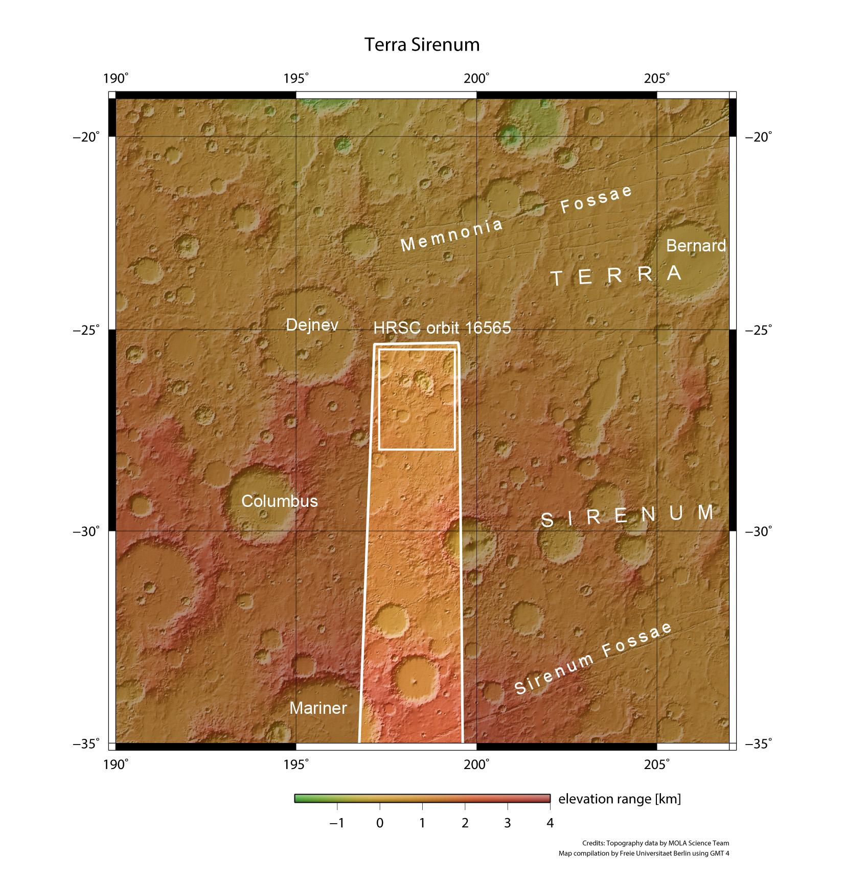
The overview map shows a section of the Terra Sirenum region, an extensive, very ancient highland region in the southwest of the Tharsis volcanic province. There are indications that groundwater escaped from the ground and evaporated in the Martian past. Hydrological modelling calculations for this region of Mars suggest that there was once a high level of ground water. The colour coding of the image emphasises the altitude differences on the surface (green = low, red = high). The images described in the article come from the small rectangle within the strip of images taken by the HRSC camera during Orbit 16,565.