False colour representation of the topography of the crater in the Margaritifer Terra region

False colour representation of the topography of the crater in the Margaritifer Terra region
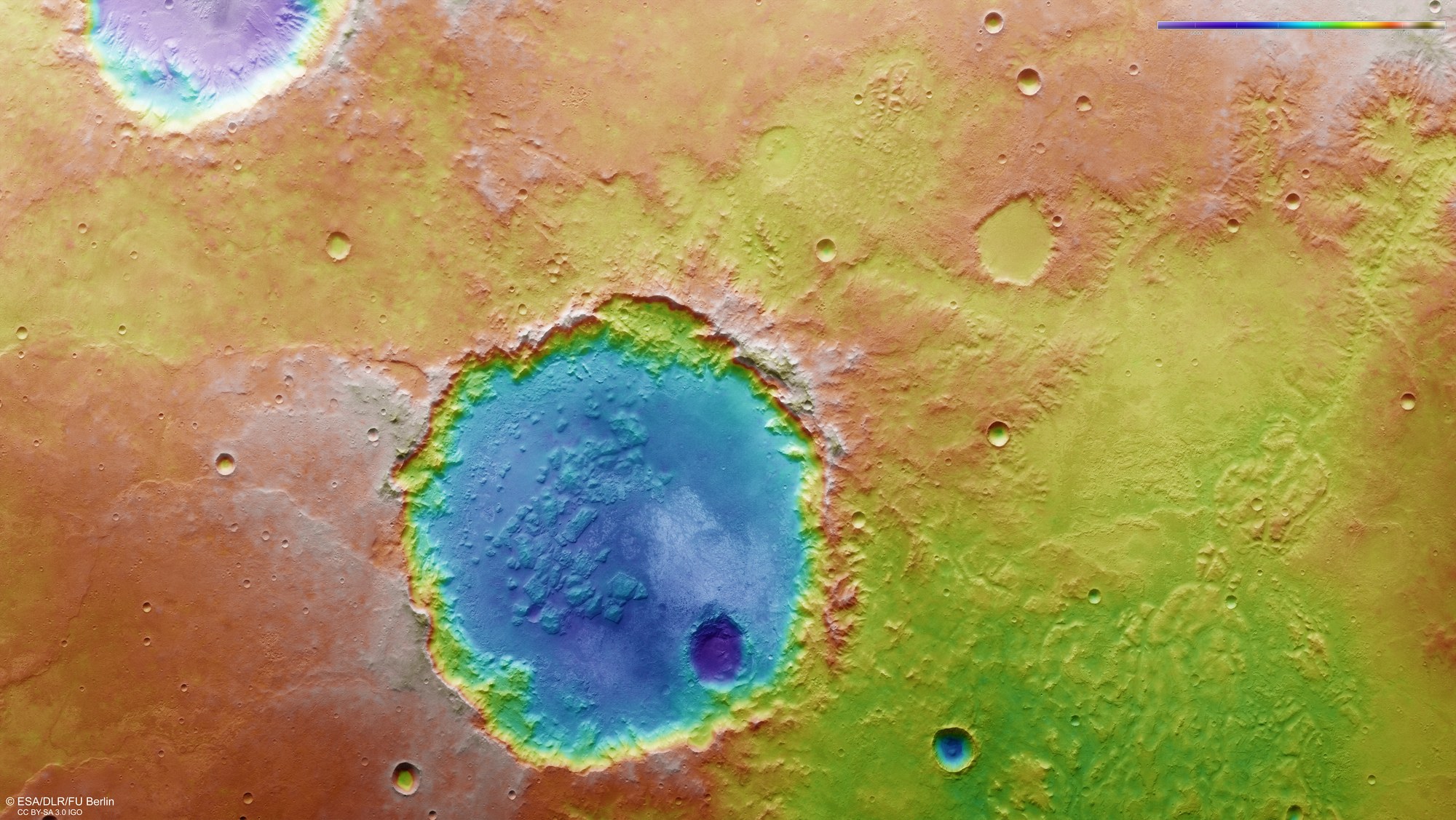
Digital terrain models of the Martian surface can be construed with an accuracy of up to 10 metres per pixel from the nadir channel, directed vertically onto the Martian surface, and the stereo channels of the HRSC camera. In these colour-coded representations, the absolute elevations above a reference level, the Areoid (derived from Ares, the Greek word for Mars), are well depicted. These elevation values can be read based on the colour scale at the top right of the image. North is to the right in the image. Despite the advanced erosion of the crater rim, the crater floor is located about 2000 metres below the surrounding plain of the southern highlands of Mars. A younger, smaller impact crater forms another 500-metre deep crater pit inside the unnamed, larger crater.