Topographic overview map of the Libya Montes region

Topographic overview map of the Libya Montes region
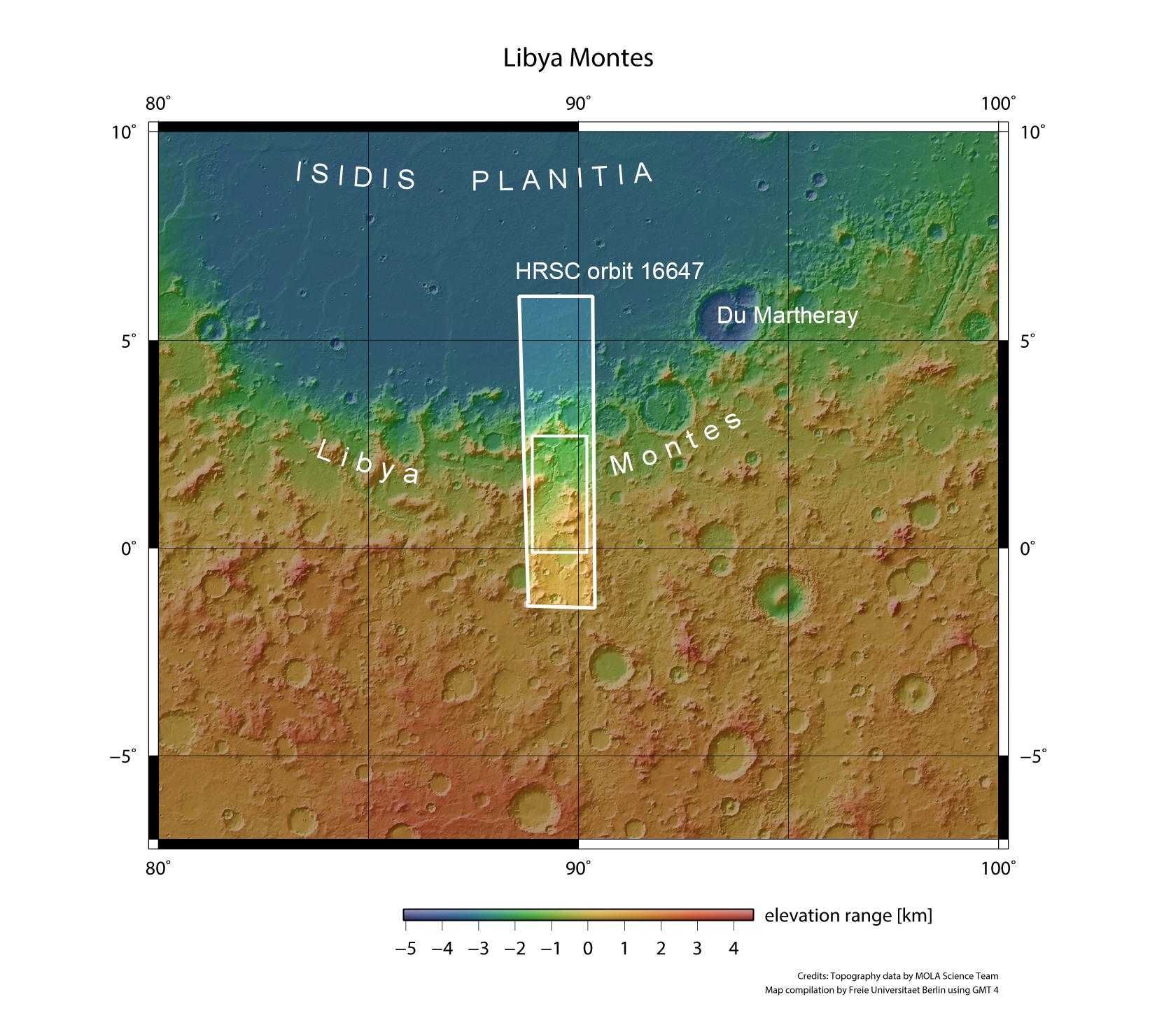
This overview map shows the Libya Montes highland region and Isidis Planitia basin to the north. The colour coding of the image illustrates differences in surface altitude (blue means low-lying, green medium altitude and brown signifies higher ground). The regional context clearly shows that there is a difference in altitude of over eight kilometres between the Martian highlands and Isidis lowlands. The images described in the article originate from the small rectangle within the image strip that was captured by the HRSC camera during Orbit 16647 of the Mars Express spacecraft.