Topographical map of the area north of the Hellas impact basin

Topographical map of the area north of the Hellas impact basin
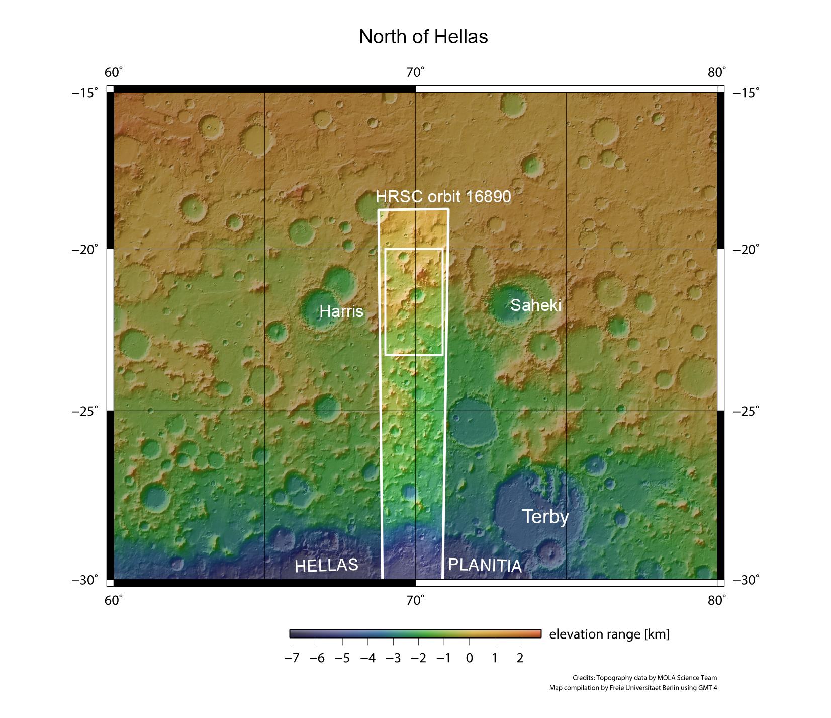
This map shows part of the area north of the great Hellas Planitia impact crater. One can see numerous craters here. The shape of their ejecta blankets indicates that at the time of impact groundwater was present near the surface. The colour coding of the image illustrates differences in the height of the surface (blue means low, yellow means high). The images described in the article are taken from the small rectangle within the image strip taken by the HRSC camera during orbit 16,890.