Topographical overview map of a section of Coracis Fossae

Topographical overview map of a section of Coracis Fossae
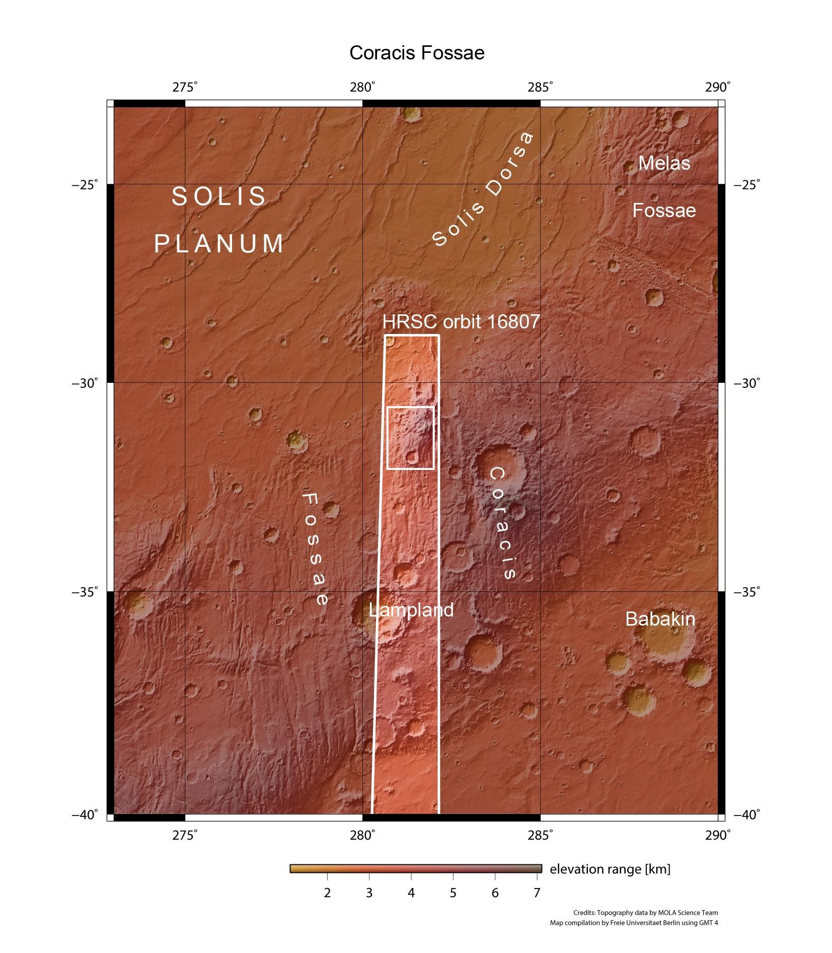
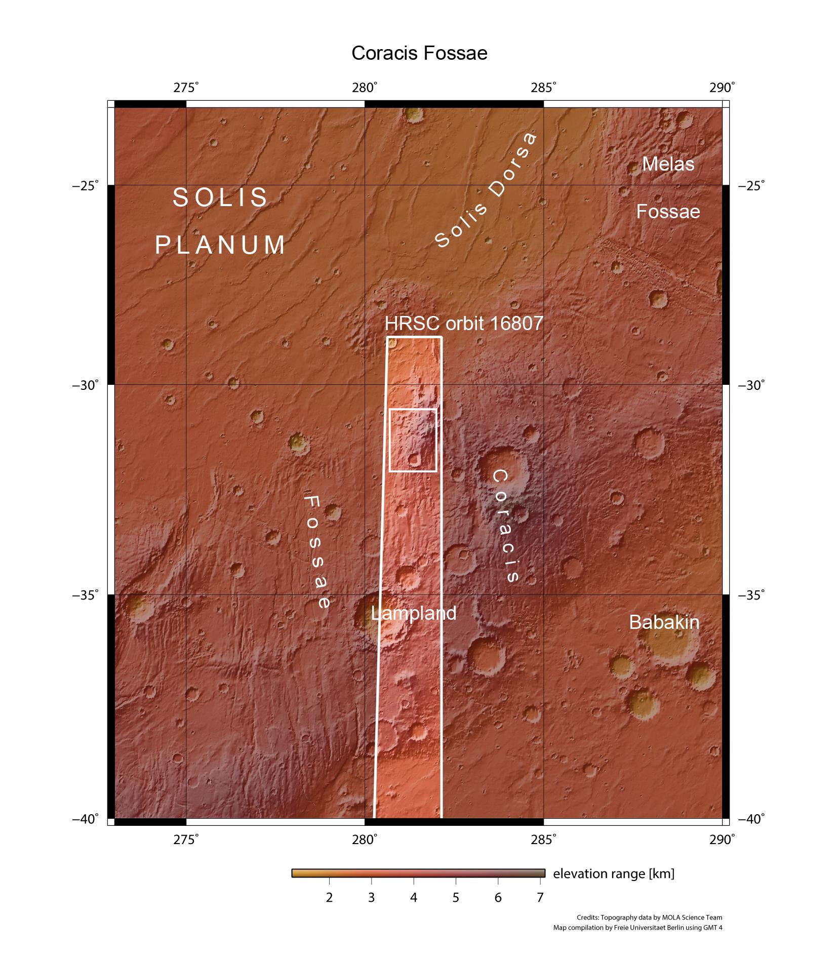
This overview map shows a section of the Coracis graben in the Thaumasia highland region. The area is characterised by mountains, tectonic graben, impact craters, fluvial valleys and periglacial structures (shapes that only occur in permafrost regions). The colour coding of the image highlights elevation differences in the surface. The images described in the article come from the small rectangle within the strip of images acquired by the HRSC camera, operated by DLR, during orbit 16807.